The right side offers the more consistently scenic experience across the flight: Central American volcanic peaks and coastal mountain ranges in Nicaragua, Guatemala, and Mexico during cruise, plus the dramatic Pacific coastline and San Francisco Bay approach at the end, compared to the largely featureless open-ocean views on the left for most of the route.
Flown PTY to SFO? Did we get it right?
Flight Path
Panama City to San Francisco is 3,321 miles (5,344 km), a flight of about 7 hours 45 minutes.
Nicaraguan volcanic chain (Momotombo, Concepción), Gulf of Fonseca, Guatemalan highlands, Gulf of Tehuantepec, Sierra Madre del Sur, and the Baja California peninsula with the Gulf of California visible before the California coast
Great circle distance and headings ›


Phase by phase
Takeoff from PTY
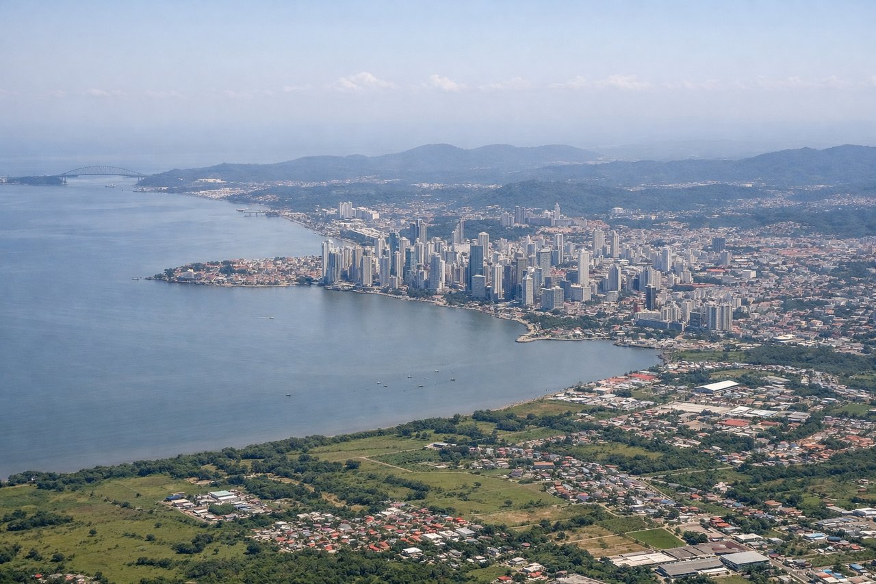
LEFTDeparting PTY to the northeast before turning northwest onto the SFO track gives a brief but striking view over the Gulf of Panama, the Panama Canal's Pacific entrance, and the Panama City skyline on the left as the aircraft banks toward the coastal route. The right side at this point shows mostly jungle lowlands with no major landmarks.

Landing at SFO
RIGHTOn approach into SFO from the south, the right side of the aircraft faces west toward the Pacific-facing coastline, giving passengers a good look at the San Francisco Peninsula, the Pacific shoreline near Pacifica, and the final turn over the bay with the city skyline and bridges visible before touchdown. The left side mostly shows the flatter East Bay hills with less definition.
Will your flight be in sunlight?
Pick a date and time in the Sun Map to watch the sun move across your whole flight.
About This Route
Which side of the plane should I sit on flying from Tocumen International (PTY) to San Francisco International (SFO)?
Sit on the Right side of the plane for the best views on flights from Panama City to San Francisco. The right side offers the more consistently scenic experience across the flight: Central American volcanic peaks and coastal mountain ranges in Nicaragua, Guatemala, and Mexico during cruise, plus the dramatic Pacific coastline and San Francisco Bay approach at the end, compared to the largely featureless open-ocean views on the left for most of the route.
What can I see during takeoff from Tocumen International in Panama City?
During takeoff from Tocumen International (PTY), sit on the Left side for the best views. Departing PTY to the northeast before turning northwest onto the SFO track gives a brief but striking view over the Gulf of Panama, the Panama Canal's Pacific entrance, and the Panama City skyline on the left as the aircraft banks toward the coastal route. The right side at this point shows mostly jungle lowlands with no major landmarks. Notable sights include: Panama City skyline, Bridge of the Americas, Gulf of Panama, Panama Canal Pacific approach.
What can I see when landing at San Francisco International in San Francisco?
When landing at San Francisco International (SFO), sit on the Right side for the best views. On approach into SFO from the south, the right side of the aircraft faces west toward the Pacific-facing coastline, giving passengers a good look at the San Francisco Peninsula, the Pacific shoreline near Pacifica, and the final turn over the bay with the city skyline and bridges visible before touchdown. The left side mostly shows the flatter East Bay hills with less definition. Notable sights include: San Francisco skyline, Golden Gate Bridge, San Francisco Bay, Pacifica coastline.
How long is the flight from Panama City to San Francisco?
The flight from Tocumen International (PTY) to San Francisco International (SFO) takes about 7 hours 45 minutes. The shortest flight path between them is 3,321 miles (5,344 km); winds and air traffic control usually add a few percent.
What does the Panama City to San Francisco flight path pass over?
Nicaraguan volcanic chain (Momotombo, Concepción), Gulf of Fonseca, Guatemalan highlands, Gulf of Tehuantepec, Sierra Madre del Sur, and the Baja California peninsula with the Gulf of California visible before the California coast