The right side scores higher due to the landing approach into Salvador, which features the visually distinctive All Saints Bay with its island-studded waters and dramatic coastal topography. While the Panama City departure offers urban interest, the Salvador landing provides greater scenic variety and more recognizable geographical features. The bay's complex geography and the city's hillside setting create more compelling views than the relatively flat Caribbean departure.
Flown PTY to SSA? Did we get it right?
Flight Path
Panama City to Salvador is 3,201 miles (5,151 km), a flight of about 6 hours 35 minutes.
The flight path crosses the Caribbean Sea and then the northern coast of Colombia/Venezuela region before turning southeast toward Brazil. Notable features include the Yucatán Channel area, the Caribbean basin, and the approach to the Brazilian coast near the Amazon Delta region. The majority of the cruise segment is open ocean with limited landmark visibility.
Great circle distance and headings ›Phase by phase
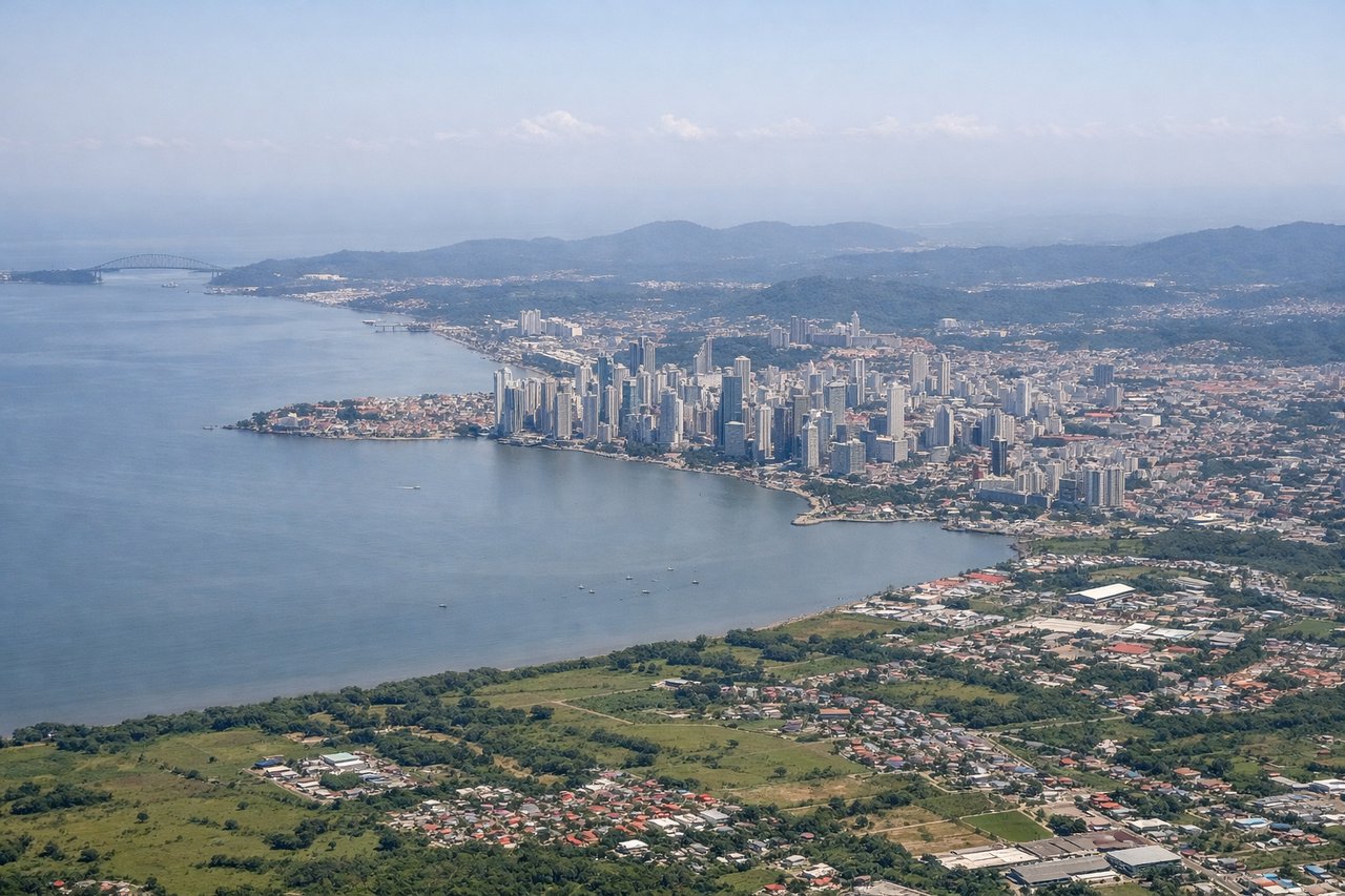
Takeoff from PTY
LEFTPanama City's urban sprawl and the Panama Canal approach provide immediate scenic interest during climb-out. The Caribbean coastline and Gatun Lake are visible from the left side as the aircraft departs northeastward.
Landing at SSA
RIGHTThe approach to Salvador reveals the Recôncavo Baiano's dramatic coastal geography—the All Saints Bay (Baía de Todos os Santos) with its numerous islands, the Atlantic coastline, and the city's distinctive hillside topography. This provides significantly more visual variety than the departure side.
Will your flight be in sunlight?
Pick a date and time in the Sun Map to watch the sun move across your whole flight.
About This Route
Which side of the plane should I sit on flying from Tocumen International (PTY) to Deputado Luis Eduardo Magalhaes (SSA)?
Sit on the Right side of the plane for the best views on flights from Panama City to Salvador. The right side scores higher due to the landing approach into Salvador, which features the visually distinctive All Saints Bay with its island-studded waters and dramatic coastal topography. While the Panama City departure offers urban interest, the Salvador landing provides greater scenic variety and more recognizable geographical features. The bay's complex geography and the city's hillside setting create more compelling views than the relatively flat Caribbean departure.
What can I see during takeoff from Tocumen International in Panama City?
During takeoff from Tocumen International (PTY), sit on the Left side for the best views. Panama City's urban sprawl and the Panama Canal approach provide immediate scenic interest during climb-out. The Caribbean coastline and Gatun Lake are visible from the left side as the aircraft departs northeastward. Notable sights include: Panama City skyline, Panama Canal and Gatun Lake, Caribbean coastline, Colón province lowlands.
What can I see when landing at Deputado Luis Eduardo Magalhaes in Salvador?
When landing at Deputado Luis Eduardo Magalhaes (SSA), sit on the Right side for the best views. The approach to Salvador reveals the Recôncavo Baiano's dramatic coastal geography—the All Saints Bay (Baía de Todos os Santos) with its numerous islands, the Atlantic coastline, and the city's distinctive hillside topography. This provides significantly more visual variety than the departure side. Notable sights include: All Saints Bay with its island archipelago, Atlantic coastline cliffs, Salvador's hillside neighborhoods, Recôncavo Baiano lowlands.
How long is the flight from Panama City to Salvador?
The flight from Tocumen International (PTY) to Deputado Luis Eduardo Magalhaes (SSA) takes about 6 hours 35 minutes. The shortest flight path between them is 3,201 miles (5,151 km); winds and air traffic control usually add a few percent.
What does the Panama City to Salvador flight path pass over?
The flight path crosses the Caribbean Sea and then the northern coast of Colombia/Venezuela region before turning southeast toward Brazil. Notable features include the Yucatán Channel area, the Caribbean basin, and the approach to the Brazilian coast near the Amazon Delta region. The majority of the cruise segment is open ocean with limited landmark visibility.