The left side strings together a genuine variety of scenery across the whole flight: the Punta Cana coastline at departure, glimpses of the eastern Bahamas and Turks and Caicos early in the cruise, the Chesapeake Bay area and Appalachian ridges of Pennsylvania later on, and finally the Toronto skyline and Lake Ontario on arrival. The right side spends most of the flight over open Atlantic water with little to look at.
Flown PUJ to YYZ? Did we get it right?
Flight Path
Punta Cana to Toronto is 1,854 miles (2,984 km), a flight of about 4 hours 15 minutes.
The route's midpoint sits over the open Atlantic Ocean roughly 150 miles east of the Georgia/South Carolina coast, over the Gulf Stream's dark blue current with no land in sight from either side.
Great circle distance and headings ›


Phase by phase
Takeoff from PUJ
LEFTPUJ departures run east into the trade winds, but the turn onto course toward Toronto swings the aircraft north, sweeping the Bavaro/Punta Cana coastline and its turquoise reef flats into view on the left side. The right side only sees open Caribbean water during this turn.
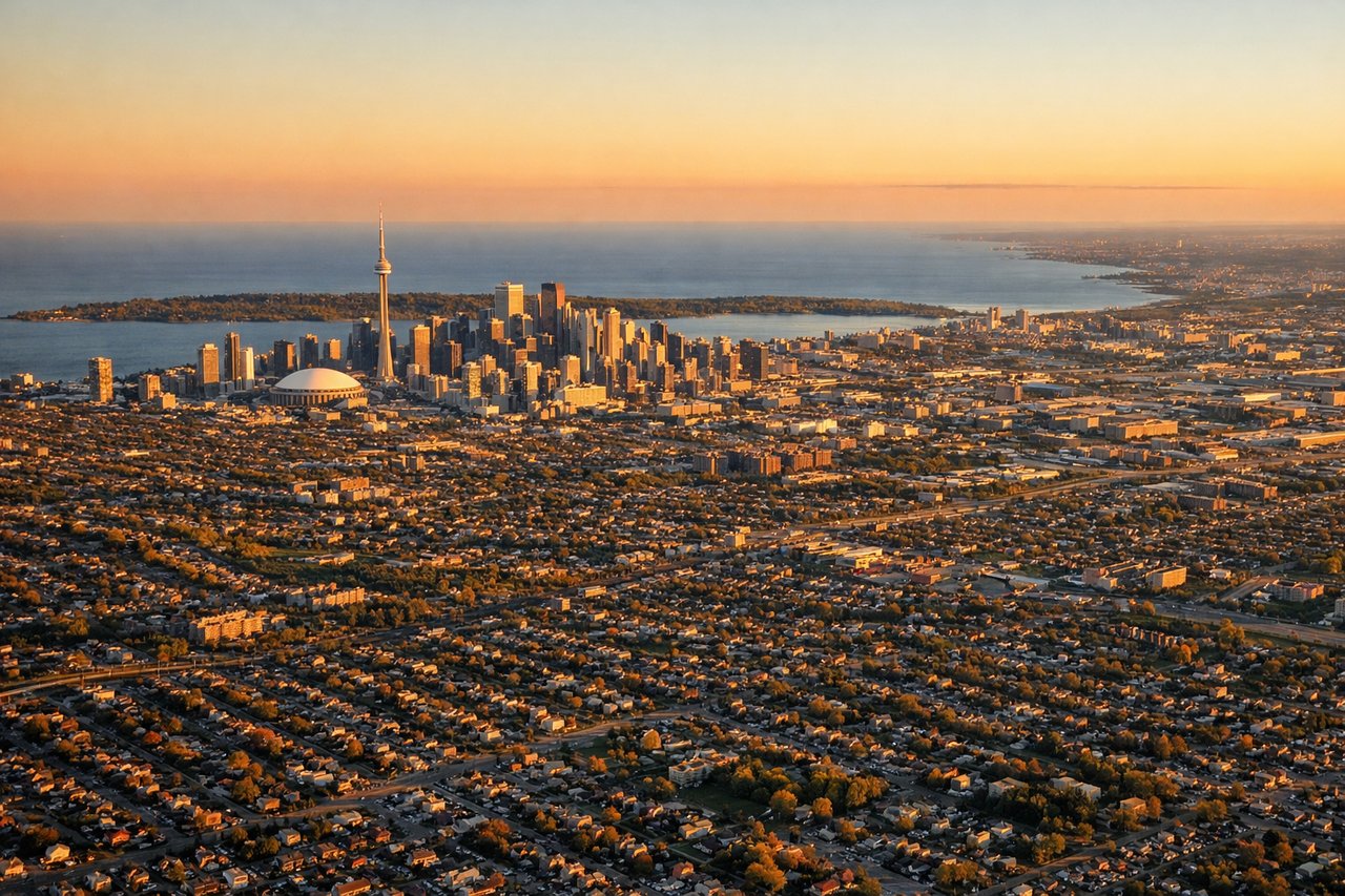
Landing at YYZ
LEFTArriving from the south/southeast, flights into YYZ typically swing over the western Lake Ontario shoreline before turning onto final, putting downtown Toronto's skyline and the lake itself on the left side of the cabin. The right side mostly faces inland suburbs with fewer distinctive features.
Will your flight be in sunlight?
Pick a date and time in the Sun Map to watch the sun move across your whole flight.
About This Route
Which side of the plane should I sit on flying from Punta Cana International (PUJ) to Lester B Pearson International (YYZ)?
Sit on the Left side of the plane for the best views on flights from Punta Cana to Toronto. The left side strings together a genuine variety of scenery across the whole flight: the Punta Cana coastline at departure, glimpses of the eastern Bahamas and Turks and Caicos early in the cruise, the Chesapeake Bay area and Appalachian ridges of Pennsylvania later on, and finally the Toronto skyline and Lake Ontario on arrival. The right side spends most of the flight over open Atlantic water with little to look at.
What can I see during takeoff from Punta Cana International in Punta Cana?
During takeoff from Punta Cana International (PUJ), sit on the Left side for the best views. PUJ departures run east into the trade winds, but the turn onto course toward Toronto swings the aircraft north, sweeping the Bavaro/Punta Cana coastline and its turquoise reef flats into view on the left side. The right side only sees open Caribbean water during this turn. Notable sights include: Bavaro Beach resort coastline, coral reef shallows, Punta Cana shoreline, Caribbean Sea.
What can I see when landing at Lester B Pearson International in Toronto?
When landing at Lester B Pearson International (YYZ), sit on the Left side for the best views. Arriving from the south/southeast, flights into YYZ typically swing over the western Lake Ontario shoreline before turning onto final, putting downtown Toronto's skyline and the lake itself on the left side of the cabin. The right side mostly faces inland suburbs with fewer distinctive features. Notable sights include: CN Tower and downtown Toronto skyline, Lake Ontario shoreline, Toronto Islands, Humber Bay waterfront.
How long is the flight from Punta Cana to Toronto?
The flight from Punta Cana International (PUJ) to Lester B Pearson International (YYZ) takes about 4 hours 15 minutes. The shortest flight path between them is 1,854 miles (2,984 km); winds and air traffic control usually add a few percent.
What does the Punta Cana to Toronto flight path pass over?
The route's midpoint sits over the open Atlantic Ocean roughly 150 miles east of the Georgia/South Carolina coast, over the Gulf Stream's dark blue current with no land in sight from either side.