Kimhae to Singapore is 2,834 miles (4,561 km), a flight of about 5 hours 15 minutes.
While takeoff offers good views of Busan's coastal features, the landing approach into Singapore provides more dramatic and varied scenery—the Johor Strait, Malaysian peninsula, Singapore's reservoirs, and the city's distinctive urban landscape all converge in the final descent. Left-side seats capture this sequence most effectively.
Flight Path
The flight path crosses the South China Sea at cruise altitude (typically 35,000 feet), passing over open water with no major landmarks visible. The route generally follows a southwest trajectory from Busan across the Korean Peninsula's southern tip, then over the Strait of Malacca region. At cruise altitude, the curvature of the coastlines and vast ocean expanses dominate; individual geographic features become too small to distinguish clearly. The most notable midpoint geography is the transition from the temperate waters and peninsular terrain of Korea to the tropical waters and island-dotted seascape of Southeast Asia, though this shift occurs gradually and is not marked by a single visible landmark.
Great circle distance and headings ›Phase by phase
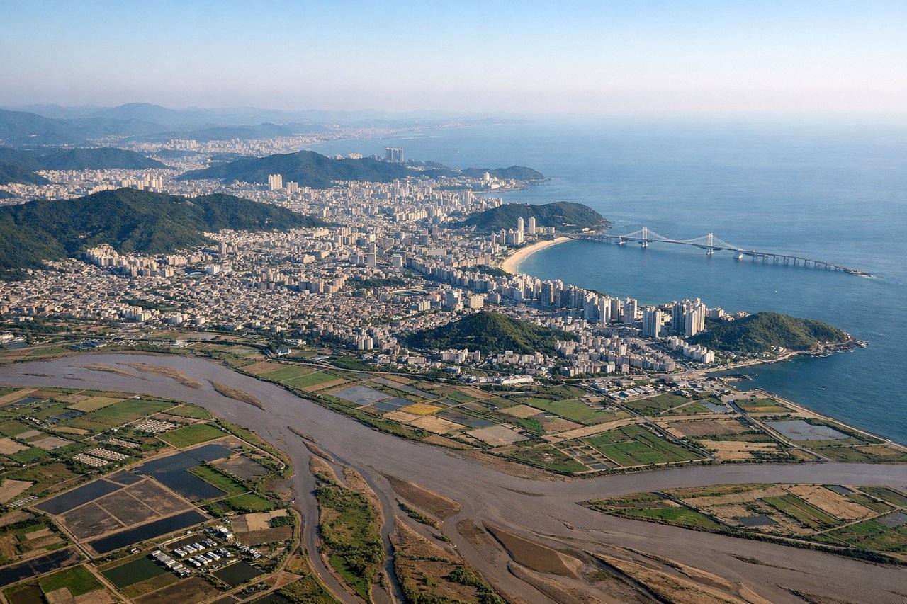
Takeoff from PUS
RIGHTRight-side seats capture the Nakdong River estuary and Busan's coastal geography as the aircraft climbs southwestward. The river delta and surrounding lowlands are distinctive from altitude and frame the initial climb-out beautifully.
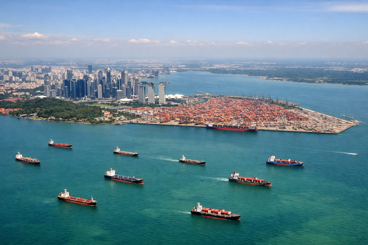
Landing at SIN
LEFTLeft-side seats offer the best views during descent into Changi. The aircraft approaches from the northwest, and left seats face the Johor Strait, Malaysian peninsula, and Singapore's northern reservoirs and urban core—all visually striking at 8,000–3,000 feet.
Landmarks on this routeAll landmarks →
Will your flight be in sunlight?
Pick a date and time in the Sun Map to watch the sun move across your whole flight.
About This Route
Which side of the plane should I sit on flying from Gimhae International (PUS) to Singapore Changi (SIN)?
Sit on the Left side of the plane for the best views on flights from Kimhae to Singapore. While takeoff offers good views of Busan's coastal features, the landing approach into Singapore provides more dramatic and varied scenery—the Johor Strait, Malaysian peninsula, Singapore's reservoirs, and the city's distinctive urban landscape all converge in the final descent. Left-side seats capture this sequence most effectively.
What can I see during takeoff from Gimhae International in Kimhae?
During takeoff from Gimhae International (PUS), sit on the Right side for the best views. Right-side seats capture the Nakdong River estuary and Busan's coastal geography as the aircraft climbs southwestward. The river delta and surrounding lowlands are distinctive from altitude and frame the initial climb-out beautifully. Notable sights include: Nakdong River estuary, Busan harbor and port facilities, Geoje Island to the southeast, Southern Gyeongsang Province lowlands.
What can I see when landing at Singapore Changi in Singapore?
When landing at Singapore Changi (SIN), sit on the Left side for the best views. Left-side seats offer the best views during descent into Changi. The aircraft approaches from the northwest, and left seats face the Johor Strait, Malaysian peninsula, and Singapore's northern reservoirs and urban core—all visually striking at 8,000–3,000 feet. Notable sights include: Johor Strait and Malaysian coastline, Singapore's northern water catchment reservoirs (Kranji, Tengah), Singapore's central business district and Marina Bay, Sentosa Island and southern coastline.
How long is the flight from Kimhae to Singapore?
The flight from Gimhae International (PUS) to Singapore Changi (SIN) takes about 5 hours 15 minutes. The shortest flight path between them is 2,834 miles (4,561 km); winds and air traffic control usually add a few percent.
What does the Kimhae to Singapore flight path pass over?
The flight path crosses the South China Sea at cruise altitude (typically 35,000 feet), passing over open water with no major landmarks visible. The route generally follows a southwest trajectory from Busan across the Korean Peninsula's southern tip, then over the Strait of Malacca region. At cruise altitude, the curvature of the coastlines and vast ocean expanses dominate; individual geographic features become too small to distinguish clearly. The most notable midpoint geography is the transition from the temperate waters and peninsular terrain of Korea to the tropical waters and island-dotted seascape of Southeast Asia, though this shift occurs gradually and is not marked by a single visible landmark.