Kimhae to Bangkok is 2,298 miles (3,698 km), a flight of about 6 hours 5 minutes.
The left side wins narrowly thanks to the more distinctive Busan coastal and harbor scenery at takeoff, since the long overwater cruise across the East and South China Seas offers little differentiation between sides.
Flight Path
The route crosses the East China Sea, passes near the southern tip of Taiwan or the Chinese coast, then continues over the South China Sea before crossing southern Vietnam and Cambodia toward the Gulf of Thailand.
Great circle distance and headings ›.jpg?width=600)

.jpg?width=600)
Phase by phase
Takeoff from PUS
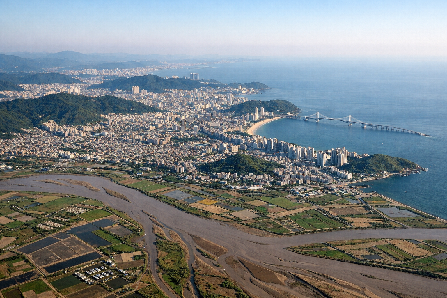
LEFTDeparting PUS to the south, the initial climb and turn toward the southwest put Busan's harbor, the Nakdong River estuary, and the offshore islands like Gadeokdo on the left side of the aircraft. The right side mostly shows the hilly interior of South Gyeongsang Province with less distinctive terrain.
Landing at BKK
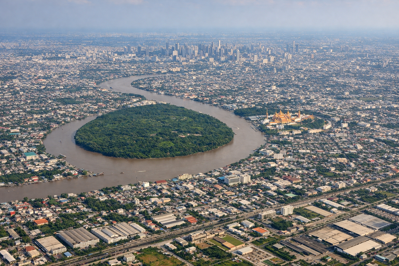
RIGHTOn approach into BKK from the south during the dry-season pattern, the final turn onto the runway puts the sprawling Bangkok skyline and the winding Chao Phraya River on the right side. The left side during this turn mostly shows flat agricultural land south of the city.
Landmarks on this routeAll landmarks →
Will your flight be in sunlight?
Pick a date and time in the Sun Map to watch the sun move across your whole flight.
About This Route
Which side of the plane should I sit on flying from Gimhae International (PUS) to Suvarnabhumi Airport (BKK)?
Sit on the Left side of the plane for the best views on flights from Kimhae to Bangkok. The left side wins narrowly thanks to the more distinctive Busan coastal and harbor scenery at takeoff, since the long overwater cruise across the East and South China Seas offers little differentiation between sides.
What can I see during takeoff from Gimhae International in Kimhae?
During takeoff from Gimhae International (PUS), sit on the Left side for the best views. Departing PUS to the south, the initial climb and turn toward the southwest put Busan's harbor, the Nakdong River estuary, and the offshore islands like Gadeokdo on the left side of the aircraft. The right side mostly shows the hilly interior of South Gyeongsang Province with less distinctive terrain. Notable sights include: Busan harbor and city skyline, Nakdong River delta, Gadeokdo and Oryukdo islands, Korea Strait coastline.
What can I see when landing at Suvarnabhumi Airport in Bangkok?
When landing at Suvarnabhumi Airport (BKK), sit on the Right side for the best views. On approach into BKK from the south during the dry-season pattern, the final turn onto the runway puts the sprawling Bangkok skyline and the winding Chao Phraya River on the right side. The left side during this turn mostly shows flat agricultural land south of the city. Notable sights include: Chao Phraya River bends, Bangkok skyline and skyscraper clusters, Gulf of Thailand shoreline, flooded rice paddies south of the city.
How long is the flight from Kimhae to Bangkok?
The flight from Gimhae International (PUS) to Suvarnabhumi Airport (BKK) takes about 6 hours 5 minutes. The shortest flight path between them is 2,298 miles (3,698 km); winds and air traffic control usually add a few percent.
What does the Kimhae to Bangkok flight path pass over?
The route crosses the East China Sea, passes near the southern tip of Taiwan or the Chinese coast, then continues over the South China Sea before crossing southern Vietnam and Cambodia toward the Gulf of Thailand.