While takeoff offers coastal views, the landing descent provides superior scenery with the dramatic San Gabriel Mountains, expansive Los Angeles basin, and Pacific Ocean all visible simultaneously. The right side captures the most geographically significant features of the destination.
Flown PVD to LAX? Did we get it right?
Flight Path
Providence to Los Angeles is 2,587 miles (4,163 km), a flight of about 5 hours 15 minutes.
Continental divide of the Rocky Mountains (visible around Utah/Colorado border), Great Salt Lake basin, Colorado Plateau, Mojave Desert, Sierra Nevada range (distant, far north of typical flight path)
Great circle distance and headings ›


Phase by phase
Takeoff from PVD
LEFTLeft side offers views of Narragansett Bay and the Rhode Island coastline as the aircraft climbs westward. You'll see the bay's distinctive shape and the Atlantic Ocean stretching to the horizon.
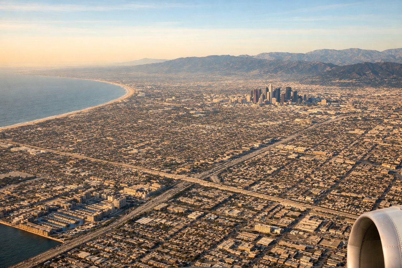
Landing at LAX
RIGHTRight side provides excellent views during the descent into LAX. You'll see the San Gabriel Mountains to the northeast and the Los Angeles basin sprawling below, with the Pacific Ocean visible to the west.
Will your flight be in sunlight?
Pick a date and time in the Sun Map to watch the sun move across your whole flight.
About This Route
Which side of the plane should I sit on flying from Theodore Francis Green State (PVD) to Los Angeles International (LAX)?
Sit on the Right side of the plane for the best views on flights from Providence to Los Angeles. While takeoff offers coastal views, the landing descent provides superior scenery with the dramatic San Gabriel Mountains, expansive Los Angeles basin, and Pacific Ocean all visible simultaneously. The right side captures the most geographically significant features of the destination.
What can I see during takeoff from Theodore Francis Green State in Providence?
During takeoff from Theodore Francis Green State (PVD), sit on the Left side for the best views. Left side offers views of Narragansett Bay and the Rhode Island coastline as the aircraft climbs westward. You'll see the bay's distinctive shape and the Atlantic Ocean stretching to the horizon. Notable sights include: Narragansett Bay, Atlantic Ocean coastline, Rhode Island Sound, Providence River estuary.
What can I see when landing at Los Angeles International in Los Angeles?
When landing at Los Angeles International (LAX), sit on the Right side for the best views. Right side provides excellent views during the descent into LAX. You'll see the San Gabriel Mountains to the northeast and the Los Angeles basin sprawling below, with the Pacific Ocean visible to the west. Notable sights include: San Gabriel Mountains, Los Angeles basin urban grid, Pacific Ocean, Long Beach harbor area.
How long is the flight from Providence to Los Angeles?
The flight from Theodore Francis Green State (PVD) to Los Angeles International (LAX) takes about 5 hours 15 minutes. The shortest flight path between them is 2,587 miles (4,163 km); winds and air traffic control usually add a few percent.
What does the Providence to Los Angeles flight path pass over?
Continental divide of the Rocky Mountains (visible around Utah/Colorado border), Great Salt Lake basin, Colorado Plateau, Mojave Desert, Sierra Nevada range (distant, far north of typical flight path)