The left side offers Narragansett Bay at departure and a skyline view of Charlotte at arrival, giving it clear visual interest over the largely featureless inland terrain seen from the right.
Flown PVD to CLT? Did we get it right?
Flight Path
Providence to Charlotte is 683 miles (1,099 km), a flight of about 1 hour 45 minutes.
Cruise track crosses the Long Island Sound approaches, the New Jersey and Delmarva coastal plain, and the northern Chesapeake Bay region, all generally visible as distant shoreline and water on the left side under clear conditions.
Great circle distance and headings ›Phase by phase
Takeoff from PVD
LEFTDeparting PVD toward the southwest, the initial climb passes just south of Providence with Narragansett Bay and its islands spread out on the left side. The right side shows only the flat, wooded interior of Rhode Island and Connecticut.
Landing at CLT
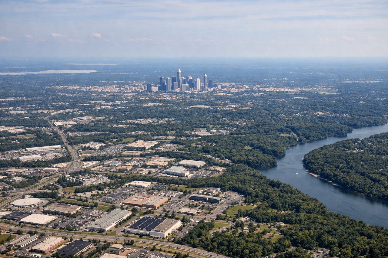
LEFTOn a typical north-to-south arrival into CLT, the aircraft flies down the eastern side of the Charlotte metro before turning onto final for the north-south runways, putting the city's skyline and suburban sprawl on the left side. The right side faces the flatter, more rural Piedmont countryside toward Gaston County.
Will your flight be in sunlight?
Pick a date and time in the Sun Map to watch the sun move across your whole flight.
About This Route
Which side of the plane should I sit on flying from Theodore Francis Green State (PVD) to Charlotte Douglas International (CLT)?
Sit on the Left side of the plane for the best views on flights from Providence to Charlotte. The left side offers Narragansett Bay at departure and a skyline view of Charlotte at arrival, giving it clear visual interest over the largely featureless inland terrain seen from the right.
What can I see during takeoff from Theodore Francis Green State in Providence?
During takeoff from Theodore Francis Green State (PVD), sit on the Left side for the best views. Departing PVD toward the southwest, the initial climb passes just south of Providence with Narragansett Bay and its islands spread out on the left side. The right side shows only the flat, wooded interior of Rhode Island and Connecticut. Notable sights include: Narragansett Bay, Providence waterfront, Conimicut Point, Rhode Island Sound.
What can I see when landing at Charlotte Douglas International in Charlotte?
When landing at Charlotte Douglas International (CLT), sit on the Left side for the best views. On a typical north-to-south arrival into CLT, the aircraft flies down the eastern side of the Charlotte metro before turning onto final for the north-south runways, putting the city's skyline and suburban sprawl on the left side. The right side faces the flatter, more rural Piedmont countryside toward Gaston County. Notable sights include: Charlotte skyline and Uptown towers, Lake Norman's southern arm, Charlotte Douglas runway complex.
How long is the flight from Providence to Charlotte?
The flight from Theodore Francis Green State (PVD) to Charlotte Douglas International (CLT) takes about 1 hour 45 minutes. The shortest flight path between them is 683 miles (1,099 km); winds and air traffic control usually add a few percent.
What does the Providence to Charlotte flight path pass over?
Cruise track crosses the Long Island Sound approaches, the New Jersey and Delmarva coastal plain, and the northern Chesapeake Bay region, all generally visible as distant shoreline and water on the left side under clear conditions.