The right side offers modest but real scenic value throughout the flight — a glimpse of Charlotte's skyline on departure and a genuinely scenic Narragansett Bay approach into Providence — while the left side stays largely over flat, featureless Mid-Atlantic terrain for the entire route.
Flown CLT to PVD? Did we get it right?
Flight Path
Charlotte to Providence is 683 miles (1,099 km), a flight of about 2 hours 5 minutes.
Rolling Piedmont and Blue Ridge foothills of Virginia, followed by the flat Coastal Plain and Chesapeake Bay lowlands of the Mid-Atlantic before crossing into southern New England.
Great circle distance and headings ›Phase by phase
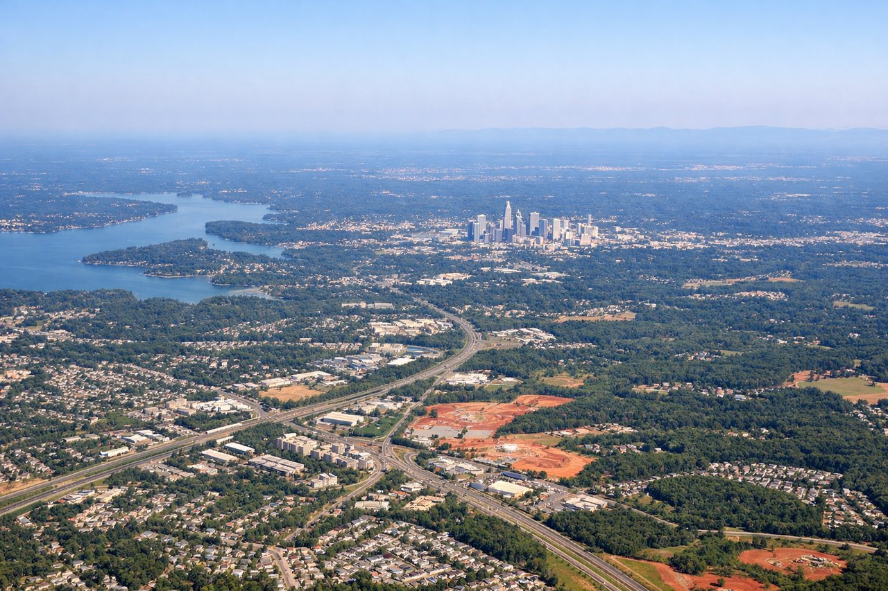
Takeoff from CLT
RIGHTDeparting CLT, the right side gives passengers a brief view over the Charlotte skyline and Piedmont plateau before the climb levels off over rolling farmland. It's not dramatic, but slightly more visually varied than the featureless plains to the left.
Landing at PVD
RIGHTOn approach into PVD, arrivals from the southwest typically curve toward Narragansett Bay before lining up for Runway 5 or 23, giving right-side passengers a clear view of the bay's inlets and the Providence waterfront skyline just before touchdown.
Will your flight be in sunlight?
Pick a date and time in the Sun Map to watch the sun move across your whole flight.
About This Route
Which side of the plane should I sit on flying from Charlotte Douglas International (CLT) to Theodore Francis Green State (PVD)?
Sit on the Right side of the plane for the best views on flights from Charlotte to Providence. The right side offers modest but real scenic value throughout the flight — a glimpse of Charlotte's skyline on departure and a genuinely scenic Narragansett Bay approach into Providence — while the left side stays largely over flat, featureless Mid-Atlantic terrain for the entire route.
What can I see during takeoff from Charlotte Douglas International in Charlotte?
During takeoff from Charlotte Douglas International (CLT), sit on the Right side for the best views. Departing CLT, the right side gives passengers a brief view over the Charlotte skyline and Piedmont plateau before the climb levels off over rolling farmland. It's not dramatic, but slightly more visually varied than the featureless plains to the left. Notable sights include: Charlotte downtown skyline, Piedmont rolling hills, scattered reservoirs.
What can I see when landing at Theodore Francis Green State in Providence?
When landing at Theodore Francis Green State (PVD), sit on the Right side for the best views. On approach into PVD, arrivals from the southwest typically curve toward Narragansett Bay before lining up for Runway 5 or 23, giving right-side passengers a clear view of the bay's inlets and the Providence waterfront skyline just before touchdown. Notable sights include: Narragansett Bay, Providence River waterfront, downtown Providence skyline, coastal salt marshes.
How long is the flight from Charlotte to Providence?
The flight from Charlotte Douglas International (CLT) to Theodore Francis Green State (PVD) takes about 2 hours 5 minutes. The shortest flight path between them is 683 miles (1,099 km); winds and air traffic control usually add a few percent.
What does the Charlotte to Providence flight path pass over?
Rolling Piedmont and Blue Ridge foothills of Virginia, followed by the flat Coastal Plain and Chesapeake Bay lowlands of the Mid-Atlantic before crossing into southern New England.