The left side departure view over Shanghai's iconic skyline and the Yangtze estuary is genuinely spectacular and hard to match. While the right side landing at IAH offers the Houston skyline, it is a modest payoff compared to the Shanghai departure. The left side also captures the Japanese coastline and Aleutian Island chain during the transpacific cruise at altitude, giving it the edge across the full flight.
Flown PVG to IAH? Did we get it right?
Flight Path
Shanghai to Houston is 7,560 miles (12,167 km), a flight of about 13 hours 45 minutes.
The great circle route arcs northeast over the East China Sea, crossing southern Japan (Kyushu and Honshu coastlines visible on clear days), then northeast over the North Pacific toward the Aleutian Islands chain — a string of volcanic islands visible as dark landmasses in the gray Pacific. The route then tracks southeast across the Gulf of Alaska, possibly passing south of Kodiak Island, before crossing the Canadian Rockies in British Columbia and Alberta (snow-capped peaks visible from altitude on clear days), then descending across the Great Plains of the central United States — flat agricultural patchwork all the way into Texas.
Great circle distance and headings ›


Phase by phase

Takeoff from PVG
LEFTPVG typically departs eastward on runways 16/34 or 17/35, with initial turns northward over the Yangtze River estuary. The left side gives you a clear view back over the Huangpu River, the dense urban grid of Pudong and Puxi, and the distinctive curve of the Bund waterfront. The right side faces open East China Sea with little of interest.
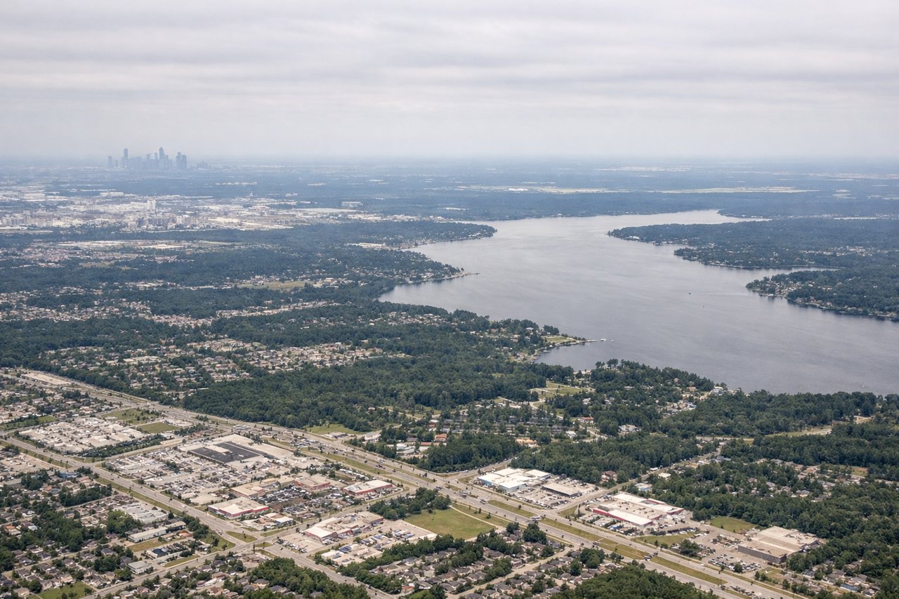
Landing at IAH
RIGHTIAH typically lands from the east or southeast on runways oriented roughly 15/33. On approach from the Pacific routing, aircraft descend from the northwest, meaning the right side faces south and southeast toward downtown Houston's skyline and the flat Gulf Coastal Plain. The left side looks north over suburban sprawl with little of visual interest.
Will your flight be in sunlight?
Pick a date and time in the Sun Map to watch the sun move across your whole flight.
About This Route
Which side of the plane should I sit on flying from Shanghai Pudong International (PVG) to George Bush Intcntl Houston (IAH)?
Sit on the Left side of the plane for the best views on flights from Shanghai to Houston. The left side departure view over Shanghai's iconic skyline and the Yangtze estuary is genuinely spectacular and hard to match. While the right side landing at IAH offers the Houston skyline, it is a modest payoff compared to the Shanghai departure. The left side also captures the Japanese coastline and Aleutian Island chain during the transpacific cruise at altitude, giving it the edge across the full flight.
What can I see during takeoff from Shanghai Pudong International in Shanghai?
During takeoff from Shanghai Pudong International (PVG), sit on the Left side for the best views. PVG typically departs eastward on runways 16/34 or 17/35, with initial turns northward over the Yangtze River estuary. The left side gives you a clear view back over the Huangpu River, the dense urban grid of Pudong and Puxi, and the distinctive curve of the Bund waterfront. The right side faces open East China Sea with little of interest. Notable sights include: Huangpu River S-curve through central Shanghai, Pudong skyline including Oriental Pearl Tower and Shanghai Tower cluster, Yangtze River estuary (massive brown sediment plume visible), Chongming Island to the north.
What can I see when landing at George Bush Intcntl Houston in Houston?
When landing at George Bush Intcntl Houston (IAH), sit on the Right side for the best views. IAH typically lands from the east or southeast on runways oriented roughly 15/33. On approach from the Pacific routing, aircraft descend from the northwest, meaning the right side faces south and southeast toward downtown Houston's skyline and the flat Gulf Coastal Plain. The left side looks north over suburban sprawl with little of visual interest. Notable sights include: Downtown Houston skyline visible to the southeast during descent, Lake Houston reservoir to the east, Buffalo Bayou watershed visible as green corridors cutting through the urban grid, the flat Gulf Coastal Plain stretching to the horizon.
How long is the flight from Shanghai to Houston?
The flight from Shanghai Pudong International (PVG) to George Bush Intcntl Houston (IAH) takes about 13 hours 45 minutes. The shortest flight path between them is 7,560 miles (12,167 km); winds and air traffic control usually add a few percent.
What does the Shanghai to Houston flight path pass over?
The great circle route arcs northeast over the East China Sea, crossing southern Japan (Kyushu and Honshu coastlines visible on clear days), then northeast over the North Pacific toward the Aleutian Islands chain — a string of volcanic islands visible as dark landmasses in the gray Pacific. The route then tracks southeast across the Gulf of Alaska, possibly passing south of Kodiak Island, before crossing the Canadian Rockies in British Columbia and Alberta (snow-capped peaks visible from altitude on clear days), then descending across the Great Plains of the central United States — flat agricultural patchwork all the way into Texas.