While takeoff favors the right for Banderas Bay and coastal views, the landing approach on the left side offers superior geography—the Cascade Range, Mount Hood, and the Willamette Valley are more visually distinctive and geologically significant than the departure scenery. Left wins the overall flight.
Flown PVR to PDX? Did we get it right?
Flight Path
Puerto Vallarta to Portland is 1,982 miles (3,190 km), a flight of about 4 hours 15 minutes.
The flight path crosses the Sierra Madre Occidental in Jalisco/Nayarit, then traverses the high deserts of northern Mexico and the southwestern United States. Notable midpoint features include the Colorado Plateau, the Great Basin, and the transition into the Pacific Northwest terrain. Mount Shasta (14,179 ft) in northern California may be visible on clear days as a distant snow-capped peak to the left on the northbound leg. The Oregon-California border region shows dramatic changes in vegetation from desert scrub to coniferous forest.
Great circle distance and headings ›


Phase by phase
Takeoff from PVR
RIGHTPVR typically departs to the north or northwest. Right-side seats offer views of Banderas Bay and the Pacific coastline as the aircraft climbs, plus the Sierra Madre Occidental mountains rising inland to the east.
Landing at PDX
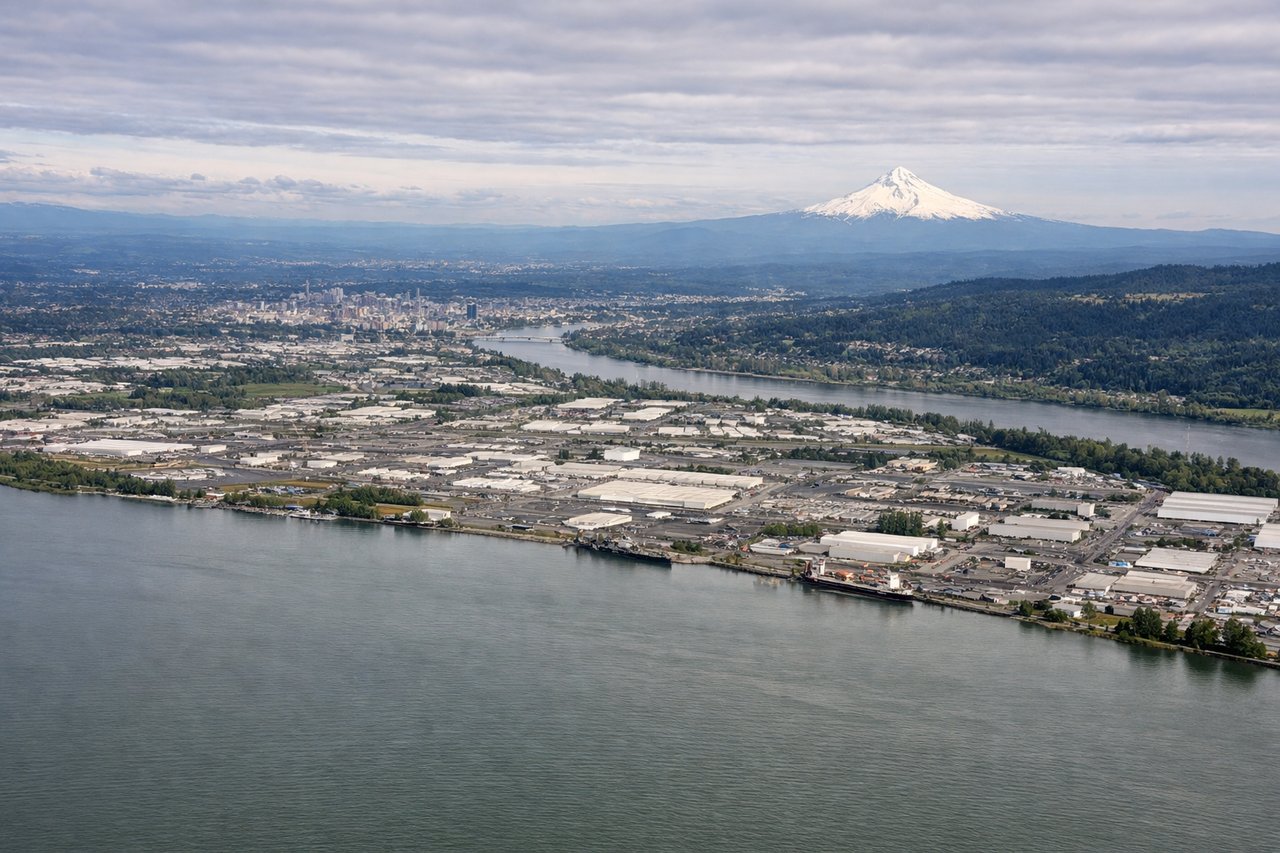
LEFTPDX typically lands from the north on runways 10L/10R or from the south on 28L/28R. On a northbound approach (most common), left-side seats provide views of the Cascade Range, Mount Hood, and the Willamette River valley as the aircraft descends toward the airport east of Portland.
Will your flight be in sunlight?
Pick a date and time in the Sun Map to watch the sun move across your whole flight.
About This Route
Which side of the plane should I sit on flying from Licenciado Gustavo Diaz Ordaz International (PVR) to Portland International (PDX)?
Sit on the Left side of the plane for the best views on flights from Puerto Vallarta to Portland. While takeoff favors the right for Banderas Bay and coastal views, the landing approach on the left side offers superior geography—the Cascade Range, Mount Hood, and the Willamette Valley are more visually distinctive and geologically significant than the departure scenery. Left wins the overall flight.
What can I see during takeoff from Licenciado Gustavo Diaz Ordaz International in Puerto Vallarta?
During takeoff from Licenciado Gustavo Diaz Ordaz International (PVR), sit on the Right side for the best views. PVR typically departs to the north or northwest. Right-side seats offer views of Banderas Bay and the Pacific coastline as the aircraft climbs, plus the Sierra Madre Occidental mountains rising inland to the east. Notable sights include: Banderas Bay (immediate offshore), Pacific Ocean, Sierra Madre Occidental foothills, Puerto Vallarta city grid.
What can I see when landing at Portland International in Portland?
When landing at Portland International (PDX), sit on the Left side for the best views. PDX typically lands from the north on runways 10L/10R or from the south on 28L/28R. On a northbound approach (most common), left-side seats provide views of the Cascade Range, Mount Hood, and the Willamette River valley as the aircraft descends toward the airport east of Portland. Notable sights include: Cascade Range peaks, Mount Hood (11,240 ft, visible 50+ miles away), Willamette River, Portland metro area.
How long is the flight from Puerto Vallarta to Portland?
The flight from Licenciado Gustavo Diaz Ordaz International (PVR) to Portland International (PDX) takes about 4 hours 15 minutes. The shortest flight path between them is 1,982 miles (3,190 km); winds and air traffic control usually add a few percent.
What does the Puerto Vallarta to Portland flight path pass over?
The flight path crosses the Sierra Madre Occidental in Jalisco/Nayarit, then traverses the high deserts of northern Mexico and the southwestern United States. Notable midpoint features include the Colorado Plateau, the Great Basin, and the transition into the Pacific Northwest terrain. Mount Shasta (14,179 ft) in northern California may be visible on clear days as a distant snow-capped peak to the left on the northbound leg. The Oregon-California border region shows dramatic changes in vegetation from desert scrub to coniferous forest.