While takeoff favors the left for Mount Hood views, the landing experience on the right side—with Banderas Bay's striking turquoise waters and Sierra Madre backdrop—is more visually rewarding and memorable. The approach descent provides extended views of the destination landscape.
Flown PDX to PVR? Did we get it right?
Flight Path
Portland to Puerto Vallarta is 1,982 miles (3,190 km), a flight of about 4 hours 15 minutes.
Flight path crosses central Oregon high desert (sparse vegetation, volcanic plateaus), then transitions over northern California's interior valleys. Crossing into Mexico, the Sierra Madre Occidental becomes increasingly prominent. The route generally follows a south-southwest heading, passing east of the California coast and over inland Mexico before descending toward the Pacific coast at Puerto Vallarta.
Great circle distance and headings ›


Phase by phase
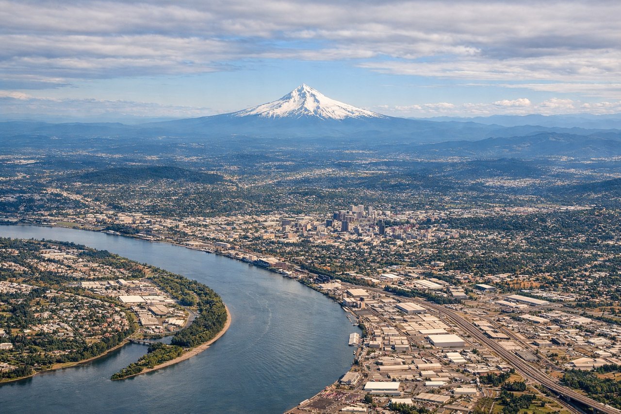
Takeoff from PDX
LEFTPDX typically departs to the north on Runway 10L/10R. Left-side seats offer views of the Cascade Range, particularly Mount Hood, which dominates the eastern skyline during northbound climb-out. Right-side views show the Willamette Valley floor and suburban sprawl.
Landing at PVR
RIGHTPVR approaches from the north over the Pacific, typically landing on Runway 03. Right-side seats provide unobstructed views of Banderas Bay's turquoise waters, the Sierra Madre Occidental mountains rising inland, and the coastal resort development. Left-side views show open ocean with minimal distinguishing features.
Will your flight be in sunlight?
Pick a date and time in the Sun Map to watch the sun move across your whole flight.
About This Route
Which side of the plane should I sit on flying from Portland International (PDX) to Licenciado Gustavo Diaz Ordaz International (PVR)?
Sit on the Right side of the plane for the best views on flights from Portland to Puerto Vallarta. While takeoff favors the left for Mount Hood views, the landing experience on the right side—with Banderas Bay's striking turquoise waters and Sierra Madre backdrop—is more visually rewarding and memorable. The approach descent provides extended views of the destination landscape.
What can I see during takeoff from Portland International in Portland?
During takeoff from Portland International (PDX), sit on the Left side for the best views. PDX typically departs to the north on Runway 10L/10R. Left-side seats offer views of the Cascade Range, particularly Mount Hood, which dominates the eastern skyline during northbound climb-out. Right-side views show the Willamette Valley floor and suburban sprawl. Notable sights include: Mount Hood (11,240 ft, ~50 miles east), Cascade Range spine, Willamette River valley floor, Portland metro area.
What can I see when landing at Licenciado Gustavo Diaz Ordaz International in Puerto Vallarta?
When landing at Licenciado Gustavo Diaz Ordaz International (PVR), sit on the Right side for the best views. PVR approaches from the north over the Pacific, typically landing on Runway 03. Right-side seats provide unobstructed views of Banderas Bay's turquoise waters, the Sierra Madre Occidental mountains rising inland, and the coastal resort development. Left-side views show open ocean with minimal distinguishing features. Notable sights include: Banderas Bay (turquoise Pacific waters), Sierra Madre Occidental foothills, Puerto Vallarta beachfront and marina, Punta Mita peninsula.
How long is the flight from Portland to Puerto Vallarta?
The flight from Portland International (PDX) to Licenciado Gustavo Diaz Ordaz International (PVR) takes about 4 hours 15 minutes. The shortest flight path between them is 1,982 miles (3,190 km); winds and air traffic control usually add a few percent.
What does the Portland to Puerto Vallarta flight path pass over?
Flight path crosses central Oregon high desert (sparse vegetation, volcanic plateaus), then transitions over northern California's interior valleys. Crossing into Mexico, the Sierra Madre Occidental becomes increasingly prominent. The route generally follows a south-southwest heading, passing east of the California coast and over inland Mexico before descending toward the Pacific coast at Puerto Vallarta.