While the left side offers excellent Black Hills scenery during takeoff, the right side dominates the longer descent phase with views of the Trinity River valley and the entire Dallas-Fort Worth metropolitan area—a more visually rewarding experience for the majority of the flight.
Flown RAP to DFW? Did we get it right?
Flight Path
Rapid City to Dallas-Fort Worth is 836 miles (1,345 km), a flight of about 2 hours 20 minutes.
The flight path crosses the Oklahoma Panhandle and northern Texas, passing over the Red River (the state boundary between Oklahoma and Texas), the Wichita Mountains in southwestern Oklahoma (visible from altitude as a low, distinct ridge), and the rolling prairie and grasslands of north-central Texas. The Red River appears as a thin, meandering line on the horizon during mid-flight. No major mountain ranges are visible in the midpoint, but the gradual transition from the High Plains to the lower Texas prairie is noticeable.
Great circle distance and headings ›Phase by phase
Takeoff from RAP
LEFTLeft side offers immediate views of the Black Hills and surrounding high plains terrain as the aircraft climbs out on a southeasterly heading. The dramatic elevation change and forested ridges of the Black Hills are striking during the initial climb.
Landing at DFW
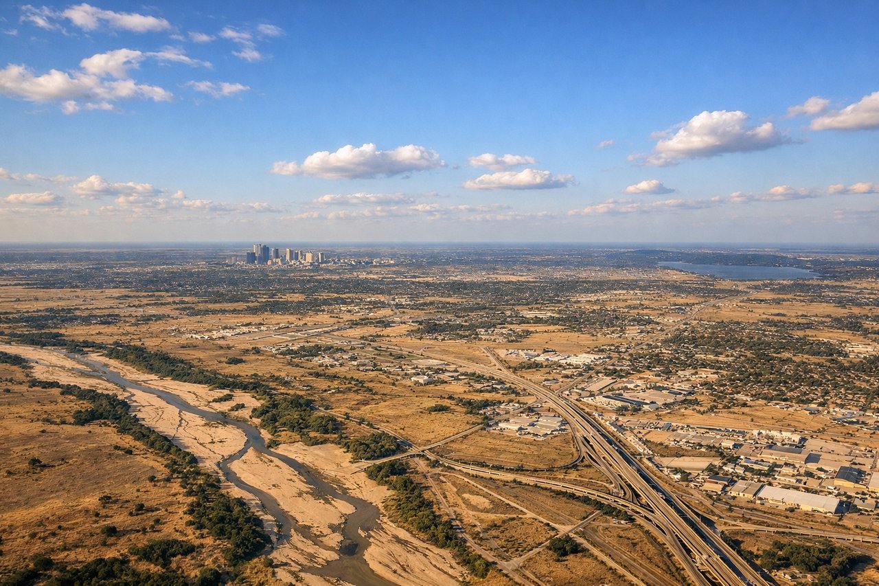
RIGHTRight side provides excellent views during descent into DFW. The approach typically brings the aircraft over the Trinity River valley and the Fort Worth-Dallas urban corridor from the north, with the sprawling metropolis, major highways, and the distinctive geometry of the Dallas-Fort Worth area clearly visible.
Will your flight be in sunlight?
Pick a date and time in the Sun Map to watch the sun move across your whole flight.
About This Route
Which side of the plane should I sit on flying from Rapid City Regional Airport (RAP) to Dallas Fort Worth International (DFW)?
Sit on the Right side of the plane for the best views on flights from Rapid City to Dallas-Fort Worth. While the left side offers excellent Black Hills scenery during takeoff, the right side dominates the longer descent phase with views of the Trinity River valley and the entire Dallas-Fort Worth metropolitan area—a more visually rewarding experience for the majority of the flight.
What can I see during takeoff from Rapid City Regional Airport in Rapid City?
During takeoff from Rapid City Regional Airport (RAP), sit on the Left side for the best views. Left side offers immediate views of the Black Hills and surrounding high plains terrain as the aircraft climbs out on a southeasterly heading. The dramatic elevation change and forested ridges of the Black Hills are striking during the initial climb. Notable sights include: Black Hills (forested ridgeline to the west and north), Harney Peak area, High Plains plateau extending southeast, Rapid City urban grid below.
What can I see when landing at Dallas Fort Worth International in Dallas-Fort Worth?
When landing at Dallas Fort Worth International (DFW), sit on the Right side for the best views. Right side provides excellent views during descent into DFW. The approach typically brings the aircraft over the Trinity River valley and the Fort Worth-Dallas urban corridor from the north, with the sprawling metropolis, major highways, and the distinctive geometry of the Dallas-Fort Worth area clearly visible. Notable sights include: Trinity River and its floodplain, Fort Worth downtown skyline, Dallas downtown skyline, Interstate 35E corridor.
How long is the flight from Rapid City to Dallas-Fort Worth?
The flight from Rapid City Regional Airport (RAP) to Dallas Fort Worth International (DFW) takes about 2 hours 20 minutes. The shortest flight path between them is 836 miles (1,345 km); winds and air traffic control usually add a few percent.
What does the Rapid City to Dallas-Fort Worth flight path pass over?
The flight path crosses the Oklahoma Panhandle and northern Texas, passing over the Red River (the state boundary between Oklahoma and Texas), the Wichita Mountains in southwestern Oklahoma (visible from altitude as a low, distinct ridge), and the rolling prairie and grasslands of north-central Texas. The Red River appears as a thin, meandering line on the horizon during mid-flight. No major mountain ranges are visible in the midpoint, but the gradual transition from the High Plains to the lower Texas prairie is noticeable.