While takeoff slightly favors the right side with urban scenery, the landing sequence on the left side provides significantly more visual interest with the Mississippi River delta, Lake Pontchartrain, and distinctive water features that dominate the approach. The delta's complexity and the river's dramatic crescent shape create memorable scenery that outweighs the modest urban views during departure. Both sides score equally for the cruise phase over flat Piedmont and coastal plain terrain.
Flown RDU to MSY? Did we get it right?
Flight Path
Raleigh-Durham to New Orleans is 779 miles (1,254 km), a flight of about 2 hours 15 minutes.
Appalachian foothills fade into Piedmont plateau; transition from North Carolina to South Carolina occurs around midpoint with Savannah River valley visible; coastal plain emerges over Georgia-South Carolina border; no major mountain ranges or dramatic terrain changes; primarily forested landscape with occasional river valleys and small urban centers (Charlotte, Columbia, Augusta areas) visible but not directly on route; final 45 minutes show increasing flatness and water features as approach to Gulf Coast begins
Great circle distance and headings ›Phase by phase
Takeoff from RDU
RIGHTRight side captures the Research Triangle urban area (Raleigh, Durham, Chapel Hill) during initial climb, with visible street grids and developed patches. Left side shows only forested Piedmont terrain with no distinctive landmarks during departure.
Landing at MSY
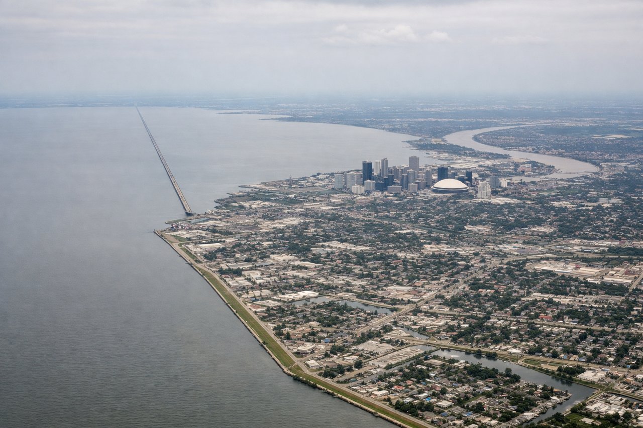
LEFTLeft side offers the Mississippi River delta approach with visible water bodies, wetlands, and the distinctive crescent bend of the river near New Orleans. Right side shows only flat coastal plain and industrial areas without the dramatic water features.
Will your flight be in sunlight?
Pick a date and time in the Sun Map to watch the sun move across your whole flight.
About This Route
Which side of the plane should I sit on flying from Raleigh Durham International (RDU) to Louis Armstrong New Orleans International (MSY)?
Sit on the Left side of the plane for the best views on flights from Raleigh-Durham to New Orleans. While takeoff slightly favors the right side with urban scenery, the landing sequence on the left side provides significantly more visual interest with the Mississippi River delta, Lake Pontchartrain, and distinctive water features that dominate the approach. The delta's complexity and the river's dramatic crescent shape create memorable scenery that outweighs the modest urban views during departure. Both sides score equally for the cruise phase over flat Piedmont and coastal plain terrain.
What can I see during takeoff from Raleigh Durham International in Raleigh-Durham?
During takeoff from Raleigh Durham International (RDU), sit on the Right side for the best views. Right side captures the Research Triangle urban area (Raleigh, Durham, Chapel Hill) during initial climb, with visible street grids and developed patches. Left side shows only forested Piedmont terrain with no distinctive landmarks during departure. Notable sights include: Research Triangle urban cluster, Neuse River valley, Piedmont forest canopy, local road networks.
What can I see when landing at Louis Armstrong New Orleans International in New Orleans?
When landing at Louis Armstrong New Orleans International (MSY), sit on the Left side for the best views. Left side offers the Mississippi River delta approach with visible water bodies, wetlands, and the distinctive crescent bend of the river near New Orleans. Right side shows only flat coastal plain and industrial areas without the dramatic water features. Notable sights include: Mississippi River crescent, Lake Pontchartrain, New Orleans urban area, coastal wetlands and bayou channels.
How long is the flight from Raleigh-Durham to New Orleans?
The flight from Raleigh Durham International (RDU) to Louis Armstrong New Orleans International (MSY) takes about 2 hours 15 minutes. The shortest flight path between them is 779 miles (1,254 km); winds and air traffic control usually add a few percent.
What does the Raleigh-Durham to New Orleans flight path pass over?
Appalachian foothills fade into Piedmont plateau; transition from North Carolina to South Carolina occurs around midpoint with Savannah River valley visible; coastal plain emerges over Georgia-South Carolina border; no major mountain ranges or dramatic terrain changes; primarily forested landscape with occasional river valleys and small urban centers (Charlotte, Columbia, Augusta areas) visible but not directly on route; final 45 minutes show increasing flatness and water features as approach to Gulf Coast begins