While takeoff favors the left side with Research Triangle visibility, the landing sequence on the right side—featuring the Ohio River's dramatic meanders and Louisville's downtown skyline—provides more visually distinctive and recognizable landmarks. The river valley approach creates stronger scenic contrast than the flat forest departure. Both sides score equally overall (2.5), but the landing experience tips the recommendation to the right window for passengers prioritizing the full flight experience.
Flown RDU to SDF? Did we get it right?
Flight Path
Raleigh-Durham to Louisville is 415 miles (667 km), a flight of about 1 hour 15 minutes.
Appalachian foothills transition zone (eastern Kentucky mountains visible as low ridges), Bluegrass region rolling terrain, multiple river valleys including the Kentucky River system, scattered small towns and agricultural patchwork across central Kentucky
Great circle distance and headings ›Phase by phase
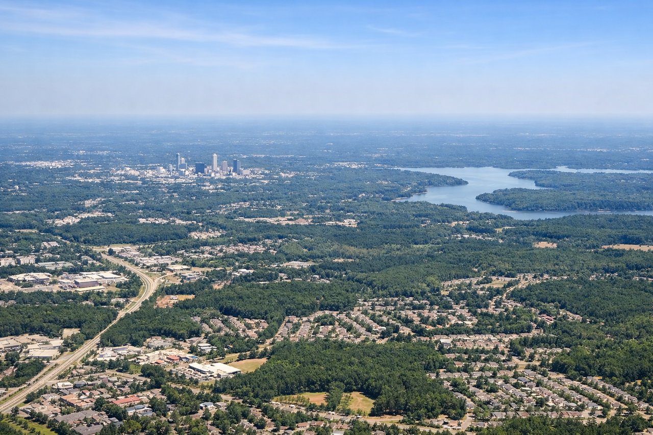
Takeoff from RDU
LEFTLeft side captures the Research Triangle urban area (Raleigh, Durham, Chapel Hill) during initial climb, with visible street grids and developed patches. Right side shows only flat pine forests and suburban sprawl with minimal distinctive features.
Landing at SDF
RIGHTRight side (west/southwest approach) provides views of the Ohio River valley and Louisville's downtown skyline during descent and final approach. Left side shows only flat farmland and suburban sprawl with no distinctive landmarks.
Will your flight be in sunlight?
Pick a date and time in the Sun Map to watch the sun move across your whole flight.
About This Route
Which side of the plane should I sit on flying from Raleigh Durham International (RDU) to Louisville Muhammad Ali International Airport (SDF)?
Sit on the Right side of the plane for the best views on flights from Raleigh-Durham to Louisville. While takeoff favors the left side with Research Triangle visibility, the landing sequence on the right side—featuring the Ohio River's dramatic meanders and Louisville's downtown skyline—provides more visually distinctive and recognizable landmarks. The river valley approach creates stronger scenic contrast than the flat forest departure. Both sides score equally overall (2.5), but the landing experience tips the recommendation to the right window for passengers prioritizing the full flight experience.
What can I see during takeoff from Raleigh Durham International in Raleigh-Durham?
During takeoff from Raleigh Durham International (RDU), sit on the Left side for the best views. Left side captures the Research Triangle urban area (Raleigh, Durham, Chapel Hill) during initial climb, with visible street grids and developed patches. Right side shows only flat pine forests and suburban sprawl with minimal distinctive features. Notable sights include: Raleigh downtown core, Durham's industrial district, Chapel Hill campus area, surrounding pine forest canopy.
What can I see when landing at Louisville Muhammad Ali International Airport in Louisville?
When landing at Louisville Muhammad Ali International Airport (SDF), sit on the Right side for the best views. Right side (west/southwest approach) provides views of the Ohio River valley and Louisville's downtown skyline during descent and final approach. Left side shows only flat farmland and suburban sprawl with no distinctive landmarks. Notable sights include: Ohio River meanders, Louisville downtown skyline, Waterfront Park area, surrounding Jefferson County farmland.
How long is the flight from Raleigh-Durham to Louisville?
The flight from Raleigh Durham International (RDU) to Louisville Muhammad Ali International Airport (SDF) takes about 1 hour 15 minutes. The shortest flight path between them is 415 miles (667 km); winds and air traffic control usually add a few percent.
What does the Raleigh-Durham to Louisville flight path pass over?
Appalachian foothills transition zone (eastern Kentucky mountains visible as low ridges), Bluegrass region rolling terrain, multiple river valleys including the Kentucky River system, scattered small towns and agricultural patchwork across central Kentucky