Right side edges ahead due to superior takeoff experience from Louisville. The Ohio River's dramatic meander and downtown skyline provide more concentrated visual interest during climb-out than the left side offers. Both sides score equally during cruise (flat to gently rolling piedmont terrain with minimal dramatic features) and landing (similar piedmont/river valley views). The takeoff advantage on the right side, combined with equivalent landing quality, gives the right side the overall edge on this short 1-hour flight.
Flown SDF to RDU? Did we get it right?
Flight Path
Louisville to Raleigh-Durham is 415 miles (667 km), a flight of about 1 hour 5 minutes.
The flight path crosses central Kentucky and southern West Virginia at cruise altitude (typically 25,000-31,000 feet). Visible features include the Cumberland Plateau's eastern edge (subtle elevation change visible as terrain texture), the Appalachian foothills' gentle ridges running northeast-southwest, and scattered reservoirs (Lake Cumberland, Laurel River Lake) appearing as dark patches in the forested terrain. The Daniel Boone National Forest occupies much of the mid-flight corridor. No dramatic peaks or major rivers dominate the cruise phase—this is classic Appalachian piedmont: rolling, forested, with minimal urban development. The terrain gradually transitions from Kentucky's limestone plateau to North Carolina's metamorphic piedmont as the flight progresses southeast.
Great circle distance and headings ›Phase by phase
Takeoff from SDF
RIGHTRight side captures Louisville's urban core and the Ohio River valley during initial climb. The river's meandering path and downtown skyline provide immediate visual interest during the critical first 5-10 minutes of flight.
Landing at RDU
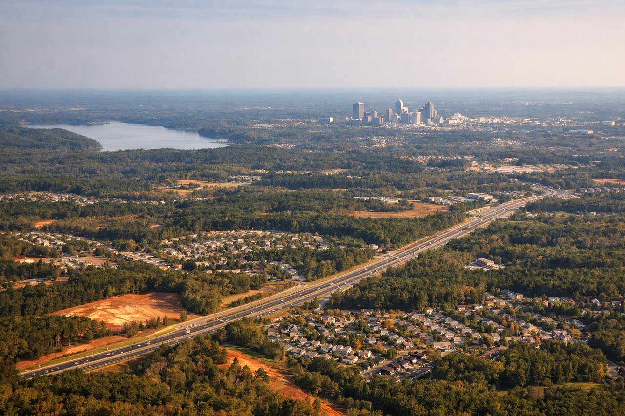
LEFTLeft side during approach to RDU runway 23L/23R captures the Neuse River valley and the transition from rural piedmont to the Research Triangle urban corridor. The descent path provides extended views of this geographic transition zone.
Will your flight be in sunlight?
Pick a date and time in the Sun Map to watch the sun move across your whole flight.
About This Route
Which side of the plane should I sit on flying from Louisville Muhammad Ali International Airport (SDF) to Raleigh Durham International (RDU)?
Sit on the Right side of the plane for the best views on flights from Louisville to Raleigh-Durham. Right side edges ahead due to superior takeoff experience from Louisville. The Ohio River's dramatic meander and downtown skyline provide more concentrated visual interest during climb-out than the left side offers. Both sides score equally during cruise (flat to gently rolling piedmont terrain with minimal dramatic features) and landing (similar piedmont/river valley views). The takeoff advantage on the right side, combined with equivalent landing quality, gives the right side the overall edge on this short 1-hour flight.
What can I see during takeoff from Louisville Muhammad Ali International Airport in Louisville?
During takeoff from Louisville Muhammad Ali International Airport (SDF), sit on the Right side for the best views. Right side captures Louisville's urban core and the Ohio River valley during initial climb. The river's meandering path and downtown skyline provide immediate visual interest during the critical first 5-10 minutes of flight. Notable sights include: Ohio River (northward bend), Louisville downtown skyline, Jefferson County suburban sprawl, Fort Knox military reservation (visible as cleared terrain southwest).
What can I see when landing at Raleigh Durham International in Raleigh-Durham?
When landing at Raleigh Durham International (RDU), sit on the Left side for the best views. Left side during approach to RDU runway 23L/23R captures the Neuse River valley and the transition from rural piedmont to the Research Triangle urban corridor. The descent path provides extended views of this geographic transition zone. Notable sights include: Neuse River (major drainage feature), Research Triangle Park developed area, Durham-Chapel Hill urban corridor, piedmont forest canopy.
How long is the flight from Louisville to Raleigh-Durham?
The flight from Louisville Muhammad Ali International Airport (SDF) to Raleigh Durham International (RDU) takes about 1 hour 5 minutes. The shortest flight path between them is 415 miles (667 km); winds and air traffic control usually add a few percent.
What does the Louisville to Raleigh-Durham flight path pass over?
The flight path crosses central Kentucky and southern West Virginia at cruise altitude (typically 25,000-31,000 feet). Visible features include the Cumberland Plateau's eastern edge (subtle elevation change visible as terrain texture), the Appalachian foothills' gentle ridges running northeast-southwest, and scattered reservoirs (Lake Cumberland, Laurel River Lake) appearing as dark patches in the forested terrain. The Daniel Boone National Forest occupies much of the mid-flight corridor. No dramatic peaks or major rivers dominate the cruise phase—this is classic Appalachian piedmont: rolling, forested, with minimal urban development. The terrain gradually transitions from Kentucky's limestone plateau to North Carolina's metamorphic piedmont as the flight progresses southeast.