Riberalta to Seattle is 5,307 miles (8,540 km), a flight of about 9 hours.
While the right seat wins at takeoff for the river confluence, the left seat delivers the more spectacular and sustained views during the long flight north — including the Andes cordillera visible to the west as you climb out of Bolivia, and the iconic Mount Rainier approach into Seattle. The left seat advantage on landing is decisive.
Flight Path
After departing the Amazon basin, the route typically climbs northwest over the Peruvian jungle toward Lima, crossing the Andes cordillera with peaks exceeding 20,000 ft visible below. North of the equator the route passes over Central America and the Pacific coast of Mexico, with the Gulf of California and Baja California visible depending on routing. Over the US Pacific Northwest, the Cascade volcanoes including Mount Shasta, Mount Jefferson, and Mount Hood appear as a chain of snow-capped peaks before the final descent into Seattle.
Great circle distance and headings ›

.jpg?width=600)

Phase by phase
Takeoff from RIB
RIGHTRiberalta's runway is oriented roughly east-west. Departing westbound toward the northwest, the right (north) side gives you views over the confluence of the Beni and Madre de Dios rivers, a dramatic meeting of two major Amazonian tributaries surrounded by dense jungle and oxbow lakes. The left side faces south into undifferentiated rainforest canopy.
Landing at SEA
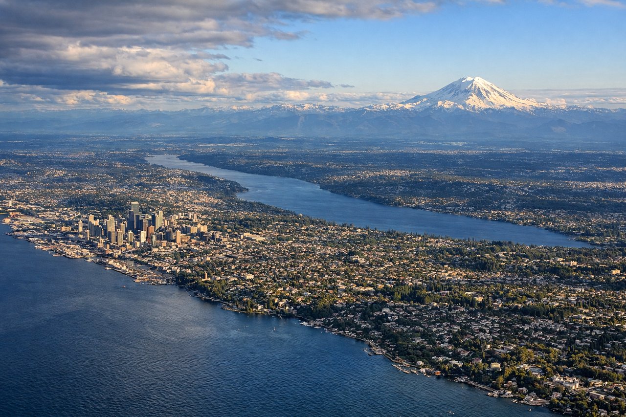
LEFTSeattle-Tacoma typically uses runways 16L/16R for southerly arrivals or 34L/34R for northerly arrivals. On the common approach from the south over Puget Sound, the left (east) side faces the Cascade Range including Mount Rainier, which dominates the skyline southeast of the airport. The right side faces west over Puget Sound and the Olympic Peninsula, which is also scenic but Mount Rainier is the more iconic and visually striking landmark.
Landmarks on this routeAll landmarks →
Will your flight be in sunlight?
Pick a date and time in the Sun Map to watch the sun move across your whole flight.
About This Route
Which side of the plane should I sit on flying from Cap De Av Selin Zeitun Lopez (RIB) to Seattle Tacoma International (SEA)?
Sit on the Left side of the plane for the best views on flights from Riberalta to Seattle. While the right seat wins at takeoff for the river confluence, the left seat delivers the more spectacular and sustained views during the long flight north — including the Andes cordillera visible to the west as you climb out of Bolivia, and the iconic Mount Rainier approach into Seattle. The left seat advantage on landing is decisive.
What can I see during takeoff from Cap De Av Selin Zeitun Lopez in Riberalta?
During takeoff from Cap De Av Selin Zeitun Lopez (RIB), sit on the Right side for the best views. Riberalta's runway is oriented roughly east-west. Departing westbound toward the northwest, the right (north) side gives you views over the confluence of the Beni and Madre de Dios rivers, a dramatic meeting of two major Amazonian tributaries surrounded by dense jungle and oxbow lakes. The left side faces south into undifferentiated rainforest canopy. Notable sights include: Beni-Madre de Dios river confluence, oxbow lakes and meander scars in the Amazon floodplain, Riberalta town grid along the riverbank, dense lowland rainforest stretching to the horizon.
What can I see when landing at Seattle Tacoma International in Seattle?
When landing at Seattle Tacoma International (SEA), sit on the Left side for the best views. Seattle-Tacoma typically uses runways 16L/16R for southerly arrivals or 34L/34R for northerly arrivals. On the common approach from the south over Puget Sound, the left (east) side faces the Cascade Range including Mount Rainier, which dominates the skyline southeast of the airport. The right side faces west over Puget Sound and the Olympic Peninsula, which is also scenic but Mount Rainier is the more iconic and visually striking landmark. Notable sights include: Mount Rainier (14,411 ft, clearly visible to the southeast), Puget Sound and its islands, the Seattle city skyline and Elliott Bay, the Cascade Range foothills.
How long is the flight from Riberalta to Seattle?
The flight from Cap De Av Selin Zeitun Lopez (RIB) to Seattle Tacoma International (SEA) takes about 9 hours. The shortest flight path between them is 5,307 miles (8,540 km); winds and air traffic control usually add a few percent.
What does the Riberalta to Seattle flight path pass over?
After departing the Amazon basin, the route typically climbs northwest over the Peruvian jungle toward Lima, crossing the Andes cordillera with peaks exceeding 20,000 ft visible below. North of the equator the route passes over Central America and the Pacific coast of Mexico, with the Gulf of California and Baja California visible depending on routing. Over the US Pacific Northwest, the Cascade volcanoes including Mount Shasta, Mount Jefferson, and Mount Hood appear as a chain of snow-capped peaks before the final descent into Seattle.