While the left side wins at takeoff for the James River and Richmond views, the right side delivers the more dramatic payoff: the Boston Harbor approach is one of the more visually striking urban airport arrivals on the East Coast, with open water giving way to a dense skyline. The right side also tracks the Chesapeake Bay coastline and Delaware Bay during the mid-flight portion heading northeast.
Flown RIC to BOS? Did we get it right?
Flight Path
Richmond to Boston is 473 miles (762 km), a flight of about 1 hour 20 minutes.
The flight tracks northeast over the Virginia Tidewater region, crossing the Potomac River near its mouth, then over the Maryland Eastern Shore and Delaware. The Chesapeake Bay is visible below for a significant portion of the early flight. The Delaware Bay crossing follows, then the New Jersey Pine Barrens, and finally the New York metro area and Long Island Sound before the descent into Boston.
Great circle distance and headings ›

Phase by phase
Takeoff from RIC
LEFTRIC's primary departure runway 16 sends aircraft northeast, putting the left (west) side over downtown Richmond and the James River. You get a clear look at the James River bends and the Richmond skyline before the aircraft tracks north toward the Chesapeake Bay corridor.
Landing at BOS
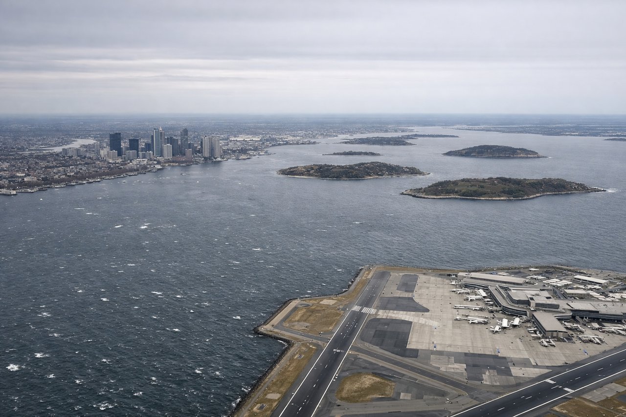
RIGHTLogan Airport sits on a peninsula in Boston Harbor, and aircraft typically approach from the southwest on runway 04R/22L or from the south on runway 33L. A right-side seat gives you Boston Harbor, the downtown Boston skyline, and the Charles River basin as you descend over the water. The approach over the harbor puts the city directly to your right.
Will your flight be in sunlight?
Pick a date and time in the Sun Map to watch the sun move across your whole flight.
About This Route
Which side of the plane should I sit on flying from Richmond International (RIC) to General Edward Lawrence Logan International (BOS)?
Sit on the Right side of the plane for the best views on flights from Richmond to Boston. While the left side wins at takeoff for the James River and Richmond views, the right side delivers the more dramatic payoff: the Boston Harbor approach is one of the more visually striking urban airport arrivals on the East Coast, with open water giving way to a dense skyline. The right side also tracks the Chesapeake Bay coastline and Delaware Bay during the mid-flight portion heading northeast.
What can I see during takeoff from Richmond International in Richmond?
During takeoff from Richmond International (RIC), sit on the Left side for the best views. RIC's primary departure runway 16 sends aircraft northeast, putting the left (west) side over downtown Richmond and the James River. You get a clear look at the James River bends and the Richmond skyline before the aircraft tracks north toward the Chesapeake Bay corridor. Notable sights include: James River and its oxbow bends south of Richmond, downtown Richmond skyline, Henrico County suburban grid, Interstate 95 corridor heading north.
What can I see when landing at General Edward Lawrence Logan International in Boston?
When landing at General Edward Lawrence Logan International (BOS), sit on the Right side for the best views. Logan Airport sits on a peninsula in Boston Harbor, and aircraft typically approach from the southwest on runway 04R/22L or from the south on runway 33L. A right-side seat gives you Boston Harbor, the downtown Boston skyline, and the Charles River basin as you descend over the water. The approach over the harbor puts the city directly to your right. Notable sights include: Boston Harbor and its islands, downtown Boston skyline including the Financial District, Charles River basin, Cape Cod Bay visible to the southeast on clear days.
How long is the flight from Richmond to Boston?
The flight from Richmond International (RIC) to General Edward Lawrence Logan International (BOS) takes about 1 hour 20 minutes. The shortest flight path between them is 473 miles (762 km); winds and air traffic control usually add a few percent.
What does the Richmond to Boston flight path pass over?
The flight tracks northeast over the Virginia Tidewater region, crossing the Potomac River near its mouth, then over the Maryland Eastern Shore and Delaware. The Chesapeake Bay is visible below for a significant portion of the early flight. The Delaware Bay crossing follows, then the New Jersey Pine Barrens, and finally the New York metro area and Long Island Sound before the descent into Boston.