Richmond to Madrid is 3,845 miles (6,188 km), a flight of about 7 hours 15 minutes.
While left offers better Richmond departure views, right side dominates the longer transatlantic portion and provides superior scenery on approach to Madrid, including the Guadarrama Mountains and the dramatic transition from plateau to urban landscape.
Flight Path
North Atlantic Ocean (6+ hours of open water with occasional ship traffic and weather systems), Azores archipelago (if visible on southern routing), Irish coast and Celtic Sea (if northern routing used), Bay of Biscay, Iberian Peninsula coastline approaching Spain
Great circle distance and headings ›Phase by phase
Takeoff from RIC
LEFTLeft side offers views of the James River winding through Richmond and the Piedmont terrain rolling eastward toward the Atlantic coastal plain. Right side faces inland toward the Blue Ridge foothills with less distinctive visual contrast during climb-out.
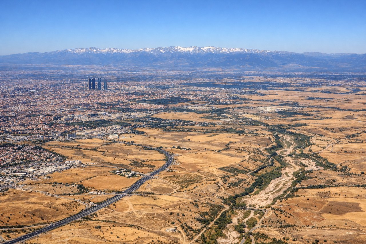
Landing at MAD
RIGHTRight side provides views of the Iberian Plateau, the Guadarrama Mountains southwest of Madrid, and the approach into the Madrid metropolitan area. Left side faces toward the interior meseta with fewer distinctive landmarks during descent.
Landmarks on this routeAll landmarks →
Will your flight be in sunlight?
Pick a date and time in the Sun Map to watch the sun move across your whole flight.
About This Route
Which side of the plane should I sit on flying from Richmond International (RIC) to Barajas (MAD)?
Sit on the Right side of the plane for the best views on flights from Richmond to Madrid. While left offers better Richmond departure views, right side dominates the longer transatlantic portion and provides superior scenery on approach to Madrid, including the Guadarrama Mountains and the dramatic transition from plateau to urban landscape.
What can I see during takeoff from Richmond International in Richmond?
During takeoff from Richmond International (RIC), sit on the Left side for the best views. Left side offers views of the James River winding through Richmond and the Piedmont terrain rolling eastward toward the Atlantic coastal plain. Right side faces inland toward the Blue Ridge foothills with less distinctive visual contrast during climb-out. Notable sights include: James River (serpentine through downtown Richmond), Piedmont plateau transitioning to coastal plain, Atlantic coastline 100+ miles distant on horizon.
What can I see when landing at Barajas in Madrid?
When landing at Barajas (MAD), sit on the Right side for the best views. Right side provides views of the Iberian Plateau, the Guadarrama Mountains southwest of Madrid, and the approach into the Madrid metropolitan area. Left side faces toward the interior meseta with fewer distinctive landmarks during descent. Notable sights include: Guadarrama Mountains (snow-capped peaks visible from distance), Madrid urban sprawl and airport infrastructure, Iberian Plateau terrain, Tagus River valley.
How long is the flight from Richmond to Madrid?
The flight from Richmond International (RIC) to Barajas (MAD) takes about 7 hours 15 minutes. The shortest flight path between them is 3,845 miles (6,188 km); winds and air traffic control usually add a few percent.
What does the Richmond to Madrid flight path pass over?
North Atlantic Ocean (6+ hours of open water with occasional ship traffic and weather systems), Azores archipelago (if visible on southern routing), Irish coast and Celtic Sea (if northern routing used), Bay of Biscay, Iberian Peninsula coastline approaching Spain