While San Diego's landing approach is visually striking, the left side captures more varied and continuous scenery across the full flight. The departure from Richmond over the James River and Piedmont terrain, combined with the extended cruise over the Appalachian Mountains (visible on the left side as the aircraft tracks westward across West Virginia and Kentucky), the Ohio River valley, and the transition into the Great Plains, provides greater landmark density and terrain variety than the right side's predominantly flat cruise segment and ocean approach.
Flown RIC to SAN? Did we get it right?
Flight Path
Richmond to San Diego is 2,260 miles (3,638 km), a flight of about 5 hours 15 minutes.
Appalachian Mountains (West Virginia and eastern Kentucky ridges), Ohio River valley, Cumberland Plateau, Mississippi River crossing near Memphis, Ozark Plateau (Missouri and Arkansas), transition to Great Plains, Rio Grande valley approaching New Mexico, Colorado Plateau and desert terrain in Arizona and southern Nevada, Mojave Desert, San Bernardino Mountains visible before descent into San Diego basin
Great circle distance and headings ›


Phase by phase
Takeoff from RIC
LEFTRichmond's departure to the west offers immediate views of the James River valley and the Piedmont terrain. Left-side seats capture the river's serpentine path through the city and surrounding forested hills as the aircraft climbs.
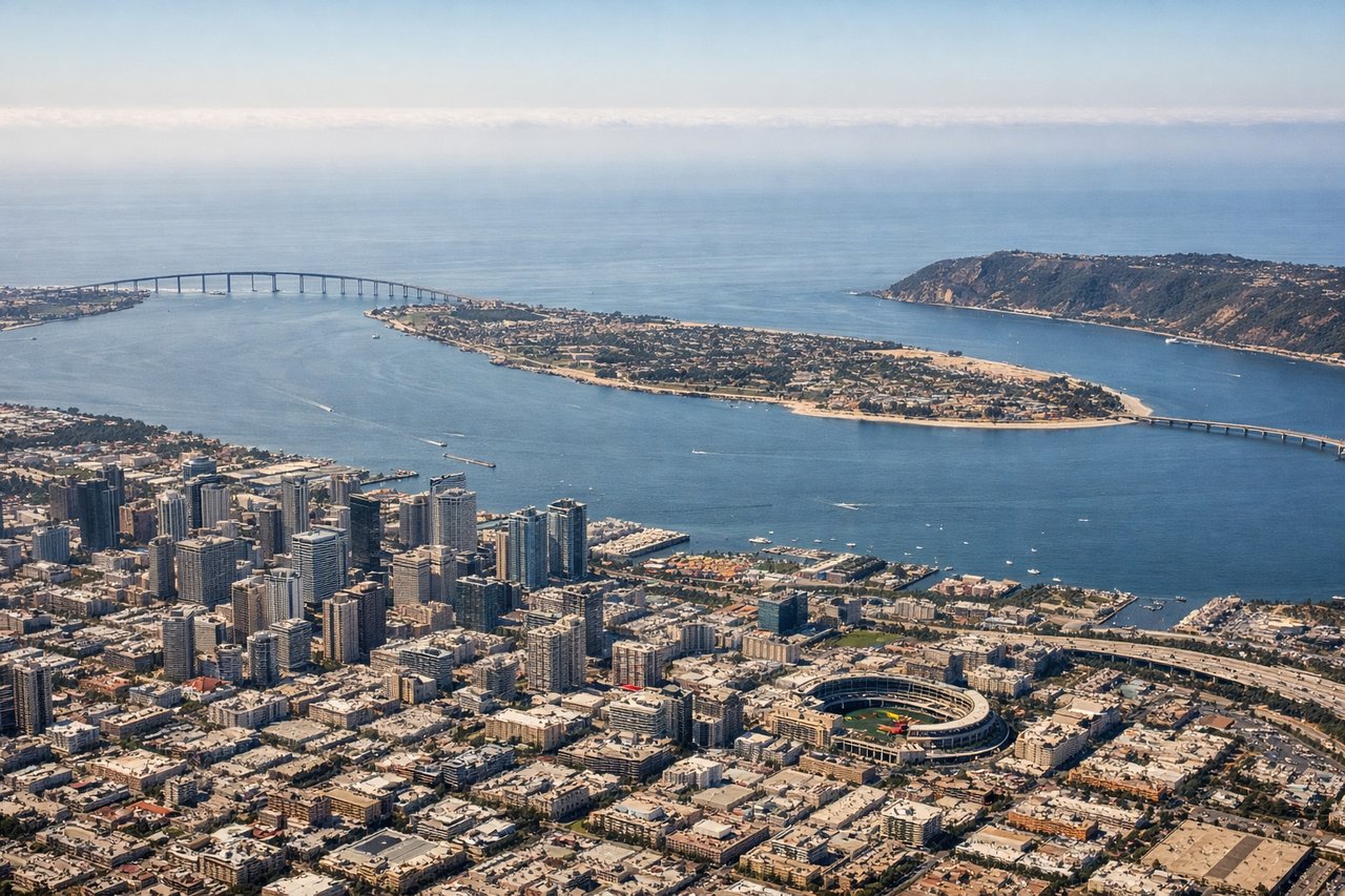
Landing at SAN
RIGHTSan Diego's approach from the east brings the Pacific coastline, Mission Bay, and the dramatic coastal bluffs into view on the right side. The final descent reveals the city's waterfront, harbor, and the distinctive geography of the San Diego peninsula.
Will your flight be in sunlight?
Pick a date and time in the Sun Map to watch the sun move across your whole flight.
About This Route
Which side of the plane should I sit on flying from Richmond International (RIC) to San Diego International Lindbergh Fld (SAN)?
Sit on the Left side of the plane for the best views on flights from Richmond to San Diego. While San Diego's landing approach is visually striking, the left side captures more varied and continuous scenery across the full flight. The departure from Richmond over the James River and Piedmont terrain, combined with the extended cruise over the Appalachian Mountains (visible on the left side as the aircraft tracks westward across West Virginia and Kentucky), the Ohio River valley, and the transition into the Great Plains, provides greater landmark density and terrain variety than the right side's predominantly flat cruise segment and ocean approach.
What can I see during takeoff from Richmond International in Richmond?
During takeoff from Richmond International (RIC), sit on the Left side for the best views. Richmond's departure to the west offers immediate views of the James River valley and the Piedmont terrain. Left-side seats capture the river's serpentine path through the city and surrounding forested hills as the aircraft climbs. Notable sights include: James River winding through Richmond, Piedmont foothills to the west, downtown Richmond skyline, forested valleys of central Virginia.
What can I see when landing at San Diego International Lindbergh Fld in San Diego?
When landing at San Diego International Lindbergh Fld (SAN), sit on the Right side for the best views. San Diego's approach from the east brings the Pacific coastline, Mission Bay, and the dramatic coastal bluffs into view on the right side. The final descent reveals the city's waterfront, harbor, and the distinctive geography of the San Diego peninsula. Notable sights include: Pacific Ocean and coastline, Mission Bay, San Diego Bay with naval vessels, downtown San Diego skyline, Coronado Island and the Coronado Bridge.
How long is the flight from Richmond to San Diego?
The flight from Richmond International (RIC) to San Diego International Lindbergh Fld (SAN) takes about 5 hours 15 minutes. The shortest flight path between them is 2,260 miles (3,638 km); winds and air traffic control usually add a few percent.
What does the Richmond to San Diego flight path pass over?
Appalachian Mountains (West Virginia and eastern Kentucky ridges), Ohio River valley, Cumberland Plateau, Mississippi River crossing near Memphis, Ozark Plateau (Missouri and Arkansas), transition to Great Plains, Rio Grande valley approaching New Mexico, Colorado Plateau and desert terrain in Arizona and southern Nevada, Mojave Desert, San Bernardino Mountains visible before descent into San Diego basin