While the takeoff offers dramatic Sierra Nevada views, the landing approach provides more sustained scenic interest with the Mississippi River and Minneapolis skyline. Right side seats capture the most visually distinctive features of this route.
Flown RNO to MSP? Did we get it right?
Flight Path
Reno to Minneapolis is 1,402 miles (2,256 km), a flight of about 3 hours 20 minutes.
The flight path crosses the Great Basin and then the Rocky Mountains (Wasatch Range near Salt Lake City visible to the north), followed by the Great Plains. Notable midpoint features include the Wasatch Range, the transition from high desert to agricultural plains, and the Missouri River valley as the aircraft approaches Minnesota.
Great circle distance and headings ›


Phase by phase
Takeoff from RNO
LEFTLeft side captures the Sierra Nevada mountain range immediately west of Reno, with snow-capped peaks visible during climb-out. Right side shows the high desert plateau extending eastward with minimal visual interest.
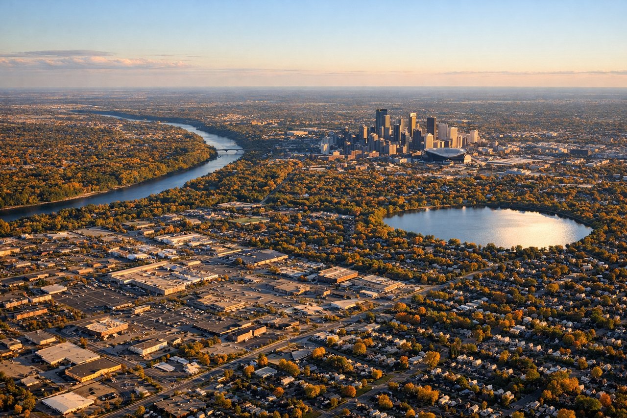
Landing at MSP
RIGHTRight side offers views of the Mississippi River and Minneapolis skyline during approach from the west. Left side shows less distinctive terrain as the aircraft descends over suburban sprawl.
Will your flight be in sunlight?
Pick a date and time in the Sun Map to watch the sun move across your whole flight.
About This Route
Which side of the plane should I sit on flying from Reno Tahoe International (RNO) to Minneapolis St Paul International (MSP)?
Sit on the Right side of the plane for the best views on flights from Reno to Minneapolis. While the takeoff offers dramatic Sierra Nevada views, the landing approach provides more sustained scenic interest with the Mississippi River and Minneapolis skyline. Right side seats capture the most visually distinctive features of this route.
What can I see during takeoff from Reno Tahoe International in Reno?
During takeoff from Reno Tahoe International (RNO), sit on the Left side for the best views. Left side captures the Sierra Nevada mountain range immediately west of Reno, with snow-capped peaks visible during climb-out. Right side shows the high desert plateau extending eastward with minimal visual interest. Notable sights include: Sierra Nevada range, Lake Tahoe (partially visible to the southwest), Truckee River valley, high desert plateau.
What can I see when landing at Minneapolis St Paul International in Minneapolis?
When landing at Minneapolis St Paul International (MSP), sit on the Right side for the best views. Right side offers views of the Mississippi River and Minneapolis skyline during approach from the west. Left side shows less distinctive terrain as the aircraft descends over suburban sprawl. Notable sights include: Mississippi River, Minneapolis downtown skyline, Minnesota River confluence, suburban Twin Cities development.
How long is the flight from Reno to Minneapolis?
The flight from Reno Tahoe International (RNO) to Minneapolis St Paul International (MSP) takes about 3 hours 20 minutes. The shortest flight path between them is 1,402 miles (2,256 km); winds and air traffic control usually add a few percent.
What does the Reno to Minneapolis flight path pass over?
The flight path crosses the Great Basin and then the Rocky Mountains (Wasatch Range near Salt Lake City visible to the north), followed by the Great Plains. Notable midpoint features include the Wasatch Range, the transition from high desert to agricultural plains, and the Missouri River valley as the aircraft approaches Minnesota.