Reno to Portland is 445 miles (716 km), a flight of about 1 hour 25 minutes.
The left side wins across all phases: Sierra Nevada terrain at takeoff, Cascade volcanic peaks like Mount Shasta and Mount Hood along the cruise and descent, and a scenic Portland skyline arrival — all facing west of the flight path.
Flight Path
The route tracks along the eastern edge of the Cascade Range, passing near Mount Shasta and Mount Lassen in northern California before continuing over south-central Oregon's high desert toward the Cascade volcanoes near Portland.
Great circle distance and headings ›

Phase by phase
Takeoff from RNO
LEFTDeparting RNO northbound, the left side faces west toward the Sierra Nevada front range and the Reno-Sparks valley floor, with glimpses of the Carson Range peaks as the aircraft climbs. The right side only shows the flat Truckee Meadows and distant high desert toward Pyramid Lake, which is less visually striking.
Landing at PDX
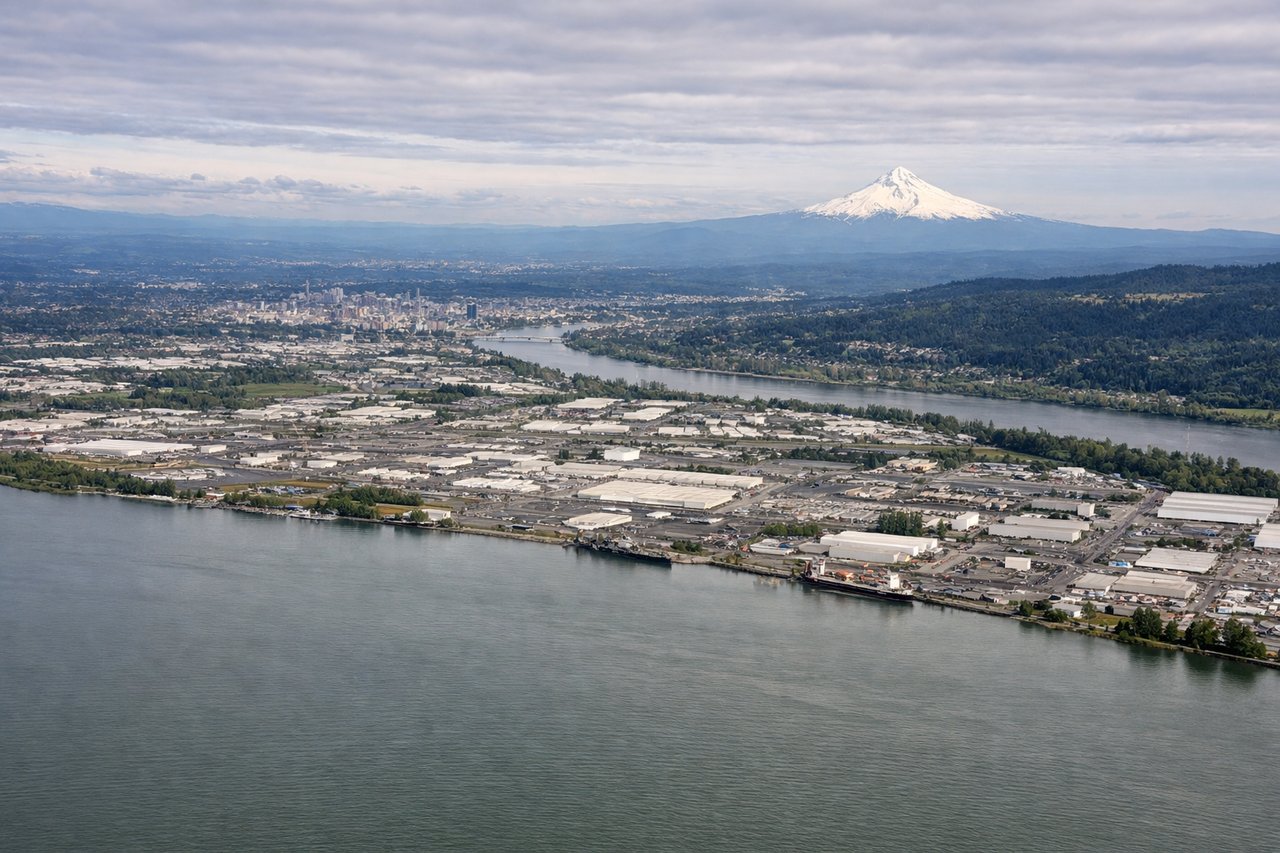
LEFTOn approach into PDX from the south, the left side offers a clear view of Mount Hood's snow-capped cone rising above the Cascade foothills, plus the Willamette River and downtown Portland skyline as the plane turns onto final for the east-west runways. The right side mostly shows the flat Willamette Valley farmland with no comparable landmark.
Landmarks on this routeAll landmarks →
Will your flight be in sunlight?
Pick a date and time in the Sun Map to watch the sun move across your whole flight.
About This Route
Which side of the plane should I sit on flying from Reno Tahoe International (RNO) to Portland International (PDX)?
Sit on the Left side of the plane for the best views on flights from Reno to Portland. The left side wins across all phases: Sierra Nevada terrain at takeoff, Cascade volcanic peaks like Mount Shasta and Mount Hood along the cruise and descent, and a scenic Portland skyline arrival — all facing west of the flight path.
What can I see during takeoff from Reno Tahoe International in Reno?
During takeoff from Reno Tahoe International (RNO), sit on the Left side for the best views. Departing RNO northbound, the left side faces west toward the Sierra Nevada front range and the Reno-Sparks valley floor, with glimpses of the Carson Range peaks as the aircraft climbs. The right side only shows the flat Truckee Meadows and distant high desert toward Pyramid Lake, which is less visually striking. Notable sights include: Sierra Nevada front range, Carson Range, Reno-Sparks valley, distant Peavine Peak.
What can I see when landing at Portland International in Portland?
When landing at Portland International (PDX), sit on the Left side for the best views. On approach into PDX from the south, the left side offers a clear view of Mount Hood's snow-capped cone rising above the Cascade foothills, plus the Willamette River and downtown Portland skyline as the plane turns onto final for the east-west runways. The right side mostly shows the flat Willamette Valley farmland with no comparable landmark. Notable sights include: Mount Hood, Willamette River, downtown Portland skyline, Cascade foothills.
How long is the flight from Reno to Portland?
The flight from Reno Tahoe International (RNO) to Portland International (PDX) takes about 1 hour 25 minutes. The shortest flight path between them is 445 miles (716 km); winds and air traffic control usually add a few percent.
What does the Reno to Portland flight path pass over?
The route tracks along the eastern edge of the Cascade Range, passing near Mount Shasta and Mount Lassen in northern California before continuing over south-central Oregon's high desert toward the Cascade volcanoes near Portland.