The right side provides superior scenery for most of the flight: the Appalachian foothills and Atlanta's approach offer more dramatic topography and urban visual interest than the relatively flat Arabian Desert and Saudi plateau visible from the left during departure.
Flown RUH to ATL? Did we get it right?
Flight Path
Riyadh to Atlanta is 7,271 miles (11,701 km), a flight of about 14 hours 20 minutes.
The flight path crosses the Mediterranean Sea (southern coast of Greece and Turkey visible), the Balkans, central Europe, and the Atlantic Ocean. Notable features include the Taurus Mountains in southern Turkey, the Alps on the horizon from central Europe, and the Atlantic coastline of Portugal and Spain before crossing the ocean toward the southeastern United States.
Great circle distance and headings ›


Phase by phase
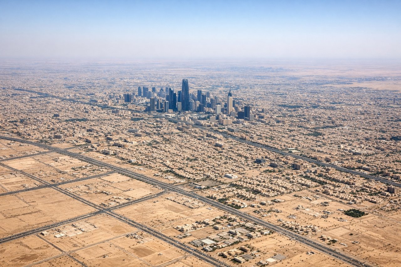
Takeoff from RUH
LEFTLeft side captures the Tuwaiq Escarpment and the sprawling grid of Riyadh's urban development spreading eastward across the Arabian Desert. The plateau edge and city layout are distinctive from altitude.
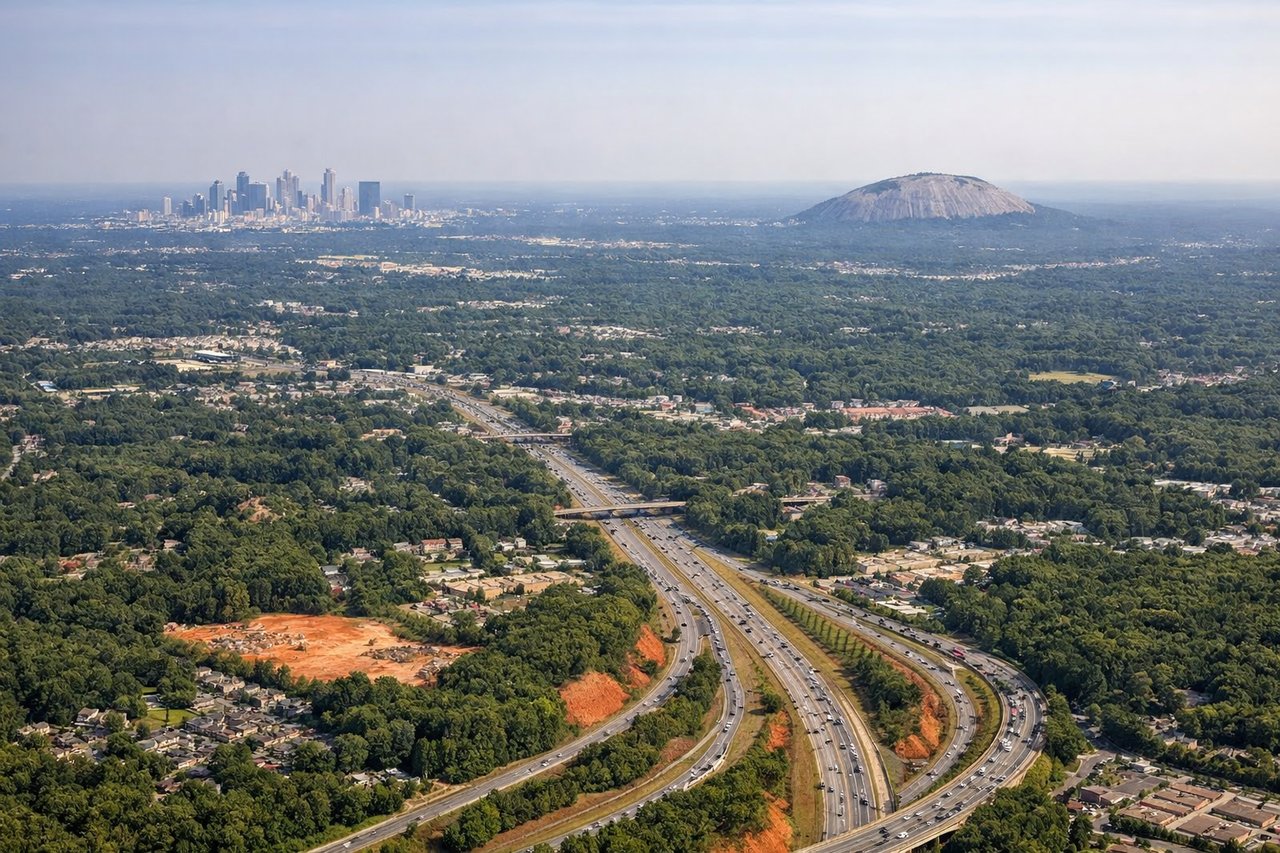
Landing at ATL
RIGHTRight side offers views of the Appalachian foothills and the Atlanta metropolitan area's northern suburbs as the aircraft descends on final approach. The terrain transition from piedmont to coastal plain and the city's sprawl are visually clear.
Will your flight be in sunlight?
Pick a date and time in the Sun Map to watch the sun move across your whole flight.
About This Route
Which side of the plane should I sit on flying from King Khaled International (RUH) to The William B Hartsfield Atlanta International (ATL)?
Sit on the Right side of the plane for the best views on flights from Riyadh to Atlanta. The right side provides superior scenery for most of the flight: the Appalachian foothills and Atlanta's approach offer more dramatic topography and urban visual interest than the relatively flat Arabian Desert and Saudi plateau visible from the left during departure.
What can I see during takeoff from King Khaled International in Riyadh?
During takeoff from King Khaled International (RUH), sit on the Left side for the best views. Left side captures the Tuwaiq Escarpment and the sprawling grid of Riyadh's urban development spreading eastward across the Arabian Desert. The plateau edge and city layout are distinctive from altitude. Notable sights include: Tuwaiq Escarpment (western rim), Riyadh urban grid, Arabian Desert plateau, Wadi Hanifah valley system.
What can I see when landing at The William B Hartsfield Atlanta International in Atlanta?
When landing at The William B Hartsfield Atlanta International (ATL), sit on the Right side for the best views. Right side offers views of the Appalachian foothills and the Atlanta metropolitan area's northern suburbs as the aircraft descends on final approach. The terrain transition from piedmont to coastal plain and the city's sprawl are visually clear. Notable sights include: Appalachian foothills (northern Georgia), Atlanta metropolitan grid, Chattahoochee River valley, Hartsfield-Jackson airport complex.
How long is the flight from Riyadh to Atlanta?
The flight from King Khaled International (RUH) to The William B Hartsfield Atlanta International (ATL) takes about 14 hours 20 minutes. The shortest flight path between them is 7,271 miles (11,701 km); winds and air traffic control usually add a few percent.
What does the Riyadh to Atlanta flight path pass over?
The flight path crosses the Mediterranean Sea (southern coast of Greece and Turkey visible), the Balkans, central Europe, and the Atlantic Ocean. Notable features include the Taurus Mountains in southern Turkey, the Alps on the horizon from central Europe, and the Atlantic coastline of Portugal and Spain before crossing the ocean toward the southeastern United States.