The takeoff views from San Salvador are more visually distinctive—volcanic peaks and crater lakes are dramatic and geographically unique. While Las Vegas landing views are iconic, the volcanic landscape of El Salvador offers more varied natural scenery. Right-side seats capture the best of both: the departure highlights and reasonable views during the long cruise over Mexico and the southwestern US.
Flown SAL to LAS? Did we get it right?
Flight Path
San Salvador to Las Vegas is 2,250 miles (3,621 km), a flight of about 4 hours 15 minutes.
Sierra Madre Occidental (Mexico, visible around 2 hours into flight), Durango and Chihuahua states (desert plateau), Rio Grande (visible during descent into southwestern US), Sonoran Desert (Arizona), Lake Mead and Colorado River (final approach to Las Vegas)
Great circle distance and headings ›


Phase by phase
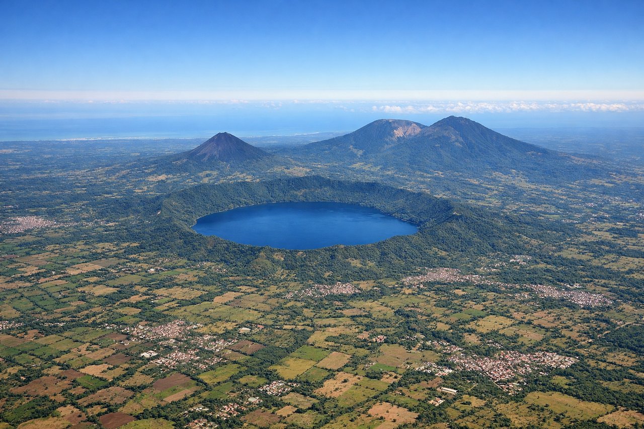
Takeoff from SAL
RIGHTRight-side seats capture the volcanic landscape immediately surrounding San Salvador. The city sits in a valley ringed by volcanic peaks, and climbing out to the north and west provides direct views of Volcán de San Salvador and the Central American highlands before turning northwest toward the US.

Landing at LAS
LEFTLeft-side seats offer the best views during descent into Las Vegas. The approach from the southeast brings the aircraft over the Mojave Desert and the Las Vegas Valley, and left-side windows frame the Strip, downtown Las Vegas, and the Spring Mountains to the west—the iconic urban and natural landmarks of the arrival.
Will your flight be in sunlight?
Pick a date and time in the Sun Map to watch the sun move across your whole flight.
About This Route
Which side of the plane should I sit on flying from El Salvador International (SAL) to Mc Carran International (LAS)?
Sit on the Right side of the plane for the best views on flights from San Salvador to Las Vegas. The takeoff views from San Salvador are more visually distinctive—volcanic peaks and crater lakes are dramatic and geographically unique. While Las Vegas landing views are iconic, the volcanic landscape of El Salvador offers more varied natural scenery. Right-side seats capture the best of both: the departure highlights and reasonable views during the long cruise over Mexico and the southwestern US.
What can I see during takeoff from El Salvador International in San Salvador?
During takeoff from El Salvador International (SAL), sit on the Right side for the best views. Right-side seats capture the volcanic landscape immediately surrounding San Salvador. The city sits in a valley ringed by volcanic peaks, and climbing out to the north and west provides direct views of Volcán de San Salvador and the Central American highlands before turning northwest toward the US. Notable sights include: Volcán de San Salvador (2,192 m), Lake Ilopango (large crater lake east of the city), San Salvador city grid, Cordillera del Bálsamo ridge.
What can I see when landing at Mc Carran International in Las Vegas?
When landing at Mc Carran International (LAS), sit on the Left side for the best views. Left-side seats offer the best views during descent into Las Vegas. The approach from the southeast brings the aircraft over the Mojave Desert and the Las Vegas Valley, and left-side windows frame the Strip, downtown Las Vegas, and the Spring Mountains to the west—the iconic urban and natural landmarks of the arrival. Notable sights include: Las Vegas Strip (south of downtown), Downtown Las Vegas, Spring Mountains (west of the valley), Lake Mead (northeast, visible on clear days).
How long is the flight from San Salvador to Las Vegas?
The flight from El Salvador International (SAL) to Mc Carran International (LAS) takes about 4 hours 15 minutes. The shortest flight path between them is 2,250 miles (3,621 km); winds and air traffic control usually add a few percent.
What does the San Salvador to Las Vegas flight path pass over?
Sierra Madre Occidental (Mexico, visible around 2 hours into flight), Durango and Chihuahua states (desert plateau), Rio Grande (visible during descent into southwestern US), Sonoran Desert (Arizona), Lake Mead and Colorado River (final approach to Las Vegas)