Right side scores higher due to superior scenic content on both legs. Departure offers San Diego Bay and Pacific coastline views; landing showcases the dramatic Southern Alps and Mount Cook approach—one of the world's most visually striking mountain landings. Left side is dominated by flat inland terrain and extended ocean crossing with minimal landmarks.
Flown SAN to MON? Did we get it right?
Flight Path
San Diego to Glentanner is 6,988 miles (11,246 km), a flight of about 13 hours 25 minutes.
Pacific Ocean (12+ hours of open water with no visible landmarks), Hawaii islands (Oahu, Maui visible if flight path passes near Hawaiian airspace on southern routing), Fiji region (if routed through South Pacific), Tasman Sea (final 2-3 hours approaching New Zealand), New Zealand North Island (if visible during descent routing)
Great circle distance and headings ›Phase by phase
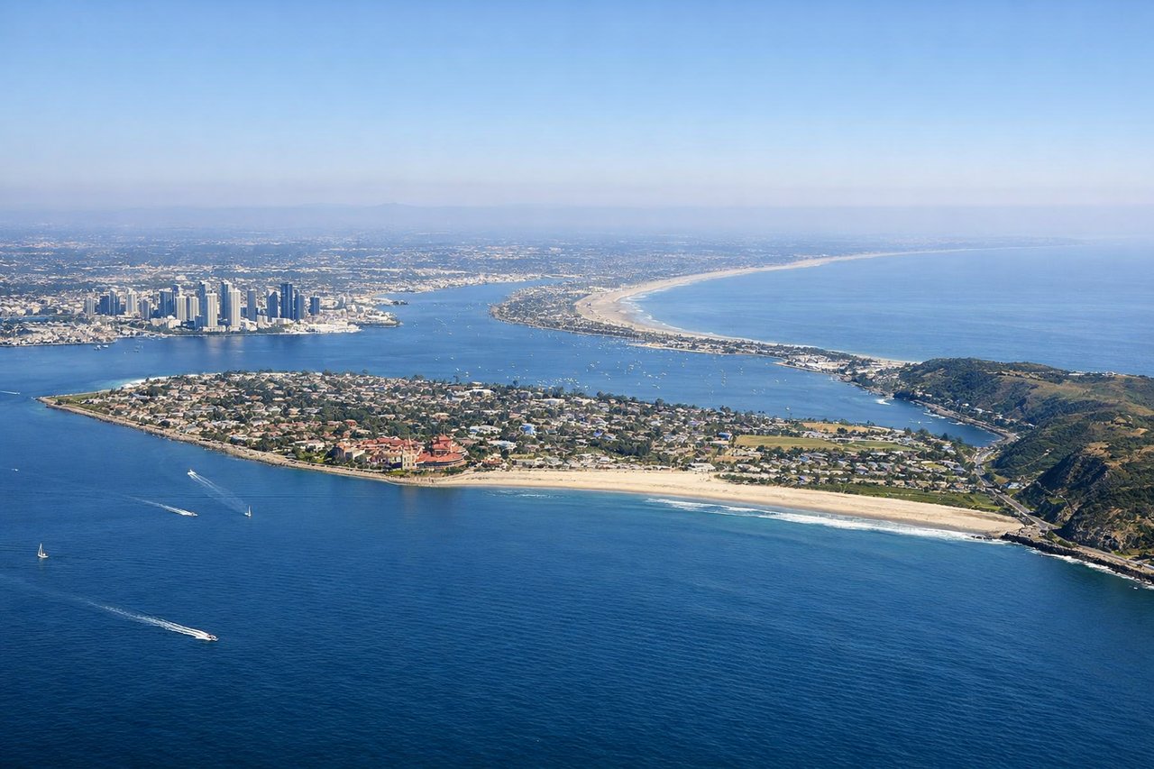
Takeoff from SAN
RIGHTRight side captures San Diego Bay, the Pacific coastline, and Point Loma during westbound departure over water. Left side shows inland urban sprawl and flat terrain toward the interior.
Landing at MON
RIGHTRight side offers the most dramatic approach to Mount Cook Airport. Aircraft descending to runway 13 (southeast) or 31 (northwest) will showcase the Southern Alps, the Mackenzie Basin, and the Tasman River valley. Right side captures the alpine terrain and glaciated peaks during final descent.
Will your flight be in sunlight?
Pick a date and time in the Sun Map to watch the sun move across your whole flight.
About This Route
Which side of the plane should I sit on flying from San Diego International Lindbergh Fld (SAN) to Mount Cook Airport (MON)?
Sit on the Right side of the plane for the best views on flights from San Diego to Glentanner. Right side scores higher due to superior scenic content on both legs. Departure offers San Diego Bay and Pacific coastline views; landing showcases the dramatic Southern Alps and Mount Cook approach—one of the world's most visually striking mountain landings. Left side is dominated by flat inland terrain and extended ocean crossing with minimal landmarks.
What can I see during takeoff from San Diego International Lindbergh Fld in San Diego?
During takeoff from San Diego International Lindbergh Fld (SAN), sit on the Right side for the best views. Right side captures San Diego Bay, the Pacific coastline, and Point Loma during westbound departure over water. Left side shows inland urban sprawl and flat terrain toward the interior. Notable sights include: San Diego Bay, Point Loma peninsula, Pacific Ocean horizon, downtown San Diego waterfront.
What can I see when landing at Mount Cook Airport in Glentanner?
When landing at Mount Cook Airport (MON), sit on the Right side for the best views. Right side offers the most dramatic approach to Mount Cook Airport. Aircraft descending to runway 13 (southeast) or 31 (northwest) will showcase the Southern Alps, the Mackenzie Basin, and the Tasman River valley. Right side captures the alpine terrain and glaciated peaks during final descent. Notable sights include: Mount Cook (Aoraki) peak, Southern Alps range, Tasman Glacier, Mackenzie Basin.
How long is the flight from San Diego to Glentanner?
The flight from San Diego International Lindbergh Fld (SAN) to Mount Cook Airport (MON) takes about 13 hours 25 minutes. The shortest flight path between them is 6,988 miles (11,246 km); winds and air traffic control usually add a few percent.
What does the San Diego to Glentanner flight path pass over?
Pacific Ocean (12+ hours of open water with no visible landmarks), Hawaii islands (Oahu, Maui visible if flight path passes near Hawaiian airspace on southern routing), Fiji region (if routed through South Pacific), Tasman Sea (final 2-3 hours approaching New Zealand), New Zealand North Island (if visible during descent routing)