While the San Diego takeoff offers a nice harbor and skyline view, the Phoenix approach delivers a longer, more visually distinct sequence with Camelback Mountain, Papago Park's red rock buttes, and the McDowell range framing the city, plus the north side also catches glimpses of the Salton Sea basin during cruise.
Flight Path
Laguna Mountains and Cuyamaca Peak east of San Diego, the Anza-Borrego Desert, the Salton Sea basin visible to the north, the Colorado River near Yuma, and the broad Sonoran Desert leading into the Phoenix basin
Great circle distance and headings ›Phase by phase
Takeoff from SAN
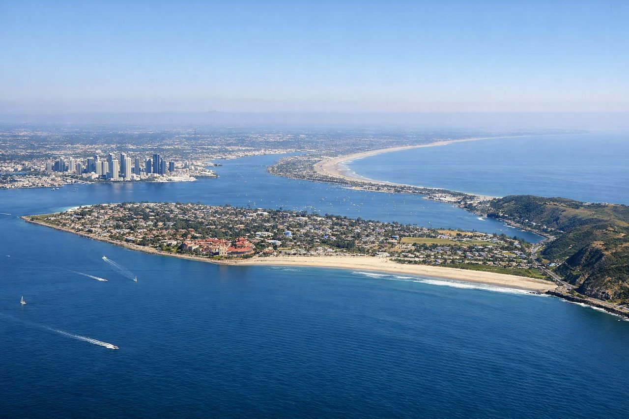
RIGHTRunway 27 departures climb straight out over San Diego Bay, and as the jet banks to turn onto its eastbound heading, the right-side windows catch downtown San Diego's skyline, the harbor, and Point Loma before the city gives way to chaparral hills.
Landing at PHX
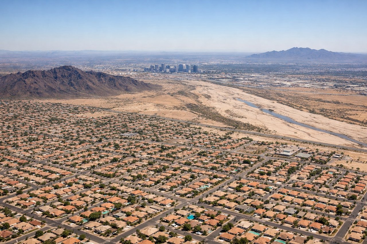
LEFTOn the descent into Phoenix Sky Harbor, the north-side windows line up with Camelback Mountain's reddish sandstone hump and the eroded buttes of Papago Park, with downtown Phoenix's cluster of towers just beyond, giving a much more distinctive view than the flatter desert to the south.
Will your flight be in sunlight?
See exactly which side of the plane gets sun and shade at your departure time.
About This Route
Which side of the plane should I sit on flying from San Diego International Lindbergh Fld (SAN) to Phoenix Sky Harbor International (PHX)?
Sit on the Left side of the plane for the best views on flights from San Diego to Phoenix. While the San Diego takeoff offers a nice harbor and skyline view, the Phoenix approach delivers a longer, more visually distinct sequence with Camelback Mountain, Papago Park's red rock buttes, and the McDowell range framing the city, plus the north side also catches glimpses of the Salton Sea basin during cruise.
What can I see during takeoff from San Diego International Lindbergh Fld in San Diego?
During takeoff from San Diego International Lindbergh Fld (SAN), sit on the Right side for the best views. Runway 27 departures climb straight out over San Diego Bay, and as the jet banks to turn onto its eastbound heading, the right-side windows catch downtown San Diego's skyline, the harbor, and Point Loma before the city gives way to chaparral hills. Notable sights include: San Diego Bay, Downtown San Diego skyline, Coronado Bridge, Point Loma peninsula.
What can I see when landing at Phoenix Sky Harbor International in Phoenix?
When landing at Phoenix Sky Harbor International (PHX), sit on the Left side for the best views. On the descent into Phoenix Sky Harbor, the north-side windows line up with Camelback Mountain's reddish sandstone hump and the eroded buttes of Papago Park, with downtown Phoenix's cluster of towers just beyond, giving a much more distinctive view than the flatter desert to the south. Notable sights include: Camelback Mountain, Papago Park buttes, Downtown Phoenix skyline, McDowell Mountains.
How long is the flight from San Diego to Phoenix?
The flight from San Diego International Lindbergh Fld (SAN) to Phoenix Sky Harbor International (PHX) takes 1h 15m.
What does the San Diego to Phoenix flight path pass over?
Laguna Mountains and Cuyamaca Peak east of San Diego, the Anza-Borrego Desert, the Salton Sea basin visible to the north, the Colorado River near Yuma, and the broad Sonoran Desert leading into the Phoenix basin