The right side offers the more dramatic full-flight experience: a San Antonio skyline departure, a cruise phase passing near the Guadalupe Mountains and Sonoran desert ranges, and a Las Vegas Strip and Lake Mead arrival — versus the comparatively flat, less landmark-dense scenery on the left over West Texas plains and the Sonoran flatlands.
Flight Path
Guadalupe Mountains, Chihuahuan Desert basins, Sonoran Desert ranges near southern Arizona, Colorado River valley approaching Lake Mead
Great circle distance and headings ›.jpg?width=600)


.jpeg?width=600)


Phase by phase
Takeoff from SAT
RIGHTDeparting SAT on runway 13R/13L, the initial turn to the northwest brings downtown San Antonio and the Alamo district into view on the right side before the aircraft climbs over the Hill Country's rolling limestone terrain.
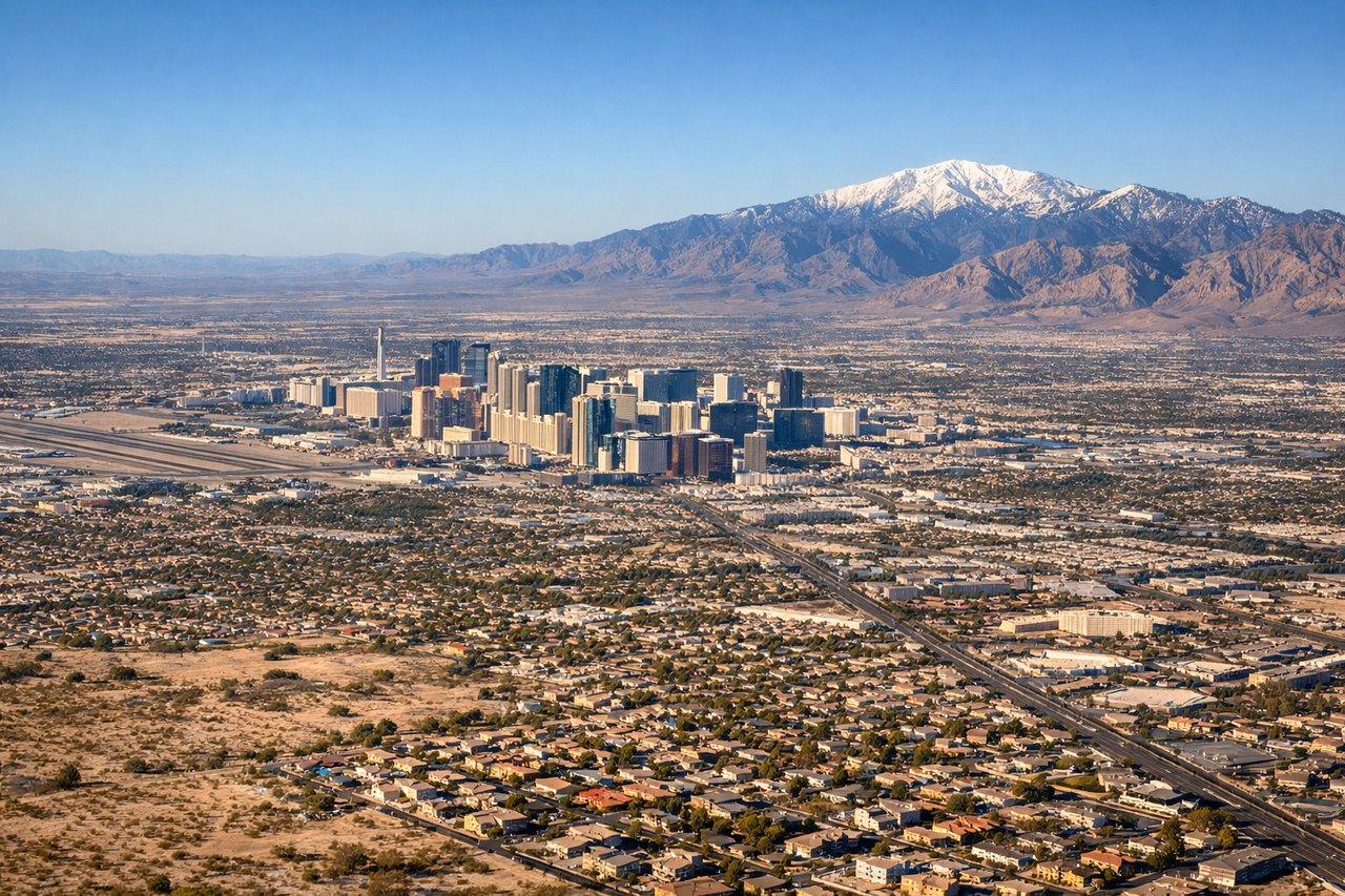
Landing at LAS
RIGHTOn a typical westbound approach into LAS using runways 26L/26R, the flight path passes north of the Strip, giving right-side passengers a clear view of the casino towers and downtown Las Vegas skyline just before touchdown, plus Lake Mead and the Colorado River canyons during the descent.
Landmarks on this routeAll landmarks →
Will your flight be in sunlight?
See exactly which side of the plane gets sun and shade at your departure time.
About This Route
Which side of the plane should I sit on flying from San Antonio International (SAT) to Mc Carran International (LAS)?
Sit on the Right side of the plane for the best views on flights from San Antonio to Las Vegas. The right side offers the more dramatic full-flight experience: a San Antonio skyline departure, a cruise phase passing near the Guadalupe Mountains and Sonoran desert ranges, and a Las Vegas Strip and Lake Mead arrival — versus the comparatively flat, less landmark-dense scenery on the left over West Texas plains and the Sonoran flatlands.
What can I see during takeoff from San Antonio International in San Antonio?
During takeoff from San Antonio International (SAT), sit on the Right side for the best views. Departing SAT on runway 13R/13L, the initial turn to the northwest brings downtown San Antonio and the Alamo district into view on the right side before the aircraft climbs over the Hill Country's rolling limestone terrain. Notable sights include: Downtown San Antonio skyline, San Antonio River bends, Texas Hill Country ridgelines.
What can I see when landing at Mc Carran International in Las Vegas?
When landing at Mc Carran International (LAS), sit on the Right side for the best views. On a typical westbound approach into LAS using runways 26L/26R, the flight path passes north of the Strip, giving right-side passengers a clear view of the casino towers and downtown Las Vegas skyline just before touchdown, plus Lake Mead and the Colorado River canyons during the descent. Notable sights include: Las Vegas Strip skyline, Lake Mead, Colorado River canyon walls, Spring Mountains.
How long is the flight from San Antonio to Las Vegas?
The flight from San Antonio International (SAT) to Mc Carran International (LAS) takes 2h 45m.
What does the San Antonio to Las Vegas flight path pass over?
Guadalupe Mountains, Chihuahuan Desert basins, Sonoran Desert ranges near southern Arizona, Colorado River valley approaching Lake Mead