While both sides score equally at 2.5, the left side (westbound departure from SBA) provides superior scenic value during takeoff with immediate coastal drama, Channel Islands, and mountain backdrop. The landing approach to DTW is equally unremarkable on both sides—flat Midwest terrain and suburban sprawl dominate. Since takeoff offers more compelling visuals and the flight's opening minutes set the tone, left side is the stronger choice.
Flown SBA to DTW? Did we get it right?
Flight Path
Santa Barbara to Detroit is 2,033 miles (3,271 km), a flight of about 4 hours 45 minutes.
The flight path crosses the Sierra Nevada mountains (visible as a distant ridge during early cruise), then traverses the Great Basin and Rocky Mountain region. Notable features include the Colorado Plateau's edge, the Great Plains' gradual transition from elevated terrain to flat farmland, and the Mississippi River valley approaching the Midwest. Lake Superior appears on the northern horizon during the final cruise phase before descent into Michigan.
Great circle distance and headings ›


Phase by phase
Takeoff from SBA
LEFTSanta Barbara's coastal departure offers immediate scenic value with the Pacific Ocean, Channel Islands, and the Santa Ynez Mountains visible during climb-out. Right side faces inland terrain with less dramatic features during the critical takeoff phase.
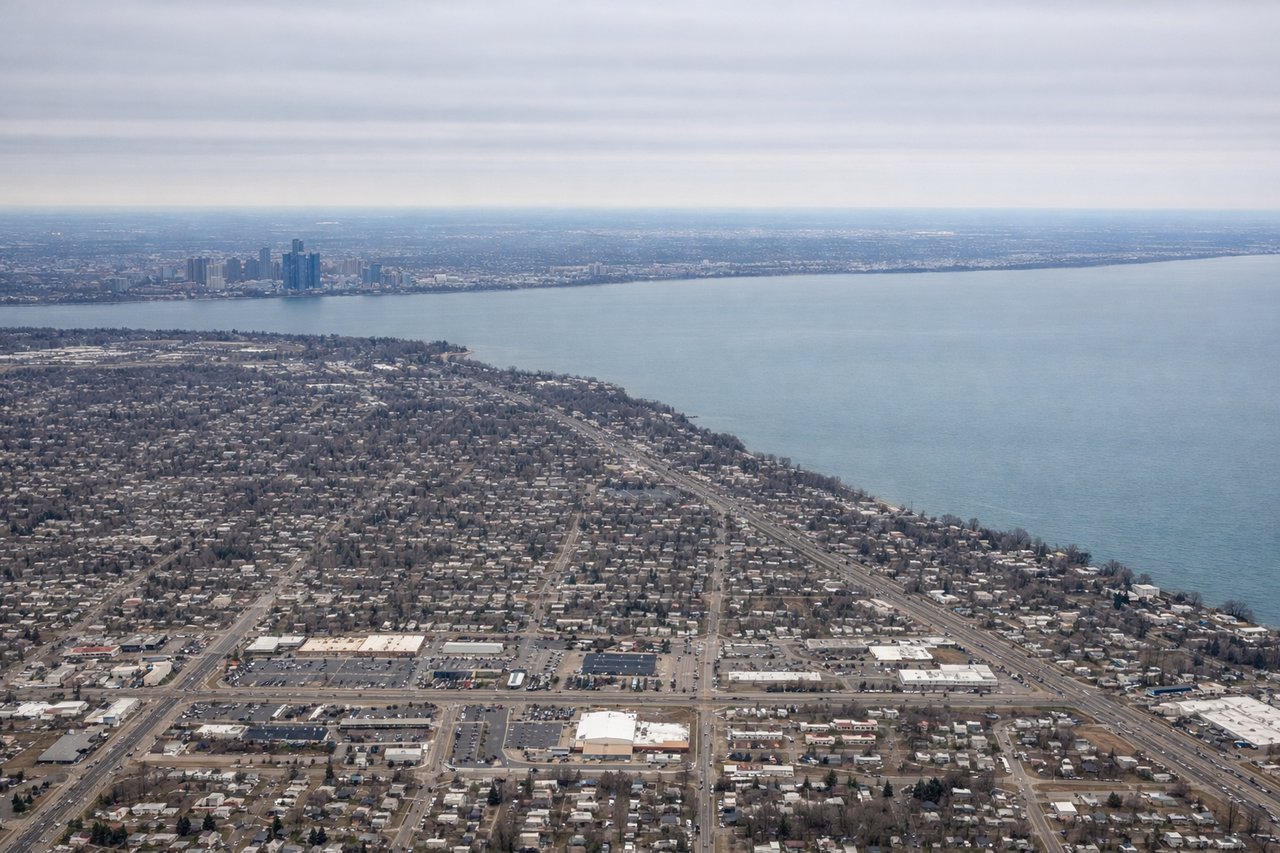
Landing at DTW
RIGHTThe approach to Detroit from the west crosses the Great Lakes region, offering views of Lake Michigan's eastern shore and the Detroit metropolitan area's urban sprawl. Right side captures the approach corridor over water and suburban development. Left side faces open water and lacks distinctive landmarks during final descent.
Will your flight be in sunlight?
Pick a date and time in the Sun Map to watch the sun move across your whole flight.
About This Route
Which side of the plane should I sit on flying from Santa Barbara Municipal Airport (SBA) to Detroit Metro Wayne Co (DTW)?
Sit on the Left side of the plane for the best views on flights from Santa Barbara to Detroit. While both sides score equally at 2.5, the left side (westbound departure from SBA) provides superior scenic value during takeoff with immediate coastal drama, Channel Islands, and mountain backdrop. The landing approach to DTW is equally unremarkable on both sides—flat Midwest terrain and suburban sprawl dominate. Since takeoff offers more compelling visuals and the flight's opening minutes set the tone, left side is the stronger choice.
What can I see during takeoff from Santa Barbara Municipal Airport in Santa Barbara?
During takeoff from Santa Barbara Municipal Airport (SBA), sit on the Left side for the best views. Santa Barbara's coastal departure offers immediate scenic value with the Pacific Ocean, Channel Islands, and the Santa Ynez Mountains visible during climb-out. Right side faces inland terrain with less dramatic features during the critical takeoff phase. Notable sights include: Pacific Ocean coastline, Channel Islands (Santa Cruz and Anacapa visible as dark silhouettes offshore), Santa Ynez Mountains rising directly inland, Santa Barbara harbor and city grid.
What can I see when landing at Detroit Metro Wayne Co in Detroit?
When landing at Detroit Metro Wayne Co (DTW), sit on the Right side for the best views. The approach to Detroit from the west crosses the Great Lakes region, offering views of Lake Michigan's eastern shore and the Detroit metropolitan area's urban sprawl. Right side captures the approach corridor over water and suburban development. Left side faces open water and lacks distinctive landmarks during final descent. Notable sights include: Lake Michigan's eastern shoreline, Detroit metropolitan sprawl and suburban grid, the Detroit River separating Michigan from Canada, Windsor, Ontario visible across the border.
How long is the flight from Santa Barbara to Detroit?
The flight from Santa Barbara Municipal Airport (SBA) to Detroit Metro Wayne Co (DTW) takes about 4 hours 45 minutes. The shortest flight path between them is 2,033 miles (3,271 km); winds and air traffic control usually add a few percent.
What does the Santa Barbara to Detroit flight path pass over?
The flight path crosses the Sierra Nevada mountains (visible as a distant ridge during early cruise), then traverses the Great Basin and Rocky Mountain region. Notable features include the Colorado Plateau's edge, the Great Plains' gradual transition from elevated terrain to flat farmland, and the Mississippi River valley approaching the Midwest. Lake Superior appears on the northern horizon during the final cruise phase before descent into Michigan.