Right side scores higher (3.5 vs 2.5) due to superior terrain drama on both legs. Takeoff from Salina-Gunnison benefits from immediate views of the Wasatch Range and high desert mountains. The cruise segment over Utah and Nevada offers moderate scenic value, but the landing approach into LAX is the decisive factor—right side captures the San Gabriel Mountains, sprawling Los Angeles Basin, and Pacific coastline, providing significantly more visual interest than the left side's view of open ocean and distant terrain.
Flown SBO to LAX? Did we get it right?
Flight Path
Salina to Los Angeles is 506 miles (815 km), a flight of about 1 hour 45 minutes.
Great Basin desert terrain, Nevada high desert, Mojave Desert, San Bernardino Mountains as the aircraft descends toward Southern California
Great circle distance and headings ›


Phase by phase
Takeoff from SBO
RIGHTRight side captures the Wasatch Range and surrounding high desert terrain immediately after departure from Salina-Gunnison. The airport sits at 4,927 feet elevation in a valley surrounded by mountains, making the right side the natural choice for viewing the dramatic terrain during climb-out.
Landing at LAX
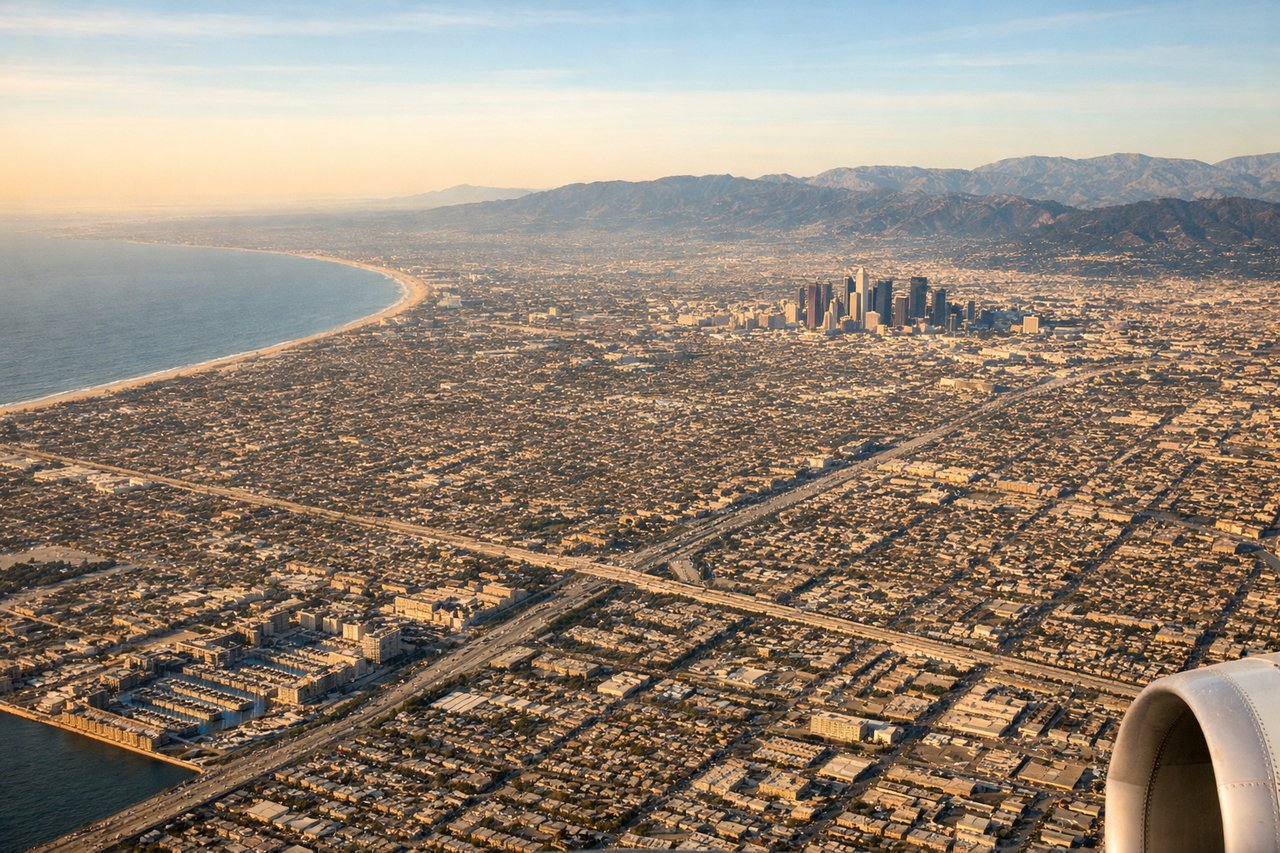
RIGHTRight side provides superior views during the LAX approach. Westbound arrivals typically descend over the San Gabriel Mountains, then follow the Los Angeles Basin toward the coast. The right side captures the mountain terrain, urban sprawl of greater Los Angeles, and the Pacific coastline during final approach.
Will your flight be in sunlight?
Pick a date and time in the Sun Map to watch the sun move across your whole flight.
About This Route
Which side of the plane should I sit on flying from Salina-Gunnison Airport (SBO) to Los Angeles International (LAX)?
Sit on the Right side of the plane for the best views on flights from Salina to Los Angeles. Right side scores higher (3.5 vs 2.5) due to superior terrain drama on both legs. Takeoff from Salina-Gunnison benefits from immediate views of the Wasatch Range and high desert mountains. The cruise segment over Utah and Nevada offers moderate scenic value, but the landing approach into LAX is the decisive factor—right side captures the San Gabriel Mountains, sprawling Los Angeles Basin, and Pacific coastline, providing significantly more visual interest than the left side's view of open ocean and distant terrain.
What can I see during takeoff from Salina-Gunnison Airport in Salina?
During takeoff from Salina-Gunnison Airport (SBO), sit on the Right side for the best views. Right side captures the Wasatch Range and surrounding high desert terrain immediately after departure from Salina-Gunnison. The airport sits at 4,927 feet elevation in a valley surrounded by mountains, making the right side the natural choice for viewing the dramatic terrain during climb-out. Notable sights include: Wasatch Range to the east, Salina Valley floor, San Pitch Mountains to the south, high desert scrubland.
What can I see when landing at Los Angeles International in Los Angeles?
When landing at Los Angeles International (LAX), sit on the Right side for the best views. Right side provides superior views during the LAX approach. Westbound arrivals typically descend over the San Gabriel Mountains, then follow the Los Angeles Basin toward the coast. The right side captures the mountain terrain, urban sprawl of greater Los Angeles, and the Pacific coastline during final approach. Notable sights include: San Gabriel Mountains, Los Angeles Basin urban grid, Santa Monica Mountains, Pacific coastline near Santa Monica Bay.
How long is the flight from Salina to Los Angeles?
The flight from Salina-Gunnison Airport (SBO) to Los Angeles International (LAX) takes about 1 hour 45 minutes. The shortest flight path between them is 506 miles (815 km); winds and air traffic control usually add a few percent.
What does the Salina to Los Angeles flight path pass over?
Great Basin desert terrain, Nevada high desert, Mojave Desert, San Bernardino Mountains as the aircraft descends toward Southern California