While takeoff offers good mountain views on the right, the landing approach into SFO from the south provides superior scenic value with expansive bay views, the Marin Headlands, and the Golden Gate Strait—all iconic Northern California geography. Left-side seats capture this dramatic finale.
Flown SBP to SFO? Did we get it right?
Flight Path
San Luis Obispo to San Francisco is 191 miles (307 km), a flight of about 1 hour 15 minutes.
Monterey Bay and the Big Sur coastline lie roughly 40 miles west of the direct flight path; the Santa Cruz Mountains form the eastern boundary of the San Francisco Peninsula; the Salinas Valley appears inland to the southeast during cruise; Carmel-by-the-Sea and Point Lobos are visible far to the west if conditions permit, but typically remain beyond the horizon for this northbound route.
Great circle distance and headings ›Phase by phase
Takeoff from SBP
RIGHTRight-side seats capture the Santa Lucia Mountains immediately after departure, rising dramatically to the east of San Luis Obispo. The northbound climb-out also aligns well with views of the Cuesta Grade and the transition from coastal valleys to inland terrain.
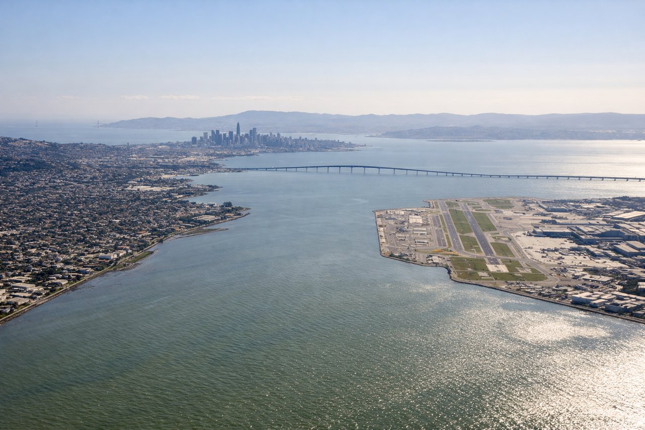
Landing at SFO
LEFTLeft-side seats offer the best views during the southbound descent into SFO. You'll see the San Francisco Bay opening up, the Diablo Range to the east, and the approach path over the bay itself with views of the Marin Headlands and the Golden Gate strait.
Will your flight be in sunlight?
Pick a date and time in the Sun Map to watch the sun move across your whole flight.
About This Route
Which side of the plane should I sit on flying from San Luis County Regional Airport (SBP) to San Francisco International (SFO)?
Sit on the Left side of the plane for the best views on flights from San Luis Obispo to San Francisco. While takeoff offers good mountain views on the right, the landing approach into SFO from the south provides superior scenic value with expansive bay views, the Marin Headlands, and the Golden Gate Strait—all iconic Northern California geography. Left-side seats capture this dramatic finale.
What can I see during takeoff from San Luis County Regional Airport in San Luis Obispo?
During takeoff from San Luis County Regional Airport (SBP), sit on the Right side for the best views. Right-side seats capture the Santa Lucia Mountains immediately after departure, rising dramatically to the east of San Luis Obispo. The northbound climb-out also aligns well with views of the Cuesta Grade and the transition from coastal valleys to inland terrain. Notable sights include: Santa Lucia Mountains, Cuesta Grade, San Luis Obispo Valley, Atascadero Basin.
What can I see when landing at San Francisco International in San Francisco?
When landing at San Francisco International (SFO), sit on the Left side for the best views. Left-side seats offer the best views during the southbound descent into SFO. You'll see the San Francisco Bay opening up, the Diablo Range to the east, and the approach path over the bay itself with views of the Marin Headlands and the Golden Gate strait. Notable sights include: San Francisco Bay, Diablo Range, Marin Headlands, Golden Gate Strait.
How long is the flight from San Luis Obispo to San Francisco?
The flight from San Luis County Regional Airport (SBP) to San Francisco International (SFO) takes about 1 hour 15 minutes. The shortest flight path between them is 191 miles (307 km); winds and air traffic control usually add a few percent.
What does the San Luis Obispo to San Francisco flight path pass over?
Monterey Bay and the Big Sur coastline lie roughly 40 miles west of the direct flight path; the Santa Cruz Mountains form the eastern boundary of the San Francisco Peninsula; the Salinas Valley appears inland to the southeast during cruise; Carmel-by-the-Sea and Point Lobos are visible far to the west if conditions permit, but typically remain beyond the horizon for this northbound route.