Left side scores higher due to superior takeoff scenery (San Francisco Bay and urban skyline) and more dramatic terrain during descent (Santa Lucia Range and coastal ridgelines). The route is short (approximately 1 hour), so the quality of departure and arrival views dominates the experience. Right side offers only flat to gently rolling inland terrain throughout.
Flown SFO to SBP? Did we get it right?
Flight Path
San Francisco to San Luis Obispo is 191 miles (307 km), a flight of about 1 hour 5 minutes.
Monterey Bay (visible to the left during cruise), Big Sur coastline (far left on horizon during cruise), Salinas Valley agricultural plains (right side during cruise), Santa Lucia Range running parallel to the flight path on the left
Great circle distance and headings ›Phase by phase
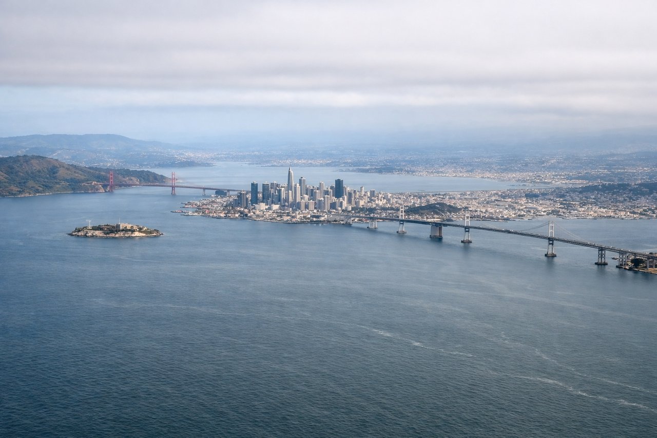
Takeoff from SFO
LEFTLeft side captures San Francisco Bay, the Golden Gate Bridge area, and the San Francisco skyline during departure. Right side faces inland toward the East Bay hills with less dramatic urban scenery.
Landing at SBP
LEFTLeft side offers views of the Santa Lucia Range and coastal terrain as the aircraft descends toward San Luis Obispo. Right side shows inland agricultural valleys with less visual drama.
Will your flight be in sunlight?
Pick a date and time in the Sun Map to watch the sun move across your whole flight.
About This Route
Which side of the plane should I sit on flying from San Francisco International (SFO) to San Luis County Regional Airport (SBP)?
Sit on the Left side of the plane for the best views on flights from San Francisco to San Luis Obispo. Left side scores higher due to superior takeoff scenery (San Francisco Bay and urban skyline) and more dramatic terrain during descent (Santa Lucia Range and coastal ridgelines). The route is short (approximately 1 hour), so the quality of departure and arrival views dominates the experience. Right side offers only flat to gently rolling inland terrain throughout.
What can I see during takeoff from San Francisco International in San Francisco?
During takeoff from San Francisco International (SFO), sit on the Left side for the best views. Left side captures San Francisco Bay, the Golden Gate Bridge area, and the San Francisco skyline during departure. Right side faces inland toward the East Bay hills with less dramatic urban scenery. Notable sights include: San Francisco Bay, Golden Gate Bridge, San Francisco skyline, Marin Headlands.
What can I see when landing at San Luis County Regional Airport in San Luis Obispo?
When landing at San Luis County Regional Airport (SBP), sit on the Left side for the best views. Left side offers views of the Santa Lucia Range and coastal terrain as the aircraft descends toward San Luis Obispo. Right side shows inland agricultural valleys with less visual drama. Notable sights include: Santa Lucia Range, Cuesta Ridge, San Luis Obispo Valley, coastal ridgelines.
How long is the flight from San Francisco to San Luis Obispo?
The flight from San Francisco International (SFO) to San Luis County Regional Airport (SBP) takes about 1 hour 5 minutes. The shortest flight path between them is 191 miles (307 km); winds and air traffic control usually add a few percent.
What does the San Francisco to San Luis Obispo flight path pass over?
Monterey Bay (visible to the left during cruise), Big Sur coastline (far left on horizon during cruise), Salinas Valley agricultural plains (right side during cruise), Santa Lucia Range running parallel to the flight path on the left