Sendai to Fukuoka is 665 miles (1,070 km), a flight of about 2 hours.
Right-side seats offer superior views on both legs: the dramatic Oshika Peninsula and Sendai Bay during departure, and a direct view of Hakata Bay's geography during approach. The southbound flight path itself passes over central Honshu's interior, which offers limited distinctive features from altitude, making the terminal views the priority.
Flight Path
The flight path crosses central Honshu at cruise altitude (around 25,000 feet), passing over the Abukuma Mountains and Ou Mountains to the west. These appear as a distant, low ridge of forested terrain with minimal visual distinction from altitude. The Kitakami River valley is visible inland from Sendai. As the aircraft descends toward Fukuoka, the Chikugo River plain becomes visible, and the Fukuoka Plain's agricultural and urban areas emerge. The Genkai Sea (northwest of Fukuoka) marks the approach to the landing area.
Great circle distance and headings ›Phase by phase
Takeoff from SDJ
RIGHTSendai typically departs runway 07/25 depending on wind. Runway 07 departures (eastbound) climb over Sendai Bay and the Pacific coast, offering views of the Ria-style coastline. Right-side seats capture the bay's intricate inlets and the Oshika Peninsula extending into the Pacific.
Landing at FUK
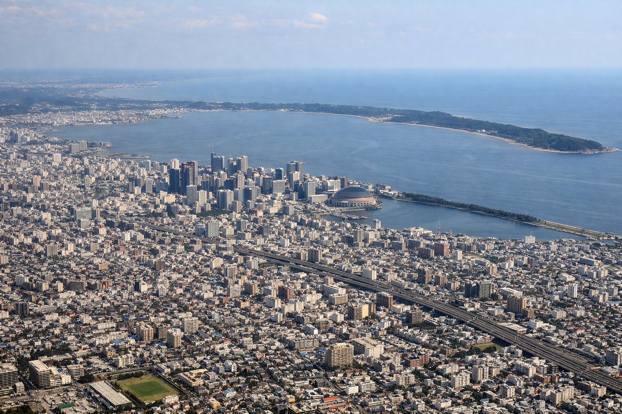
LEFTFukuoka typically lands runway 16/34 depending on wind. Runway 34 approaches (from the north) descend over Hakata Bay and the Fukuoka urban area. Left-side seats on final approach offer views of Hakata Bay's distinctive shape, the bay islands, and the city's waterfront districts before touchdown.
Will your flight be in sunlight?
Pick a date and time in the Sun Map to watch the sun move across your whole flight.
About This Route
Which side of the plane should I sit on flying from Sendai (SDJ) to Fukuoka (FUK)?
Sit on the Right side of the plane for the best views on flights from Sendai to Fukuoka. Right-side seats offer superior views on both legs: the dramatic Oshika Peninsula and Sendai Bay during departure, and a direct view of Hakata Bay's geography during approach. The southbound flight path itself passes over central Honshu's interior, which offers limited distinctive features from altitude, making the terminal views the priority.
What can I see during takeoff from Sendai in Sendai?
During takeoff from Sendai (SDJ), sit on the Right side for the best views. Sendai typically departs runway 07/25 depending on wind. Runway 07 departures (eastbound) climb over Sendai Bay and the Pacific coast, offering views of the Ria-style coastline. Right-side seats capture the bay's intricate inlets and the Oshika Peninsula extending into the Pacific. Notable sights include: Sendai Bay (immediate offshore waters), Oshika Peninsula (rocky headland to the east), Pacific Ocean horizon, Kitakami River delta (visible inland to the southwest).
What can I see when landing at Fukuoka in Fukuoka?
When landing at Fukuoka (FUK), sit on the Left side for the best views. Fukuoka typically lands runway 16/34 depending on wind. Runway 34 approaches (from the north) descend over Hakata Bay and the Fukuoka urban area. Left-side seats on final approach offer views of Hakata Bay's distinctive shape, the bay islands, and the city's waterfront districts before touchdown. Notable sights include: Hakata Bay (large enclosed bay with visible islands), Shika Island and Uminokuchi Island (bay islands), Fukuoka city waterfront and Hakata district, Genkai Sea to the northwest.
How long is the flight from Sendai to Fukuoka?
The flight from Sendai (SDJ) to Fukuoka (FUK) takes about 2 hours. The shortest flight path between them is 665 miles (1,070 km); winds and air traffic control usually add a few percent.
What does the Sendai to Fukuoka flight path pass over?
The flight path crosses central Honshu at cruise altitude (around 25,000 feet), passing over the Abukuma Mountains and Ou Mountains to the west. These appear as a distant, low ridge of forested terrain with minimal visual distinction from altitude. The Kitakami River valley is visible inland from Sendai. As the aircraft descends toward Fukuoka, the Chikugo River plain becomes visible, and the Fukuoka Plain's agricultural and urban areas emerge. The Genkai Sea (northwest of Fukuoka) marks the approach to the landing area.