The takeoff view from SDU over Guanabara Bay and the Serra da Carioca is more visually distinctive and geographically dramatic than the landing approach into São Paulo's urban sprawl. The bay and mountain backdrop offer clearer geographic reference points.
Flight Path
The flight path travels southwest from Rio de Janeiro across the Paraíba do Sul River valley, passing over the Serra da Mantiqueira's northern slopes. At cruise altitude (around 25,000 feet), passengers may glimpse the Paraíba do Sul as a thin line in the valley below, with forested mountains on both sides. The landscape transitions from Rio's coastal mountains to São Paulo's interior plateau, with increasing urban development visible as the aircraft descends toward Congonhas.
Great circle distance and headings ›

Phase by phase
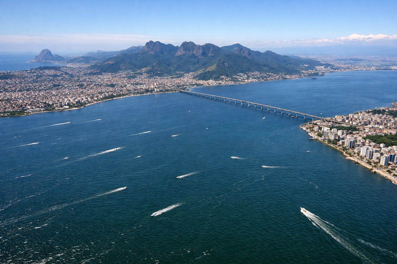
Takeoff from SDU
RIGHTSDU typically departs to the northeast (runway 02) over Guanabara Bay. Right-side seats offer direct views of the bay's eastern shoreline, the Niterói waterfront, and the Serra da Carioca mountain range receding northward. Left seats face inland toward the city.
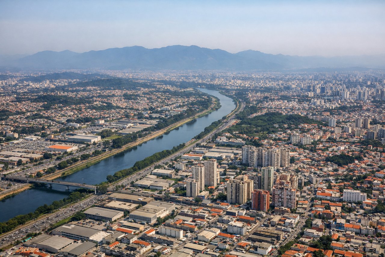
Landing at CGH
LEFTCGH approaches from the northeast (runway 09L/09R). Left-side seats descending into São Paulo offer views of the Pinheiros River valley, the city's southern districts, and the Serra da Mantiqueira foothills to the southwest. Right seats face the urban sprawl with less geographic definition.
Landmarks on this routeAll landmarks →
Will your flight be in sunlight?
See exactly which side of the plane gets sun and shade at your departure time.
About This Route
Which side of the plane should I sit on flying from Santos Dumont (SDU) to Congonhas (CGH)?
Sit on the Right side of the plane for the best views on flights from Rio De Janeiro to Sao Paulo. The takeoff view from SDU over Guanabara Bay and the Serra da Carioca is more visually distinctive and geographically dramatic than the landing approach into São Paulo's urban sprawl. The bay and mountain backdrop offer clearer geographic reference points.
What can I see during takeoff from Santos Dumont in Rio De Janeiro?
During takeoff from Santos Dumont (SDU), sit on the Right side for the best views. SDU typically departs to the northeast (runway 02) over Guanabara Bay. Right-side seats offer direct views of the bay's eastern shoreline, the Niterói waterfront, and the Serra da Carioca mountain range receding northward. Left seats face inland toward the city. Notable sights include: Guanabara Bay (immediate foreground), Niterói waterfront (northeast), Serra da Carioca mountains (north-northeast horizon), Christ the Redeemer peak (visible briefly to the left as reference).
What can I see when landing at Congonhas in Sao Paulo?
When landing at Congonhas (CGH), sit on the Left side for the best views. CGH approaches from the northeast (runway 09L/09R). Left-side seats descending into São Paulo offer views of the Pinheiros River valley, the city's southern districts, and the Serra da Mantiqueira foothills to the southwest. Right seats face the urban sprawl with less geographic definition. Notable sights include: Pinheiros River (visible as a winding linear feature through the city), Serra da Mantiqueira foothills (southwest horizon), São Paulo's southern residential zones (Morumbi, Santo Amaro districts), Represa Billings reservoir (visible as a large dark water body to the south).
How long is the flight from Rio De Janeiro to Sao Paulo?
The flight from Santos Dumont (SDU) to Congonhas (CGH) takes Approximately 1 hour 15 minutes.
What does the Rio De Janeiro to Sao Paulo flight path pass over?
The flight path travels southwest from Rio de Janeiro across the Paraíba do Sul River valley, passing over the Serra da Mantiqueira's northern slopes. At cruise altitude (around 25,000 feet), passengers may glimpse the Paraíba do Sul as a thin line in the valley below, with forested mountains on both sides. The landscape transitions from Rio's coastal mountains to São Paulo's interior plateau, with increasing urban development visible as the aircraft descends toward Congonhas.