Seattle to Burbank is 938 miles (1,509 km), a flight of about 2 hours 35 minutes.
The left side delivers a dramatic, sustained mountain show — Mt. Rainier at takeoff followed by Mt. Shasta and the Sierra Nevada crest during cruise — giving it more consistent scenic drama across the flight than the right side's ocean views and single strong landing sequence.
Flight Path
Mt. Shasta and the Cascade Range give way to the northern Sierra Nevada and the Central Valley as the route continues south toward Southern California.
Great circle distance and headings ›


.jpg?width=600)
Phase by phase
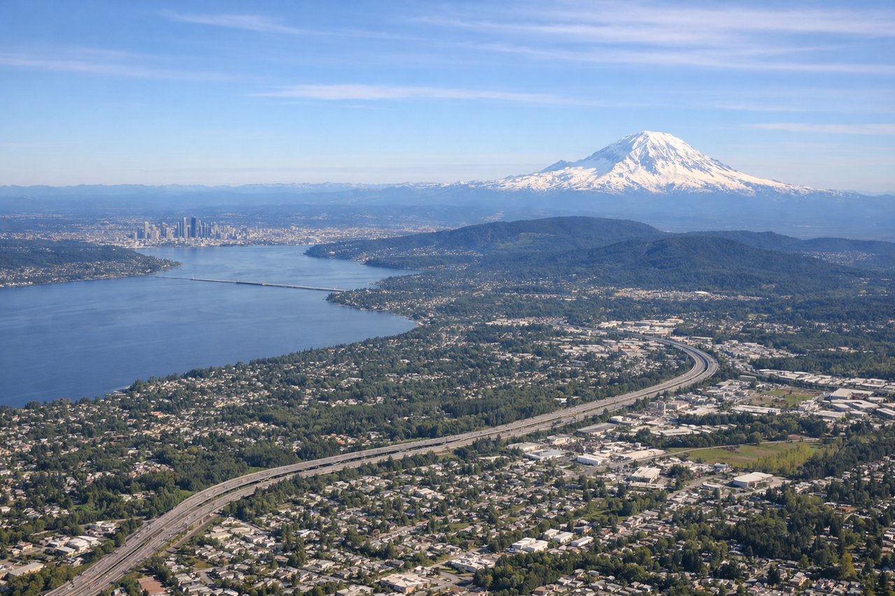
Takeoff from SEA
LEFTDeparting SEA southbound, the climb-out puts Mt. Rainier's glaciated cone directly on the left side, towering over the Cascade foothills. Seattle's downtown skyline and Puget Sound recede to the right, but the volcano dominates the view.
Landing at BUR
RIGHTOn the typical Runway 33 approach into BUR from the south, the aircraft tracks north over the Los Angeles basin, giving right-side passengers views of the Hollywood Hills, Griffith Observatory, and the downtown LA skyline before crossing into the San Fernando Valley for landing.
Landmarks on this routeAll landmarks →
Will your flight be in sunlight?
Pick a date and time in the Sun Map to watch the sun move across your whole flight.
About This Route
Which side of the plane should I sit on flying from Seattle Tacoma International (SEA) to Burbank Glendale Pasadena (BUR)?
Sit on the Left side of the plane for the best views on flights from Seattle to Burbank. The left side delivers a dramatic, sustained mountain show — Mt. Rainier at takeoff followed by Mt. Shasta and the Sierra Nevada crest during cruise — giving it more consistent scenic drama across the flight than the right side's ocean views and single strong landing sequence.
What can I see during takeoff from Seattle Tacoma International in Seattle?
During takeoff from Seattle Tacoma International (SEA), sit on the Left side for the best views. Departing SEA southbound, the climb-out puts Mt. Rainier's glaciated cone directly on the left side, towering over the Cascade foothills. Seattle's downtown skyline and Puget Sound recede to the right, but the volcano dominates the view. Notable sights include: Mt. Rainier, Cascade foothills, Puget Sound (right side), Lake Washington.
What can I see when landing at Burbank Glendale Pasadena in Burbank?
When landing at Burbank Glendale Pasadena (BUR), sit on the Right side for the best views. On the typical Runway 33 approach into BUR from the south, the aircraft tracks north over the Los Angeles basin, giving right-side passengers views of the Hollywood Hills, Griffith Observatory, and the downtown LA skyline before crossing into the San Fernando Valley for landing. Notable sights include: Downtown Los Angeles skyline, Hollywood Hills and Griffith Observatory, Griffith Park, San Fernando Valley.
How long is the flight from Seattle to Burbank?
The flight from Seattle Tacoma International (SEA) to Burbank Glendale Pasadena (BUR) takes about 2 hours 35 minutes. The shortest flight path between them is 938 miles (1,509 km); winds and air traffic control usually add a few percent.
What does the Seattle to Burbank flight path pass over?
Mt. Shasta and the Cascade Range give way to the northern Sierra Nevada and the Central Valley as the route continues south toward Southern California.