The right side captures the most dramatic terrain at both ends of the flight: Mount Rainier and the Cascades on departure, and Dublin Bay with Howth Head on arrival, while the left side offers comparatively flat or open-water views during these same phases.
Flight Path
Route crosses northern Canada near Hudson Bay, then the southern tip of Greenland's ice sheet and fjord coastline (weather and routing permitting), before crossing open North Atlantic waters toward Ireland.
Great circle distance and headings ›
.jpg?width=600)


Phase by phase

Takeoff from SEA
RIGHTDeparting SEA on runway 34, the aircraft climbs north over Puget Sound before banking east toward Canada, putting the Cascade Range and the glaciated summit of Mount Rainier on the right side of the plane. The left side mostly shows the flatter Kitsap Peninsula and Olympic foothills, which are less dramatic.
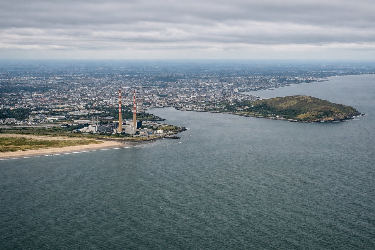
Landing at DUB
RIGHTArriving at DUB on runway 28 means approaching from the east over the Irish Sea, and the final turn typically swings the aircraft south of Dublin Bay before lining up west. This puts Dublin Bay, the Howth Head peninsula, and the city's coastline on the right side of the cabin during descent.
Landmarks on this routeAll landmarks →
Will your flight be in sunlight?
See exactly which side of the plane gets sun and shade at your departure time.
About This Route
Which side of the plane should I sit on flying from Seattle Tacoma International (SEA) to Dublin (DUB)?
Sit on the Right side of the plane for the best views on flights from Seattle to Dublin. The right side captures the most dramatic terrain at both ends of the flight: Mount Rainier and the Cascades on departure, and Dublin Bay with Howth Head on arrival, while the left side offers comparatively flat or open-water views during these same phases.
What can I see during takeoff from Seattle Tacoma International in Seattle?
During takeoff from Seattle Tacoma International (SEA), sit on the Right side for the best views. Departing SEA on runway 34, the aircraft climbs north over Puget Sound before banking east toward Canada, putting the Cascade Range and the glaciated summit of Mount Rainier on the right side of the plane. The left side mostly shows the flatter Kitsap Peninsula and Olympic foothills, which are less dramatic. Notable sights include: Mount Rainier, Cascade Range foothills, Puget Sound waterways, Lake Washington.
What can I see when landing at Dublin in Dublin?
When landing at Dublin (DUB), sit on the Right side for the best views. Arriving at DUB on runway 28 means approaching from the east over the Irish Sea, and the final turn typically swings the aircraft south of Dublin Bay before lining up west. This puts Dublin Bay, the Howth Head peninsula, and the city's coastline on the right side of the cabin during descent. Notable sights include: Dublin Bay, Howth Head, Dublin city coastline, Irish Sea.
How long is the flight from Seattle to Dublin?
The flight from Seattle Tacoma International (SEA) to Dublin (DUB) takes 8h 10m.
What does the Seattle to Dublin flight path pass over?
Route crosses northern Canada near Hudson Bay, then the southern tip of Greenland's ice sheet and fjord coastline (weather and routing permitting), before crossing open North Atlantic waters toward Ireland.