Left side scores higher due to the dramatic Pacific Northwest departure over Puget Sound and the Cascade-Olympic mountain frame, which provides more visual variety and recognizable landmarks than the Guadalajara approach. While the landing on the right side is scenic, the takeoff advantage and the full-flight mountain-and-water scenery on the left outweigh it.
Flown SEA to GDL? Did we get it right?
Flight Path
Seattle to Guadalajara is 2,142 miles (3,448 km), a flight of about 4 hours 15 minutes.
The flight path crosses the Cascade Range (volcanic peaks including Mount Shasta visible on clear days), descends over northern California's interior valleys, crosses the Sierra Madre Occidental foothills in Durango/Nayarit, and approaches the Jalisco highlands where Guadalajara sits at 5,000 feet elevation. Lake Chapala and the Lerma River basin mark the final descent corridor.
Great circle distance and headings ›


Phase by phase
Takeoff from SEA
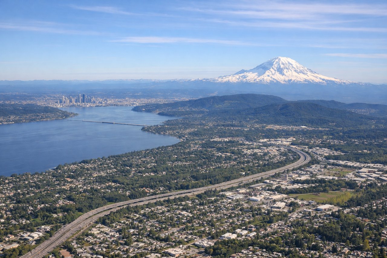
LEFTLeft side captures Seattle-Tacoma's dramatic Puget Sound waterfront, the Olympic Mountains to the west, and the Cascade Range to the east during departure. Right side faces inland toward flat agricultural valleys with minimal visual interest during climb-out.
Landing at GDL
RIGHTRight side offers superior approach scenery into Guadalajara, with views of the Sierra Madre Occidental foothills, the Chapala Lake basin, and the city's urban sprawl nestled in a highland valley. Left side faces open terrain with fewer distinctive landmarks during descent.
Will your flight be in sunlight?
Pick a date and time in the Sun Map to watch the sun move across your whole flight.
About This Route
Which side of the plane should I sit on flying from Seattle Tacoma International (SEA) to Don Miguel Y Hidalgo International (GDL)?
Sit on the Left side of the plane for the best views on flights from Seattle to Guadalajara. Left side scores higher due to the dramatic Pacific Northwest departure over Puget Sound and the Cascade-Olympic mountain frame, which provides more visual variety and recognizable landmarks than the Guadalajara approach. While the landing on the right side is scenic, the takeoff advantage and the full-flight mountain-and-water scenery on the left outweigh it.
What can I see during takeoff from Seattle Tacoma International in Seattle?
During takeoff from Seattle Tacoma International (SEA), sit on the Left side for the best views. Left side captures Seattle-Tacoma's dramatic Puget Sound waterfront, the Olympic Mountains to the west, and the Cascade Range to the east during departure. Right side faces inland toward flat agricultural valleys with minimal visual interest during climb-out. Notable sights include: Puget Sound with its island-dotted waters, Olympic Mountains (snow-capped peaks visible on clear days), Mount Rainier to the southeast, Seattle's downtown skyline and Elliott Bay waterfront.
What can I see when landing at Don Miguel Y Hidalgo International in Guadalajara?
When landing at Don Miguel Y Hidalgo International (GDL), sit on the Right side for the best views. Right side offers superior approach scenery into Guadalajara, with views of the Sierra Madre Occidental foothills, the Chapala Lake basin, and the city's urban sprawl nestled in a highland valley. Left side faces open terrain with fewer distinctive landmarks during descent. Notable sights include: Sierra Madre Occidental mountain range (eastern approach), Lake Chapala (Mexico's largest freshwater lake, visible as a blue expanse), Guadalajara's urban grid and surrounding agricultural valleys, volcanic highlands of the Jalisco plateau.
How long is the flight from Seattle to Guadalajara?
The flight from Seattle Tacoma International (SEA) to Don Miguel Y Hidalgo International (GDL) takes about 4 hours 15 minutes. The shortest flight path between them is 2,142 miles (3,448 km); winds and air traffic control usually add a few percent.
What does the Seattle to Guadalajara flight path pass over?
The flight path crosses the Cascade Range (volcanic peaks including Mount Shasta visible on clear days), descends over northern California's interior valleys, crosses the Sierra Madre Occidental foothills in Durango/Nayarit, and approaches the Jalisco highlands where Guadalajara sits at 5,000 feet elevation. Lake Chapala and the Lerma River basin mark the final descent corridor.