Takeoff offers superior scenery with Mount Rainier and the Cascade Range as dramatic focal points. While landing provides London views, the Pacific Northwest departure is more visually striking and geographically distinctive.
Flown SEA to LCY? Did we get it right?
Flight Path
Seattle to London is 4,798 miles (7,721 km), a flight of about 9 hours 15 minutes.
Northern Rocky Mountains (Montana/Idaho border region), Great Lakes (Superior visible from northern route), Appalachian Mountains (eastern North America), Atlantic coastline (Nova Scotia or Newfoundland depending on exact routing), Greenland ice sheet (possible on northerly transatlantic route), Iceland (if routed via NATS North Atlantic Tracks), Norwegian Sea, North Sea
Great circle distance and headings ›


Phase by phase
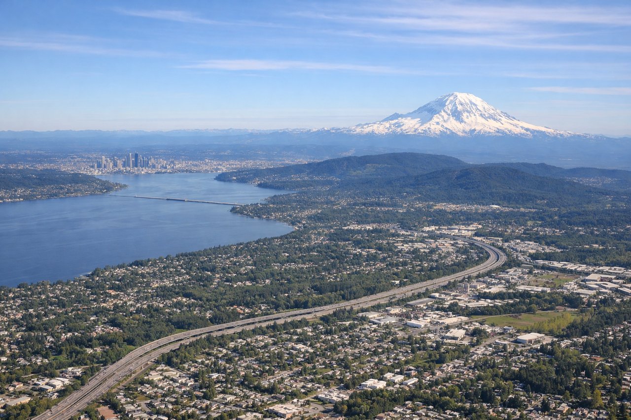
Takeoff from SEA
LEFTLeft side offers immediate views of the Cascade Range and Mount Rainier during climb-out heading northeast over Washington state. Right side faces the Puget Sound and Olympic Mountains but with less dramatic relief.
Landing at LCY
RIGHTRight side provides views of the Thames River, central London landmarks, and the approach path over the English countryside. Left side faces away from the city during the typical eastbound descent into City Airport.
Will your flight be in sunlight?
Pick a date and time in the Sun Map to watch the sun move across your whole flight.
About This Route
Which side of the plane should I sit on flying from Seattle Tacoma International (SEA) to City (LCY)?
Sit on the Left side of the plane for the best views on flights from Seattle to London. Takeoff offers superior scenery with Mount Rainier and the Cascade Range as dramatic focal points. While landing provides London views, the Pacific Northwest departure is more visually striking and geographically distinctive.
What can I see during takeoff from Seattle Tacoma International in Seattle?
During takeoff from Seattle Tacoma International (SEA), sit on the Left side for the best views. Left side offers immediate views of the Cascade Range and Mount Rainier during climb-out heading northeast over Washington state. Right side faces the Puget Sound and Olympic Mountains but with less dramatic relief. Notable sights include: Mount Rainier (14,411 ft, dominant volcanic peak), Cascade Range (north-south trending mountains), Puget Sound (water body to the west), Lake Washington (visible east of Seattle).
What can I see when landing at City in London?
When landing at City (LCY), sit on the Right side for the best views. Right side provides views of the Thames River, central London landmarks, and the approach path over the English countryside. Left side faces away from the city during the typical eastbound descent into City Airport. Notable sights include: Thames River (winding through London), Central London urban grid (visible as dense building clusters), Essex countryside (agricultural fields and towns), North Sea coast (distant, on horizon).
How long is the flight from Seattle to London?
The flight from Seattle Tacoma International (SEA) to City (LCY) takes about 9 hours 15 minutes. The shortest flight path between them is 4,798 miles (7,721 km); winds and air traffic control usually add a few percent.
What does the Seattle to London flight path pass over?
Northern Rocky Mountains (Montana/Idaho border region), Great Lakes (Superior visible from northern route), Appalachian Mountains (eastern North America), Atlantic coastline (Nova Scotia or Newfoundland depending on exact routing), Greenland ice sheet (possible on northerly transatlantic route), Iceland (if routed via NATS North Atlantic Tracks), Norwegian Sea, North Sea