The left side delivers the flight's most dramatic single moment — Mount Rainier on departure — plus views of the Cascades as the route crosses into eastern Washington. Over the Rockies and Great Plains the views are more symmetric, but the left side also picks up better angles on the Missouri River crossings and approaches the Ohio Valley from a favorable angle. The Rainier view alone makes left the clear winner.
Flown SEA to LOU? Did we get it right?
Flight Path
Seattle to Louisville is 1,942 miles (3,125 km), a flight of about 3 hours 45 minutes.
Eastern Washington high desert and Columbia River plateau, the Rocky Mountain foothills over Idaho and Montana if routing goes north, more likely the Snake River Plain, then the wide Missouri River crossings over Missouri, the Mississippi River valley, and the rolling karst farmland of southern Indiana before descending into Louisville
Great circle distance and headings ›


Phase by phase
Takeoff from SEA
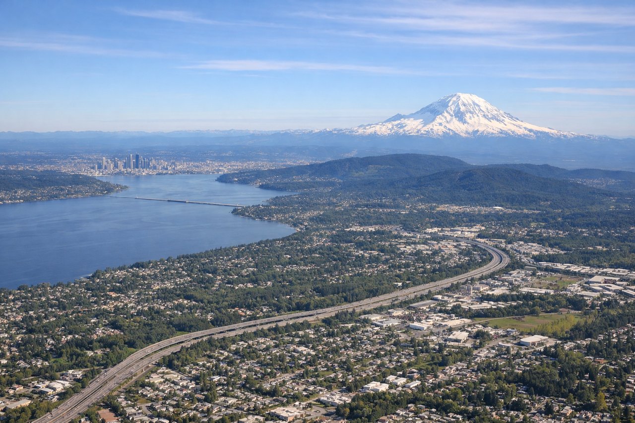
LEFTSEA primarily uses runways 16L/16R for southbound departures, meaning the aircraft heads south and then turns east. The left side faces east toward the Cascades, giving you a direct view of Mount Rainier dominating the skyline. The right side looks west over Puget Sound but quickly loses interest as the route turns inland.
Landing at LOU
RIGHTBowman Field sits just east of downtown Louisville, and aircraft typically approach from the west or northwest on runway 06/24. On a westerly approach heading east, the right side faces south toward the Ohio River and the Kentucky countryside, while the left side looks north into Indiana flatlands. The right side gives you the Ohio River bend and Louisville's downtown skyline as you descend.
Will your flight be in sunlight?
Pick a date and time in the Sun Map to watch the sun move across your whole flight.
About This Route
Which side of the plane should I sit on flying from Seattle Tacoma International (SEA) to Bowman Fld (LOU)?
Sit on the Left side of the plane for the best views on flights from Seattle to Louisville. The left side delivers the flight's most dramatic single moment — Mount Rainier on departure — plus views of the Cascades as the route crosses into eastern Washington. Over the Rockies and Great Plains the views are more symmetric, but the left side also picks up better angles on the Missouri River crossings and approaches the Ohio Valley from a favorable angle. The Rainier view alone makes left the clear winner.
What can I see during takeoff from Seattle Tacoma International in Seattle?
During takeoff from Seattle Tacoma International (SEA), sit on the Left side for the best views. SEA primarily uses runways 16L/16R for southbound departures, meaning the aircraft heads south and then turns east. The left side faces east toward the Cascades, giving you a direct view of Mount Rainier dominating the skyline. The right side looks west over Puget Sound but quickly loses interest as the route turns inland. Notable sights include: Mount Rainier (14,411 ft, unmistakable snow cone to the southeast), Lake Washington (large urban lake east of Seattle), the Seattle city skyline briefly visible to the north, Cascade Range foothills stretching south.
What can I see when landing at Bowman Fld in Louisville?
When landing at Bowman Fld (LOU), sit on the Right side for the best views. Bowman Field sits just east of downtown Louisville, and aircraft typically approach from the west or northwest on runway 06/24. On a westerly approach heading east, the right side faces south toward the Ohio River and the Kentucky countryside, while the left side looks north into Indiana flatlands. The right side gives you the Ohio River bend and Louisville's downtown skyline as you descend. Notable sights include: Ohio River (wide, winding, marking the Kentucky-Indiana border), Louisville downtown skyline (visible to the northwest on approach), Churchill Downs racetrack (distinctive twin spires, south Louisville), Kentucky bluegrass farmland patchwork.
How long is the flight from Seattle to Louisville?
The flight from Seattle Tacoma International (SEA) to Bowman Fld (LOU) takes about 3 hours 45 minutes. The shortest flight path between them is 1,942 miles (3,125 km); winds and air traffic control usually add a few percent.
What does the Seattle to Louisville flight path pass over?
Eastern Washington high desert and Columbia River plateau, the Rocky Mountain foothills over Idaho and Montana if routing goes north, more likely the Snake River Plain, then the wide Missouri River crossings over Missouri, the Mississippi River valley, and the rolling karst farmland of southern Indiana before descending into Louisville