The left side delivers a near-continuous Cascade volcano show — Rainier at takeoff and Shasta near landing — with forested mountain terrain visible for most of the flight, while the right side offers only farmland, coastal foothills, and less distinctive scenery.
Flown SEA to MFR? Did we get it right?
Flight Path
Seattle to Medford is 352 miles (566 km), a flight of about 1 hour 15 minutes.
Cascade Range peaks including Mount St Helens and Mount Adams may be visible to the left/east depending on routing, with the Willamette Valley farmland below
Great circle distance and headings ›


Phase by phase
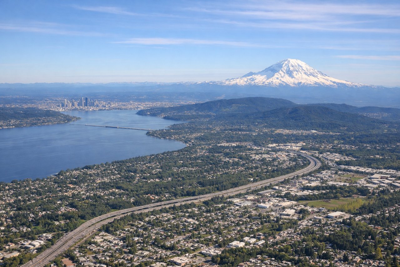
Takeoff from SEA
LEFTDeparting SEA southbound on runway 34, the climb-out puts Mount Rainier's massive glaciated summit directly on the left horizon, with the Cascade foothills stretching south. The right side only shows Puget Sound and the Olympic Mountains fading behind as the plane turns south.
Landing at MFR
LEFTOn approach into MFR, the descent through the Rogue Valley reveals Mount Shasta's isolated volcanic cone to the south-left and the forested Cascade-Siskiyou range framing the valley on the left side. The right side shows only the lower Siskiyou foothills and the Rogue Valley floor.
Will your flight be in sunlight?
Pick a date and time in the Sun Map to watch the sun move across your whole flight.
About This Route
Which side of the plane should I sit on flying from Seattle Tacoma International (SEA) to Rogue Valley International-Medford Airport (MFR)?
Sit on the Left side of the plane for the best views on flights from Seattle to Medford. The left side delivers a near-continuous Cascade volcano show — Rainier at takeoff and Shasta near landing — with forested mountain terrain visible for most of the flight, while the right side offers only farmland, coastal foothills, and less distinctive scenery.
What can I see during takeoff from Seattle Tacoma International in Seattle?
During takeoff from Seattle Tacoma International (SEA), sit on the Left side for the best views. Departing SEA southbound on runway 34, the climb-out puts Mount Rainier's massive glaciated summit directly on the left horizon, with the Cascade foothills stretching south. The right side only shows Puget Sound and the Olympic Mountains fading behind as the plane turns south. Notable sights include: Mount Rainier, Cascade foothills, Puget Sound (fading right).
What can I see when landing at Rogue Valley International-Medford Airport in Medford?
When landing at Rogue Valley International-Medford Airport (MFR), sit on the Left side for the best views. On approach into MFR, the descent through the Rogue Valley reveals Mount Shasta's isolated volcanic cone to the south-left and the forested Cascade-Siskiyou range framing the valley on the left side. The right side shows only the lower Siskiyou foothills and the Rogue Valley floor. Notable sights include: Mount Shasta, Cascade-Siskiyou range, Rogue Valley farmland.
How long is the flight from Seattle to Medford?
The flight from Seattle Tacoma International (SEA) to Rogue Valley International-Medford Airport (MFR) takes about 1 hour 15 minutes. The shortest flight path between them is 352 miles (566 km); winds and air traffic control usually add a few percent.
What does the Seattle to Medford flight path pass over?
Cascade Range peaks including Mount St Helens and Mount Adams may be visible to the left/east depending on routing, with the Willamette Valley farmland below