Seattle to Omaha is 1,364 miles (2,195 km), a flight of about 3 hours 15 minutes.
The left side delivers the most dramatic scenery at both ends of the flight — Mount Rainier and the Cascades on departure, and the Missouri River valley on approach into Omaha. The right side offers some Cascade views but misses Rainier's best angle and gets a less interesting Iowa farmland perspective on landing.
Flight Path
The flight crosses the Columbia Plateau and high desert of eastern Washington, then the Rocky Mountain foothills and the wide plains of southern Idaho and Wyoming. Over Montana and Wyoming the terrain transitions to the Great Plains, with the Bighorn Mountains visible to the north as a distant ridgeline. The flight then crosses the flat agricultural expanse of Nebraska, with the Platte River valley visible as a broad shallow corridor running east-west below.
Great circle distance and headings ›
.jpg?width=600)

Phase by phase
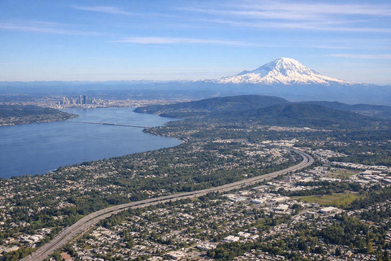
Takeoff from SEA
LEFTSEA typically departs south on runway 16L/16R, then turns east toward Omaha. A left-side seat captures the Cascade Range including Mount Rainier as the aircraft climbs and banks eastward. The left side also gives you a clear look back at Puget Sound and the Seattle skyline during the initial climb.
Landing at OMA
LEFTEppley Airfield sits on the east bank of the Missouri River, and aircraft typically approach from the west on runway 14R/14L or from the northwest. A left-side seat on approach gives a clear view of the Missouri River valley, the Omaha downtown skyline, and the broad agricultural grid of eastern Nebraska and western Iowa spreading out below.
Landmarks on this routeAll landmarks →
Will your flight be in sunlight?
Pick a date and time in the Sun Map to watch the sun move across your whole flight.
About This Route
Which side of the plane should I sit on flying from Seattle Tacoma International (SEA) to Eppley Afld (OMA)?
Sit on the Left side of the plane for the best views on flights from Seattle to Omaha. The left side delivers the most dramatic scenery at both ends of the flight — Mount Rainier and the Cascades on departure, and the Missouri River valley on approach into Omaha. The right side offers some Cascade views but misses Rainier's best angle and gets a less interesting Iowa farmland perspective on landing.
What can I see during takeoff from Seattle Tacoma International in Seattle?
During takeoff from Seattle Tacoma International (SEA), sit on the Left side for the best views. SEA typically departs south on runway 16L/16R, then turns east toward Omaha. A left-side seat captures the Cascade Range including Mount Rainier as the aircraft climbs and banks eastward. The left side also gives you a clear look back at Puget Sound and the Seattle skyline during the initial climb. Notable sights include: Mount Rainier (dominant volcanic peak to the southeast), Puget Sound (water body to the west during climb), Seattle city center and Lake Washington, Cascade Range ridgeline stretching north-south.
What can I see when landing at Eppley Afld in Omaha?
When landing at Eppley Afld (OMA), sit on the Left side for the best views. Eppley Airfield sits on the east bank of the Missouri River, and aircraft typically approach from the west on runway 14R/14L or from the northwest. A left-side seat on approach gives a clear view of the Missouri River valley, the Omaha downtown skyline, and the broad agricultural grid of eastern Nebraska and western Iowa spreading out below. Notable sights include: Missouri River (wide brown river forming the Nebraska-Iowa border), Omaha downtown skyline (visible to the northwest on approach), Platte River confluence region to the south, Iowa farmland grid stretching east.
How long is the flight from Seattle to Omaha?
The flight from Seattle Tacoma International (SEA) to Eppley Afld (OMA) takes about 3 hours 15 minutes. The shortest flight path between them is 1,364 miles (2,195 km); winds and air traffic control usually add a few percent.
What does the Seattle to Omaha flight path pass over?
The flight crosses the Columbia Plateau and high desert of eastern Washington, then the Rocky Mountain foothills and the wide plains of southern Idaho and Wyoming. Over Montana and Wyoming the terrain transitions to the Great Plains, with the Bighorn Mountains visible to the north as a distant ridgeline. The flight then crosses the flat agricultural expanse of Nebraska, with the Platte River valley visible as a broad shallow corridor running east-west below.