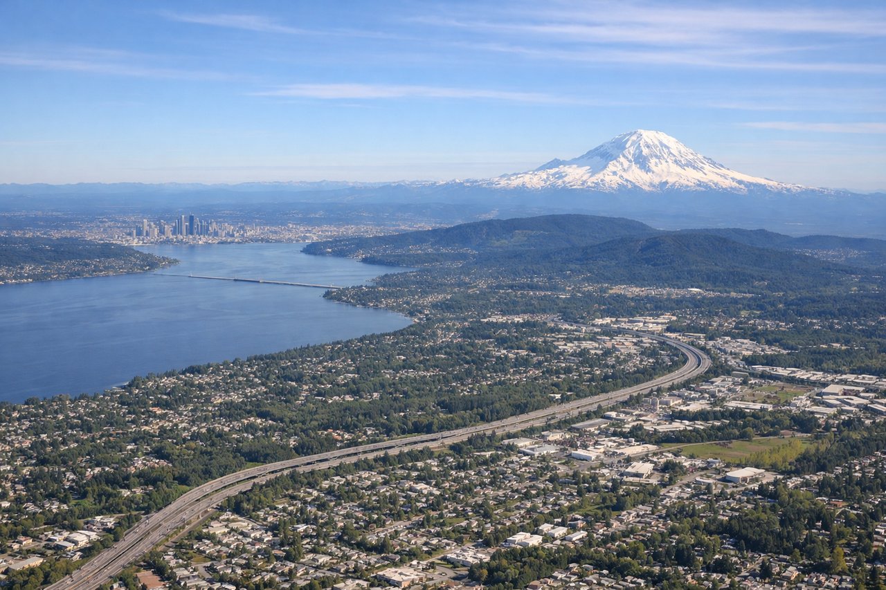
The left side delivers the most dramatic single moment of the flight — Mount Rainier and the Cascades on departure — plus decent views of the northern Rockies crossing and the Great Lakes region in the distance. The right side landing view over Pittsburgh is excellent but briefer. Left wins on total scenic value across the full flight.
Flown SEA to PIT? Did we get it right?
Flight Path
Seattle to Pittsburgh is 2,119 miles (3,411 km), a flight of about 4 hours 30 minutes.
After crossing the Cascades, the flight tracks over the Columbia Plateau and northern Idaho, then across the northern Rocky Mountains with visible river valleys and ridgelines. Over Montana and Wyoming the terrain flattens into the high plains. Crossing South Dakota and Minnesota the landscape becomes agricultural flatland. Over Ohio and western Pennsylvania the Allegheny Plateau's forested rolling hills become visible before descent into Pittsburgh.
Great circle distance and headings ›


Phase by phase
Takeoff from SEA
LEFTSEA primarily uses runways 16L/16R for southbound departures, meaning a left-side seat faces east toward the Cascade Range. You get a clear view of Mount Rainier dominating the skyline, with the Seattle skyline and Elliott Bay visible during the initial climb before the turn eastward.
Landing at PIT
RIGHTPittsburgh International sits west of the city, and aircraft typically approach from the west on runway 28R/28L heading east. A right-side seat during approach gives you the view to the south and southeast, where the dramatic confluence of the Allegheny, Monongahela, and Ohio Rivers at Pittsburgh's Point is visible, along with the downtown Golden Triangle skyline.
Will your flight be in sunlight?
Pick a date and time in the Sun Map to watch the sun move across your whole flight.
About This Route
Which side of the plane should I sit on flying from Seattle Tacoma International (SEA) to Pittsburgh International (PIT)?
Sit on the Left side of the plane for the best views on flights from Seattle to Pittsburgh. The left side delivers the most dramatic single moment of the flight — Mount Rainier and the Cascades on departure — plus decent views of the northern Rockies crossing and the Great Lakes region in the distance. The right side landing view over Pittsburgh is excellent but briefer. Left wins on total scenic value across the full flight.
What can I see during takeoff from Seattle Tacoma International in Seattle?
During takeoff from Seattle Tacoma International (SEA), sit on the Left side for the best views. SEA primarily uses runways 16L/16R for southbound departures, meaning a left-side seat faces east toward the Cascade Range. You get a clear view of Mount Rainier dominating the skyline, with the Seattle skyline and Elliott Bay visible during the initial climb before the turn eastward. Notable sights include: Mount Rainier, Elliott Bay and Seattle skyline, Lake Washington, Cascade Range foothills.
What can I see when landing at Pittsburgh International in Pittsburgh?
When landing at Pittsburgh International (PIT), sit on the Right side for the best views. Pittsburgh International sits west of the city, and aircraft typically approach from the west on runway 28R/28L heading east. A right-side seat during approach gives you the view to the south and southeast, where the dramatic confluence of the Allegheny, Monongahela, and Ohio Rivers at Pittsburgh's Point is visible, along with the downtown Golden Triangle skyline. Notable sights include: Pittsburgh downtown Golden Triangle, confluence of Allegheny and Monongahela Rivers forming the Ohio River, Monongahela River valley, Allegheny River valley.
How long is the flight from Seattle to Pittsburgh?
The flight from Seattle Tacoma International (SEA) to Pittsburgh International (PIT) takes about 4 hours 30 minutes. The shortest flight path between them is 2,119 miles (3,411 km); winds and air traffic control usually add a few percent.
What does the Seattle to Pittsburgh flight path pass over?
After crossing the Cascades, the flight tracks over the Columbia Plateau and northern Idaho, then across the northern Rocky Mountains with visible river valleys and ridgelines. Over Montana and Wyoming the terrain flattens into the high plains. Crossing South Dakota and Minnesota the landscape becomes agricultural flatland. Over Ohio and western Pennsylvania the Allegheny Plateau's forested rolling hills become visible before descent into Pittsburgh.