While Seattle's departure is scenic, the right side wins overall because the landing approach into Taichung provides sustained dramatic scenery: the Taiwan Strait crossing, the striking contrast between ocean and mountainous terrain, and the Central Mountain Range backdrop create more visual variety and landmark density than the predominantly ocean-based cruise segment. The left side suffers from 10+ hours of open Pacific Ocean with minimal features, whereas the right side benefits from a visually rich approach sequence.
Flown SEA to RMQ? Did we get it right?
Flight Path
Seattle to Taichung is 6,131 miles (9,866 km), a flight of about 11 hours 15 minutes.
North Pacific Ocean (open water dominates 70% of cruise); Aleutian Islands region passes to the north (not directly visible on typical routing); International Date Line crossing; gradual transition from temperate to subtropical air masses; no significant terrain features visible during mid-cruise; approach to Taiwan begins with Luzon Strait and Philippine Sea, then Taiwan's dramatic east coast (if visible on descent routing) or western coastal approach depending on final approach vector
Great circle distance and headings ›Phase by phase
Takeoff from SEA
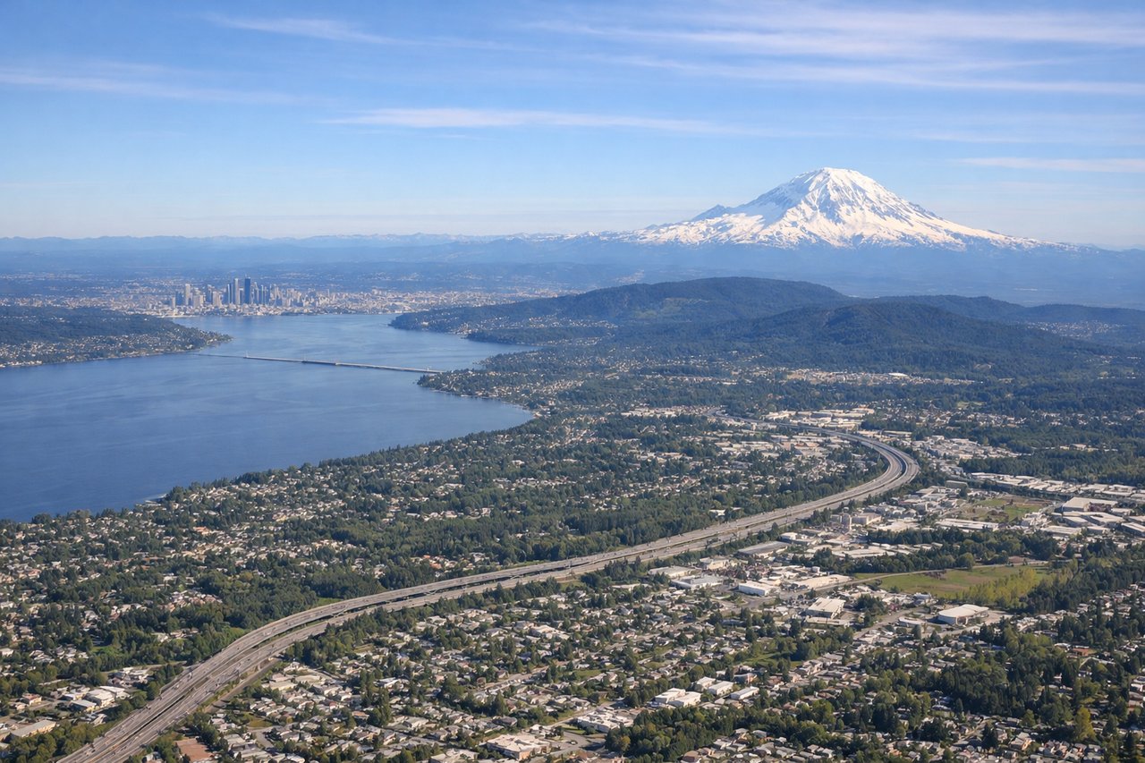
LEFTSeattle departure offers immediate Puget Sound views and the Cascade Range to the east. The left side captures the urban waterfront, Elliott Bay, and snow-capped Mount Rainier during climb-out, providing dramatic terrain contrast within the first 15 minutes.
Landing at RMQ
RIGHTThe right side during approach to Taichung captures the Taiwan Strait coastline, the western coastal plain, and the Central Mountain Range backdrop. Descent into Taichung reveals the dramatic transition from ocean to agricultural lowlands and urban development, with the high peaks of Taiwan's interior visible inland.
Will your flight be in sunlight?
Pick a date and time in the Sun Map to watch the sun move across your whole flight.
About This Route
Which side of the plane should I sit on flying from Seattle Tacoma International (SEA) to Taichung International Airport / Ching Chuang Kang Air Base (RMQ)?
Sit on the Right side of the plane for the best views on flights from Seattle to Taichung. While Seattle's departure is scenic, the right side wins overall because the landing approach into Taichung provides sustained dramatic scenery: the Taiwan Strait crossing, the striking contrast between ocean and mountainous terrain, and the Central Mountain Range backdrop create more visual variety and landmark density than the predominantly ocean-based cruise segment. The left side suffers from 10+ hours of open Pacific Ocean with minimal features, whereas the right side benefits from a visually rich approach sequence.
What can I see during takeoff from Seattle Tacoma International in Seattle?
During takeoff from Seattle Tacoma International (SEA), sit on the Left side for the best views. Seattle departure offers immediate Puget Sound views and the Cascade Range to the east. The left side captures the urban waterfront, Elliott Bay, and snow-capped Mount Rainier during climb-out, providing dramatic terrain contrast within the first 15 minutes. Notable sights include: Mount Rainier (14,411 ft, visible southeast), Puget Sound and Elliott Bay (urban water features), Cascade Range foothills, Seattle-Tacoma urban sprawl.
What can I see when landing at Taichung International Airport / Ching Chuang Kang Air Base in Taichung?
When landing at Taichung International Airport / Ching Chuang Kang Air Base (RMQ), sit on the Right side for the best views. The right side during approach to Taichung captures the Taiwan Strait coastline, the western coastal plain, and the Central Mountain Range backdrop. Descent into Taichung reveals the dramatic transition from ocean to agricultural lowlands and urban development, with the high peaks of Taiwan's interior visible inland. Notable sights include: Taiwan Strait (western approach), Taichung Harbor and coastal industrial zones, Central Mountain Range (Yushan massif visible inland), agricultural plains of central Taiwan.
How long is the flight from Seattle to Taichung?
The flight from Seattle Tacoma International (SEA) to Taichung International Airport / Ching Chuang Kang Air Base (RMQ) takes about 11 hours 15 minutes. The shortest flight path between them is 6,131 miles (9,866 km); winds and air traffic control usually add a few percent.
What does the Seattle to Taichung flight path pass over?
North Pacific Ocean (open water dominates 70% of cruise); Aleutian Islands region passes to the north (not directly visible on typical routing); International Date Line crossing; gradual transition from temperate to subtropical air masses; no significant terrain features visible during mid-cruise; approach to Taiwan begins with Luzon Strait and Philippine Sea, then Taiwan's dramatic east coast (if visible on descent routing) or western coastal approach depending on final approach vector