The east-facing left side wins because it captures Mount Rainier on departure and the Sierra Nevada foothills on arrival, bracketing the flight with real topographic interest, while the right side is dominated by flat agricultural land and open water with little variation.
Flown SEA to SAC? Did we get it right?
Flight Path
Seattle to Sacramento is 619 miles (996 km), a flight of about 1 hour 55 minutes.
Cascade Range volcanoes (Mount St Helens, Mount Hood, Mount Shasta visible in the distance), Klamath Mountains, upper Sacramento Valley
Great circle distance and headings ›


Phase by phase
Takeoff from SEA
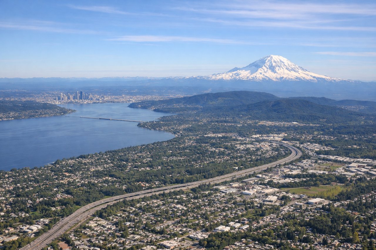
LEFTDeparting SEA southbound, the left (east) side offers a dramatic view of Mount Rainier's glaciated summit rising above the foothills, a classic sight for southbound flights out of Seattle. The right side mostly shows Puget Sound and the flat Kitsap Peninsula, which is pleasant but less dramatic.
Landing at SAC
LEFTOn approach into Sacramento Executive from the north, the left side gives passengers a view toward the distant Sierra Nevada foothills and the Sacramento River winding through the valley, while the right side faces the flatter Coast Range and Central Valley farmland with less relief.
Will your flight be in sunlight?
Pick a date and time in the Sun Map to watch the sun move across your whole flight.
About This Route
Which side of the plane should I sit on flying from Seattle Tacoma International (SEA) to Sacramento Executive (SAC)?
Sit on the Left side of the plane for the best views on flights from Seattle to Sacramento. The east-facing left side wins because it captures Mount Rainier on departure and the Sierra Nevada foothills on arrival, bracketing the flight with real topographic interest, while the right side is dominated by flat agricultural land and open water with little variation.
What can I see during takeoff from Seattle Tacoma International in Seattle?
During takeoff from Seattle Tacoma International (SEA), sit on the Left side for the best views. Departing SEA southbound, the left (east) side offers a dramatic view of Mount Rainier's glaciated summit rising above the foothills, a classic sight for southbound flights out of Seattle. The right side mostly shows Puget Sound and the flat Kitsap Peninsula, which is pleasant but less dramatic. Notable sights include: Mount Rainier, Puget Sound (right), Seattle skyline, Cascade foothills.
What can I see when landing at Sacramento Executive in Sacramento?
When landing at Sacramento Executive (SAC), sit on the Left side for the best views. On approach into Sacramento Executive from the north, the left side gives passengers a view toward the distant Sierra Nevada foothills and the Sacramento River winding through the valley, while the right side faces the flatter Coast Range and Central Valley farmland with less relief. Notable sights include: Sacramento River, Sierra Nevada foothills (distant), Sacramento city grid, Sutter Buttes.
How long is the flight from Seattle to Sacramento?
The flight from Seattle Tacoma International (SEA) to Sacramento Executive (SAC) takes about 1 hour 55 minutes. The shortest flight path between them is 619 miles (996 km); winds and air traffic control usually add a few percent.
What does the Seattle to Sacramento flight path pass over?
Cascade Range volcanoes (Mount St Helens, Mount Hood, Mount Shasta visible in the distance), Klamath Mountains, upper Sacramento Valley