Left side wins both departure and arrival. During the flight, the left side also faces generally south and southeast, which on this roughly east-northeast routing keeps the Canadian Rockies and then the prairies in view during the first half, and the Great Lakes region during the descent.
Flown SEA to YTZ? Did we get it right?
Flight Path
Seattle to Toronto is 2,067 miles (3,326 km), a flight of about 4 hours 30 minutes.
The flight crosses the Canadian Rockies over Alberta, then the flat agricultural prairies of Saskatchewan and Manitoba, followed by the boreal forest of northern Ontario, and finally the northern shore of Lake Superior and Lake Huron before descending toward Lake Ontario and Toronto
Great circle distance and headings ›


Phase by phase
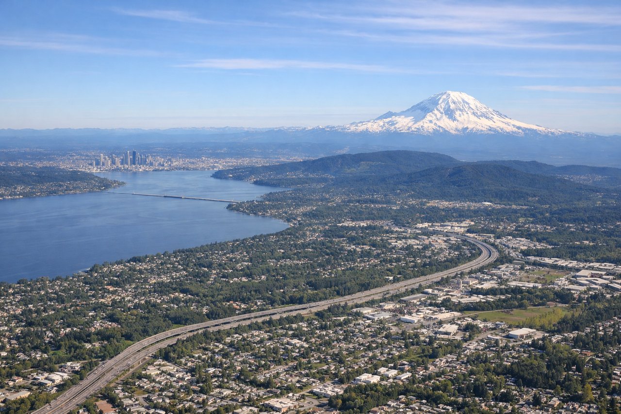
Takeoff from SEA
LEFTSEA typically departs north on runways 16L/16R (heading roughly 340 degrees) or south on 34L/34R. On a northbound departure toward Toronto, aircraft often turn east, putting the left side facing north and then northeast toward the Cascades. The left side gets Mount Rainier to the southeast and the Olympic Peninsula across Puget Sound during the initial climb and turn.
Landing at YTZ
LEFTBilly Bishop Toronto City Centre Airport (YTZ) sits on the Toronto Islands in Lake Ontario, and aircraft typically approach from the west or southwest over the lake. A left-side seat on approach gives a direct view of the Toronto downtown skyline including the CN Tower, with Lake Ontario spread out below.
Will your flight be in sunlight?
Pick a date and time in the Sun Map to watch the sun move across your whole flight.
About This Route
Which side of the plane should I sit on flying from Seattle Tacoma International (SEA) to City Centre (YTZ)?
Sit on the Left side of the plane for the best views on flights from Seattle to Toronto. Left side wins both departure and arrival. During the flight, the left side also faces generally south and southeast, which on this roughly east-northeast routing keeps the Canadian Rockies and then the prairies in view during the first half, and the Great Lakes region during the descent.
What can I see during takeoff from Seattle Tacoma International in Seattle?
During takeoff from Seattle Tacoma International (SEA), sit on the Left side for the best views. SEA typically departs north on runways 16L/16R (heading roughly 340 degrees) or south on 34L/34R. On a northbound departure toward Toronto, aircraft often turn east, putting the left side facing north and then northeast toward the Cascades. The left side gets Mount Rainier to the southeast and the Olympic Peninsula across Puget Sound during the initial climb and turn. Notable sights include: Mount Rainier to the southeast, Puget Sound directly below and to the west, the Olympic Mountains across the sound, Lake Washington to the northeast.
What can I see when landing at City Centre in Toronto?
When landing at City Centre (YTZ), sit on the Left side for the best views. Billy Bishop Toronto City Centre Airport (YTZ) sits on the Toronto Islands in Lake Ontario, and aircraft typically approach from the west or southwest over the lake. A left-side seat on approach gives a direct view of the Toronto downtown skyline including the CN Tower, with Lake Ontario spread out below. Notable sights include: CN Tower and downtown Toronto skyline, Toronto Islands and the harbour, Lake Ontario, the Gardiner Expressway waterfront corridor.
How long is the flight from Seattle to Toronto?
The flight from Seattle Tacoma International (SEA) to City Centre (YTZ) takes about 4 hours 30 minutes. The shortest flight path between them is 2,067 miles (3,326 km); winds and air traffic control usually add a few percent.
What does the Seattle to Toronto flight path pass over?
The flight crosses the Canadian Rockies over Alberta, then the flat agricultural prairies of Saskatchewan and Manitoba, followed by the boreal forest of northern Ontario, and finally the northern shore of Lake Superior and Lake Huron before descending toward Lake Ontario and Toronto