San Francisco to Santa Fe is 912 miles (1,469 km), a flight of about 2 hours 15 minutes.
Left side wins both ends of the flight. During the cruise over Nevada and Arizona, the left side also tracks closer to the Colorado Plateau features including the Grand Canyon region on the southern horizon, making it the stronger choice throughout the entire route.
Flight Path
The route crosses the Sierra Nevada east of Fresno, then tracks over the Nevada desert basin-and-range terrain, crosses into Arizona over the Mojave transition zone, passes north of the Grand Canyon region and the Colorado Plateau, crosses the Painted Desert and the high mesas of the Navajo Nation, then descends over the Jemez Plateau and Rio Grande valley into Santa Fe.
Great circle distance and headings ›


.jpeg?width=600)
.jpg?width=600)
.jpg?width=600)
Phase by phase
Takeoff from SFO
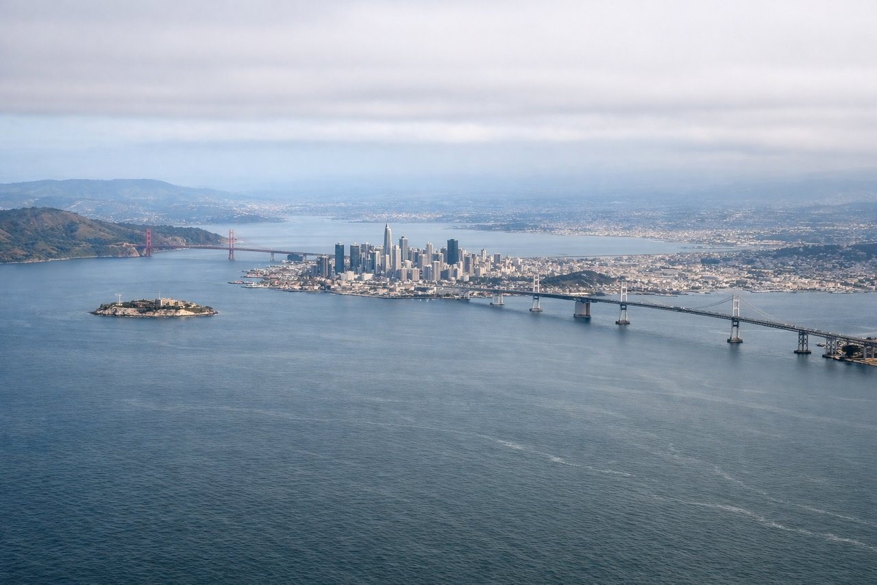
LEFTSFO's primary departure runways (28L/28R) head west over the bay before turning. A left seat gives you San Francisco Bay, the city skyline, and the Bay Bridge as you climb out and bank southeast. The right side faces the peninsula suburbs with less visual interest.
Landing at SAF
LEFTSanta Fe Municipal typically uses runway 20 for arrivals from the north, meaning the aircraft approaches from the north-northwest heading south. A left seat faces east toward the Sangre de Cristo Mountains, which rise dramatically above the high desert plateau directly beside the approach path. The right side looks west over flat scrubland.
Landmarks on this routeAll landmarks →
Will your flight be in sunlight?
Pick a date and time in the Sun Map to watch the sun move across your whole flight.
About This Route
Which side of the plane should I sit on flying from San Francisco International (SFO) to Santa Fe Muni (SAF)?
Sit on the Left side of the plane for the best views on flights from San Francisco to Santa Fe. Left side wins both ends of the flight. During the cruise over Nevada and Arizona, the left side also tracks closer to the Colorado Plateau features including the Grand Canyon region on the southern horizon, making it the stronger choice throughout the entire route.
What can I see during takeoff from San Francisco International in San Francisco?
During takeoff from San Francisco International (SFO), sit on the Left side for the best views. SFO's primary departure runways (28L/28R) head west over the bay before turning. A left seat gives you San Francisco Bay, the city skyline, and the Bay Bridge as you climb out and bank southeast. The right side faces the peninsula suburbs with less visual interest. Notable sights include: San Francisco Bay, Bay Bridge, San Francisco city skyline, San Mateo Bridge.
What can I see when landing at Santa Fe Muni in Santa Fe?
When landing at Santa Fe Muni (SAF), sit on the Left side for the best views. Santa Fe Municipal typically uses runway 20 for arrivals from the north, meaning the aircraft approaches from the north-northwest heading south. A left seat faces east toward the Sangre de Cristo Mountains, which rise dramatically above the high desert plateau directly beside the approach path. The right side looks west over flat scrubland. Notable sights include: Sangre de Cristo Mountains, Santa Fe city grid, Jemez Mountains (distant, west), Rio Grande valley.
How long is the flight from San Francisco to Santa Fe?
The flight from San Francisco International (SFO) to Santa Fe Muni (SAF) takes about 2 hours 15 minutes. The shortest flight path between them is 912 miles (1,469 km); winds and air traffic control usually add a few percent.
What does the San Francisco to Santa Fe flight path pass over?
The route crosses the Sierra Nevada east of Fresno, then tracks over the Nevada desert basin-and-range terrain, crosses into Arizona over the Mojave transition zone, passes north of the Grand Canyon region and the Colorado Plateau, crosses the Painted Desert and the high mesas of the Navajo Nation, then descends over the Jemez Plateau and Rio Grande valley into Santa Fe.