While takeoff favors the right for Shanghai's urban geography, the landing view from the left—Moreton Bay's islands and Brisbane River's dramatic loops—is more visually distinctive and memorable. The left side captures the defining geographic feature of Brisbane's location.
Flight Path
The flight path crosses the Coral Sea at altitude. Notable waypoints include passing east of the Great Barrier Reef (not visible at cruise altitude but geographically significant to the route), the Coral Sea's open water (featureless at 35,000 feet), and approach to the Queensland coast near Gladstone or Rockhampton before descending toward Brisbane. The Mackay region and Whitsunday Islands lie south of the typical flight corridor. At cruise altitude, the view is predominantly open ocean with occasional cloud formations; no major landmarks are visible for the 6+ hours of oceanic flight.
Great circle distance and headings ›.jpg?width=600)


Phase by phase
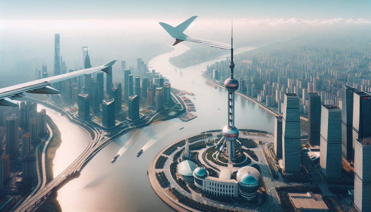
Takeoff from SHA
RIGHTRight-side seats capture the Huangpu River bend and Pudong's skyline during the initial climb. Hongqiao typically departs runway 06 (northeast) or 09 (east), and right-side views show the urban sprawl and water features that define Shanghai's geography during the first 5-10 minutes of flight.
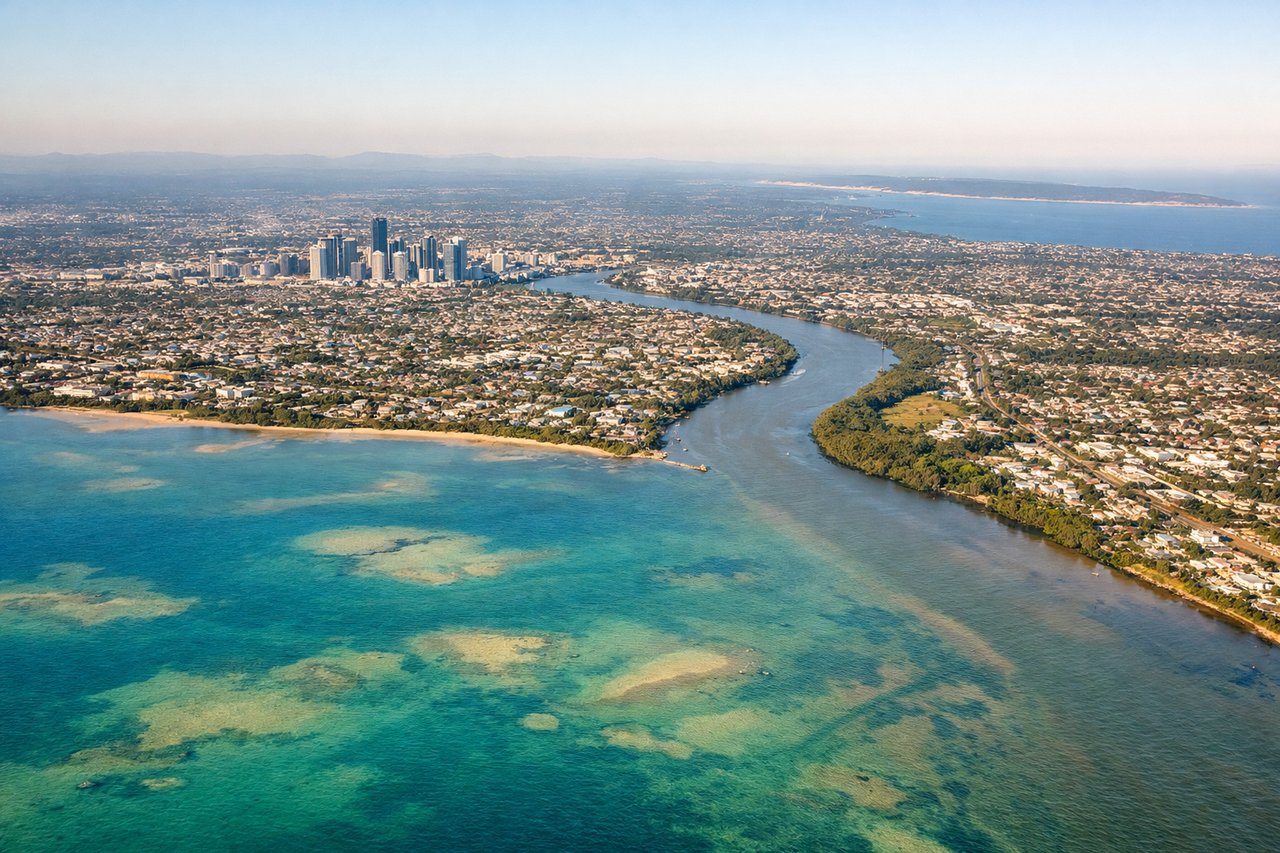
Landing at BNE
LEFTLeft-side seats offer views of Moreton Bay's islands and the Brisbane River's distinctive loops during descent. Brisbane typically lands runway 01 (north) or 10 (east), and left-side views during approach show the bay's geography and the river's serpentine path through the city, which is the defining feature of Brisbane's setting.
Landmarks on this routeAll landmarks →
Will your flight be in sunlight?
See exactly which side of the plane gets sun and shade at your departure time.
About This Route
Which side of the plane should I sit on flying from Hongqiao International (SHA) to Brisbane International (BNE)?
Sit on the Left side of the plane for the best views on flights from Shanghai to Brisbane. While takeoff favors the right for Shanghai's urban geography, the landing view from the left—Moreton Bay's islands and Brisbane River's dramatic loops—is more visually distinctive and memorable. The left side captures the defining geographic feature of Brisbane's location.
What can I see during takeoff from Hongqiao International in Shanghai?
During takeoff from Hongqiao International (SHA), sit on the Right side for the best views. Right-side seats capture the Huangpu River bend and Pudong's skyline during the initial climb. Hongqiao typically departs runway 06 (northeast) or 09 (east), and right-side views show the urban sprawl and water features that define Shanghai's geography during the first 5-10 minutes of flight. Notable sights include: Huangpu River (distinctive S-curve through the city), Pudong financial district skyline, Suzhou Creek confluence, Yangtze River estuary to the northeast.
What can I see when landing at Brisbane International in Brisbane?
When landing at Brisbane International (BNE), sit on the Left side for the best views. Left-side seats offer views of Moreton Bay's islands and the Brisbane River's distinctive loops during descent. Brisbane typically lands runway 01 (north) or 10 (east), and left-side views during approach show the bay's geography and the river's serpentine path through the city, which is the defining feature of Brisbane's setting. Notable sights include: Moreton Bay (with North Stradbroke Island and Moreton Island visible as dark landmasses), Brisbane River's multiple loops and oxbow bends, South Bank Parklands area, Bremer River confluence.
How long is the flight from Shanghai to Brisbane?
The flight from Hongqiao International (SHA) to Brisbane International (BNE) takes Approximately 7.5 to 8.5 hours.
What does the Shanghai to Brisbane flight path pass over?
The flight path crosses the Coral Sea at altitude. Notable waypoints include passing east of the Great Barrier Reef (not visible at cruise altitude but geographically significant to the route), the Coral Sea's open water (featureless at 35,000 feet), and approach to the Queensland coast near Gladstone or Rockhampton before descending toward Brisbane. The Mackay region and Whitsunday Islands lie south of the typical flight corridor. At cruise altitude, the view is predominantly open ocean with occasional cloud formations; no major landmarks are visible for the 6+ hours of oceanic flight.