Right side scores 3.5 versus left's 2.5 due to superior scenery on both ends of the flight. Takeoff offers Shanghai's iconic river and skyline; cruise crosses the Tibetan Plateau and Central Asian mountains (visible from both sides but slightly better from right); landing provides the dramatic Nile valley and Cairo approach. Left side faces inland terrain with less visual drama throughout.
Flight Path
Tibetan Plateau with snow-capped peaks (Kunlun Mountains visible around 6-7 hours into flight), Taklamakan Desert, Hindu Kush and Pamir mountain ranges, Caspian Sea, Caucasus Mountains, Mesopotamian plains approaching Cairo
Great circle distance and headings ›
.jpg?width=600)
.jpg?width=600)


.JPG?width=600)
.jpg?width=600)


Phase by phase

Takeoff from SHA
RIGHTRight side captures Shanghai's Huangpu River and Pudong skyline during initial climb, with the Yangtze River estuary visible as the aircraft turns westward. Left side faces inland toward flat Jiangsu Province with minimal visual interest.
Landing at CAI
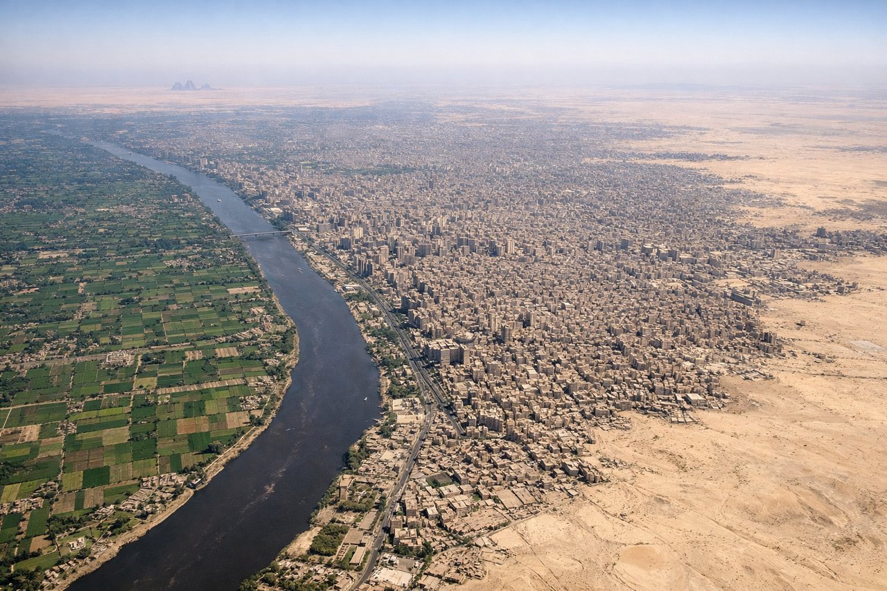
RIGHTRight side offers the most dramatic approach into Cairo: the Nile River valley becomes increasingly visible during descent, with the river's distinctive green ribbon cutting through the Sahara Desert. The pyramids of Giza and Cairo's sprawling urban area are visible on approach to runways 05/23. Left side shows only desert monotony.
Landmarks on this routeAll landmarks →
Will your flight be in sunlight?
See exactly which side of the plane gets sun and shade at your departure time.
About This Route
Which side of the plane should I sit on flying from Hongqiao International (SHA) to Cairo International (CAI)?
Sit on the Right side of the plane for the best views on flights from Shanghai to Cairo. Right side scores 3.5 versus left's 2.5 due to superior scenery on both ends of the flight. Takeoff offers Shanghai's iconic river and skyline; cruise crosses the Tibetan Plateau and Central Asian mountains (visible from both sides but slightly better from right); landing provides the dramatic Nile valley and Cairo approach. Left side faces inland terrain with less visual drama throughout.
What can I see during takeoff from Hongqiao International in Shanghai?
During takeoff from Hongqiao International (SHA), sit on the Right side for the best views. Right side captures Shanghai's Huangpu River and Pudong skyline during initial climb, with the Yangtze River estuary visible as the aircraft turns westward. Left side faces inland toward flat Jiangsu Province with minimal visual interest. Notable sights include: Huangpu River with Bund waterfront, Pudong financial district towers, Yangtze River estuary mudflats.
What can I see when landing at Cairo International in Cairo?
When landing at Cairo International (CAI), sit on the Right side for the best views. Right side offers the most dramatic approach into Cairo: the Nile River valley becomes increasingly visible during descent, with the river's distinctive green ribbon cutting through the Sahara Desert. The pyramids of Giza and Cairo's sprawling urban area are visible on approach to runways 05/23. Left side shows only desert monotony. Notable sights include: Nile River valley with green agricultural strip, Cairo metropolitan area sprawl, Giza plateau with pyramids, Sahara Desert surrounding the river.
How long is the flight from Shanghai to Cairo?
The flight from Hongqiao International (SHA) to Cairo International (CAI) takes 11h 15m.
What does the Shanghai to Cairo flight path pass over?
Tibetan Plateau with snow-capped peaks (Kunlun Mountains visible around 6-7 hours into flight), Taklamakan Desert, Hindu Kush and Pamir mountain ranges, Caspian Sea, Caucasus Mountains, Mesopotamian plains approaching Cairo