San Juan to Denver is 2,726 miles (4,387 km), a flight of about 5 hours 15 minutes.
While takeoff offers coastal scenery, the landing approach into Denver provides more dramatic and visually distinctive mountain views. The Colorado Front Range is one of the most striking geographic features on this route and dominates the final descent phase.
Flight Path
The flight path crosses the Gulf of Mexico (visible as open water for roughly 1.5 hours after takeoff), then the Texas coastline near Corpus Christi or Galveston, followed by the flat terrain of central Texas and Oklahoma. The Wichita Mountains in southwestern Oklahoma may be visible as low ridges. As you approach Colorado, the Texas Panhandle and New Mexico high plains appear as increasingly elevated terrain, with the Sangre de Cristo Range and Spanish Peaks visible on the left (south) side before the final approach to Denver's Front Range.
Great circle distance and headings ›
.jpg?width=600)
Phase by phase
Takeoff from SIG
RIGHTRight-side seats offer views of the Atlantic coastline and the northern Puerto Rico shore as the aircraft climbs westward. You'll see the irregular rocky coastline and turquoise waters that characterize the northeastern coast of the island.
Landing at DEN
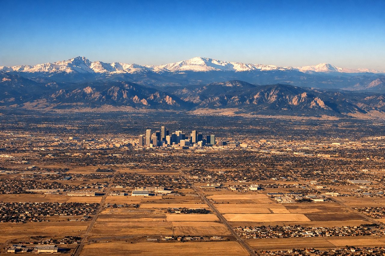
LEFTLeft-side seats provide excellent views of the Colorado Front Range and the Rocky Mountains during descent into Denver. The dramatic eastern escarpment of the Rockies is clearly visible as the aircraft approaches from the east, with the peaks becoming more defined as you descend.
Landmarks on this routeAll landmarks →
Will your flight be in sunlight?
Pick a date and time in the Sun Map to watch the sun move across your whole flight.
About This Route
Which side of the plane should I sit on flying from Fernando Luis Ribas Dominicci (SIG) to Denver International (DEN)?
Sit on the Left side of the plane for the best views on flights from San Juan to Denver. While takeoff offers coastal scenery, the landing approach into Denver provides more dramatic and visually distinctive mountain views. The Colorado Front Range is one of the most striking geographic features on this route and dominates the final descent phase.
What can I see during takeoff from Fernando Luis Ribas Dominicci in San Juan?
During takeoff from Fernando Luis Ribas Dominicci (SIG), sit on the Right side for the best views. Right-side seats offer views of the Atlantic coastline and the northern Puerto Rico shore as the aircraft climbs westward. You'll see the irregular rocky coastline and turquoise waters that characterize the northeastern coast of the island. Notable sights include: Atlantic Ocean, Puerto Rico's northern coastline, El Yunque National Forest (visible as dense green terrain inland), San Juan metropolitan area receding below.
What can I see when landing at Denver International in Denver?
When landing at Denver International (DEN), sit on the Left side for the best views. Left-side seats provide excellent views of the Colorado Front Range and the Rocky Mountains during descent into Denver. The dramatic eastern escarpment of the Rockies is clearly visible as the aircraft approaches from the east, with the peaks becoming more defined as you descend. Notable sights include: Colorado Front Range (Rocky Mountains), Denver metropolitan area sprawl, South Platte River valley, high plains of eastern Colorado.
How long is the flight from San Juan to Denver?
The flight from Fernando Luis Ribas Dominicci (SIG) to Denver International (DEN) takes about 5 hours 15 minutes. The shortest flight path between them is 2,726 miles (4,387 km); winds and air traffic control usually add a few percent.
What does the San Juan to Denver flight path pass over?
The flight path crosses the Gulf of Mexico (visible as open water for roughly 1.5 hours after takeoff), then the Texas coastline near Corpus Christi or Galveston, followed by the flat terrain of central Texas and Oklahoma. The Wichita Mountains in southwestern Oklahoma may be visible as low ridges. As you approach Colorado, the Texas Panhandle and New Mexico high plains appear as increasingly elevated terrain, with the Sangre de Cristo Range and Spanish Peaks visible on the left (south) side before the final approach to Denver's Front Range.