Right-side seats capture the most dramatic scenery: Singapore's harbor and strait during departure, then views of the Indian coastline and Western Ghats as you approach Gujarat. Left side offers the Narmada valley on descent but misses the coastal and maritime highlights of the early flight.
Flown SIN to BDQ? Did we get it right?
Flight Path
Singapore to Baroda is 2,524 miles (4,062 km), a flight of about 5 hours 25 minutes.
Arabian Sea coastline (Gujarat and Maharashtra), Western Ghats mountain range visible as a distant ridge to the east, coastal cities including Surat and Bharuch along the flight path, transition from maritime to inland agricultural landscape
Great circle distance and headings ›Phase by phase
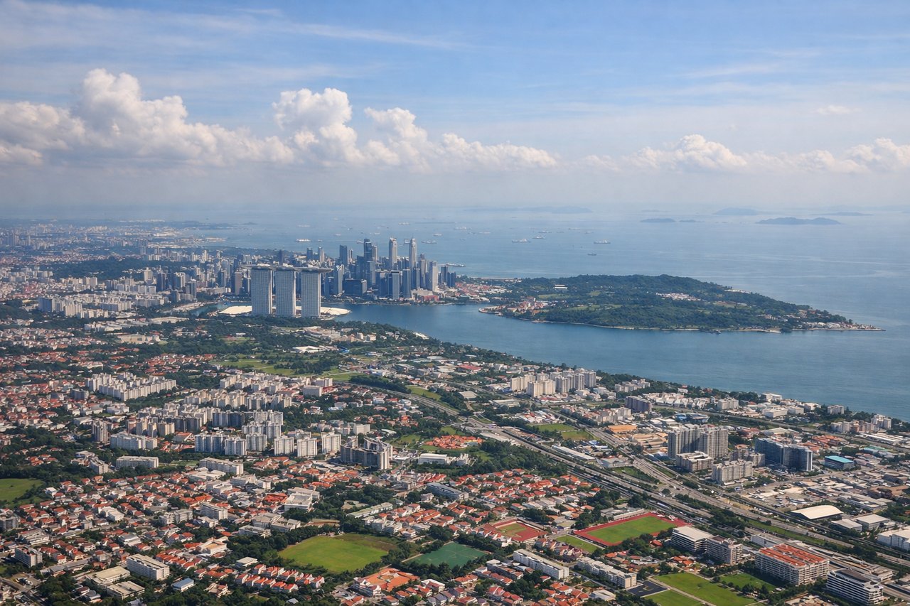
Takeoff from SIN
RIGHTRight-side seats offer views of Singapore's urban sprawl and the Strait of Malacca as the aircraft climbs northwestward. You'll see the contrast between Singapore's dense development and the surrounding water and Malaysian coastline.
Landing at BDQ
LEFTLeft-side seats provide views of the Narmada River valley and the approach to Vadodara from the south. You'll see the river's distinctive course and the surrounding agricultural plains as you descend into Gujarat.
Will your flight be in sunlight?
Pick a date and time in the Sun Map to watch the sun move across your whole flight.
About This Route
Which side of the plane should I sit on flying from Singapore Changi (SIN) to Vadodara (BDQ)?
Sit on the Right side of the plane for the best views on flights from Singapore to Baroda. Right-side seats capture the most dramatic scenery: Singapore's harbor and strait during departure, then views of the Indian coastline and Western Ghats as you approach Gujarat. Left side offers the Narmada valley on descent but misses the coastal and maritime highlights of the early flight.
What can I see during takeoff from Singapore Changi in Singapore?
During takeoff from Singapore Changi (SIN), sit on the Right side for the best views. Right-side seats offer views of Singapore's urban sprawl and the Strait of Malacca as the aircraft climbs northwestward. You'll see the contrast between Singapore's dense development and the surrounding water and Malaysian coastline. Notable sights include: Singapore city center and harbor, Strait of Malacca, Johor Bahru (Malaysia) across the strait, Malaysian peninsula coastline.
What can I see when landing at Vadodara in Baroda?
When landing at Vadodara (BDQ), sit on the Left side for the best views. Left-side seats provide views of the Narmada River valley and the approach to Vadodara from the south. You'll see the river's distinctive course and the surrounding agricultural plains as you descend into Gujarat. Notable sights include: Narmada River and valley, Gujarat plains and agricultural fields, Vadodara city and surrounding urban area, low hills to the east.
How long is the flight from Singapore to Baroda?
The flight from Singapore Changi (SIN) to Vadodara (BDQ) takes about 5 hours 25 minutes. The shortest flight path between them is 2,524 miles (4,062 km); winds and air traffic control usually add a few percent.
What does the Singapore to Baroda flight path pass over?
Arabian Sea coastline (Gujarat and Maharashtra), Western Ghats mountain range visible as a distant ridge to the east, coastal cities including Surat and Bharuch along the flight path, transition from maritime to inland agricultural landscape