Right side scores higher due to superior landing approach scenery over the northern Thai highlands and Kok River valley, which provides dramatic mountainous terrain and distinctive geographic features. While takeoff over the Strait of Malacca is comparable on both sides, the landing approach into Chiang Rai's mountain setting significantly elevates the right side's overall score.
Flown SIN to CEI? Did we get it right?
Flight Path
Singapore to Chiang Rai is 1,315 miles (2,116 km), a flight of about 3 hours 10 minutes.
Andaman Sea coastline (western Thailand), Phang Nga Bay's limestone karsts, Isthmus of Kra narrowing, transition from coastal lowlands to northern Thai highlands, Phrae and Nan provinces' river valleys
Great circle distance and headings ›Phase by phase
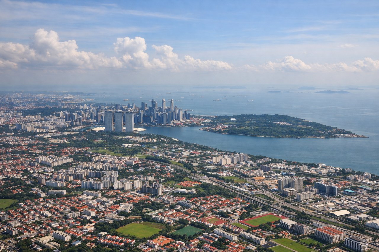
Takeoff from SIN
RIGHTRight side captures Singapore Changi's departure over the Strait of Malacca and the Malay Peninsula's western coastline, with visible urban sprawl of Singapore and Port Klang. Left side departs over the South China Sea with minimal early landmarks.
Landing at CEI
RIGHTRight side provides the superior landing approach into Mae Fah Luang-Chiang Rai, descending over the dramatic northern Thai highlands with the Kok River valley, forested mountains, and the distinctive terrain of the Golden Triangle region. Left side approaches over flatter central Thai plains with less visual drama.
Will your flight be in sunlight?
Pick a date and time in the Sun Map to watch the sun move across your whole flight.
About This Route
Which side of the plane should I sit on flying from Singapore Changi (SIN) to Mae Fah Luang - Chiang Rai International Airport (CEI)?
Sit on the Right side of the plane for the best views on flights from Singapore to Chiang Rai. Right side scores higher due to superior landing approach scenery over the northern Thai highlands and Kok River valley, which provides dramatic mountainous terrain and distinctive geographic features. While takeoff over the Strait of Malacca is comparable on both sides, the landing approach into Chiang Rai's mountain setting significantly elevates the right side's overall score.
What can I see during takeoff from Singapore Changi in Singapore?
During takeoff from Singapore Changi (SIN), sit on the Right side for the best views. Right side captures Singapore Changi's departure over the Strait of Malacca and the Malay Peninsula's western coastline, with visible urban sprawl of Singapore and Port Klang. Left side departs over the South China Sea with minimal early landmarks. Notable sights include: Singapore city grid and harbor, Port Klang (Malaysia's major port), Strait of Malacca coastline, Johor Bahru urban area.
What can I see when landing at Mae Fah Luang - Chiang Rai International Airport in Chiang Rai?
When landing at Mae Fah Luang - Chiang Rai International Airport (CEI), sit on the Right side for the best views. Right side provides the superior landing approach into Mae Fah Luang-Chiang Rai, descending over the dramatic northern Thai highlands with the Kok River valley, forested mountains, and the distinctive terrain of the Golden Triangle region. Left side approaches over flatter central Thai plains with less visual drama. Notable sights include: Kok River valley and its meandering course, northern Thai mountain ranges (part of the Luang Prabang Range), Chiang Rai city and surrounding agricultural valleys, Golden Triangle plateau terrain.
How long is the flight from Singapore to Chiang Rai?
The flight from Singapore Changi (SIN) to Mae Fah Luang - Chiang Rai International Airport (CEI) takes about 3 hours 10 minutes. The shortest flight path between them is 1,315 miles (2,116 km); winds and air traffic control usually add a few percent.
What does the Singapore to Chiang Rai flight path pass over?
Andaman Sea coastline (western Thailand), Phang Nga Bay's limestone karsts, Isthmus of Kra narrowing, transition from coastal lowlands to northern Thai highlands, Phrae and Nan provinces' river valleys