The left side offers meaningful scenery bookends—Singapore's skyline and strait at departure, and Manila Bay with its islands and city skyline on arrival—while the right side faces mostly featureless open water for both takeoff and landing.
Flight Path
The route crosses the South China Sea, passing near the northern tip of Borneo and skirting the western edge of Palawan island before crossing the Mindoro Strait toward Luzon.
Great circle distance and headings ›Phase by phase

Takeoff from SIN
LEFTDeparting Changi, the initial climb and turn toward the Philippines gives left-side passengers a view back over Singapore's skyline, the Johor Strait, and the ships anchored in the Singapore Strait before the aircraft settles onto its northeast track over open water.
Landing at MNL
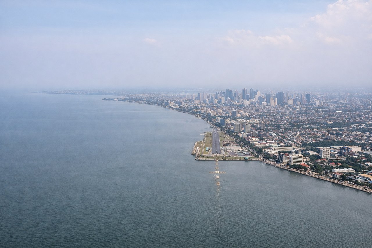
LEFTOn approach into Manila from the south or southwest, left-side windows face Manila Bay, giving views of Corregidor Island, the Bataan Peninsula coastline, and the dense Metro Manila skyline as the aircraft lines up for landing.
Landmarks on this routeAll landmarks →
Will your flight be in sunlight?
See exactly which side of the plane gets sun and shade at your departure time.
About This Route
Which side of the plane should I sit on flying from Singapore Changi (SIN) to Ninoy Aquino International (MNL)?
Sit on the Left side of the plane for the best views on flights from Singapore to Manila. The left side offers meaningful scenery bookends—Singapore's skyline and strait at departure, and Manila Bay with its islands and city skyline on arrival—while the right side faces mostly featureless open water for both takeoff and landing.
What can I see during takeoff from Singapore Changi in Singapore?
During takeoff from Singapore Changi (SIN), sit on the Left side for the best views. Departing Changi, the initial climb and turn toward the Philippines gives left-side passengers a view back over Singapore's skyline, the Johor Strait, and the ships anchored in the Singapore Strait before the aircraft settles onto its northeast track over open water. Notable sights include: Singapore CBD skyline, Johor Strait, Singapore Strait shipping lanes, Sentosa Island.
What can I see when landing at Ninoy Aquino International in Manila?
When landing at Ninoy Aquino International (MNL), sit on the Left side for the best views. On approach into Manila from the south or southwest, left-side windows face Manila Bay, giving views of Corregidor Island, the Bataan Peninsula coastline, and the dense Metro Manila skyline as the aircraft lines up for landing. Notable sights include: Manila Bay, Corregidor Island, Bataan Peninsula, Metro Manila skyline.
How long is the flight from Singapore to Manila?
The flight from Singapore Changi (SIN) to Ninoy Aquino International (MNL) takes 3h 10m.
What does the Singapore to Manila flight path pass over?
The route crosses the South China Sea, passing near the northern tip of Borneo and skirting the western edge of Palawan island before crossing the Mindoro Strait toward Luzon.